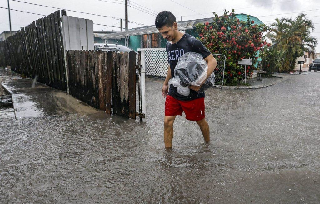
Due to a tropical disturbance, South Florida faced a rare flash flood emergency, delaying flights at two of the state’s largest airports and leaving waterlogged and stuck vehicles on some of the area’s lowest-lying streets.
Travelers in the area were trying to adjust their plans Thursday morning. More than 50 centimeters of rain have fallen in some areas of South Florida since Tuesday, and more precipitation is forecast for the coming days.
Lines for tickets and security snaked around the domestic concourse at Fort Lauderdale-Hollywood International Airport shortly before noon. Dashboards indicated that about half of the flights at that terminal had been canceled or postponed.
Wednesday’s heavy rains and subsequent flooding blocked roads, washed away vehicles and even delayed the Florida Panthers who were traveling to Canada to play the Stanley Cup against the Edmonton Oilers.
The disorganized storm system was moving across Florida from the Gulf of Mexico around the same time as the start of the hurricane season, which this year is expected to be one of the most active in recent memory amid fears that climate change increases the intensity of storms.
According to the National Hurricane Center, the disturbance has not reached cyclone status and has only a small chance of becoming a tropical system when it emerges into the Atlantic Ocean after crossing Florida.
Emergency state
The National Weather Service in Miami said in a message posted on the social network X early Thursday that a band of heavy precipitation was expected over the region for the third day in a row.
“Even a short duration of heavy rain could lead to additional flash flooding,” the message warns.
The mayors of Fort Lauderdale and Hollywood declared states of emergency for their cities Wednesday afternoon. Later in the day, Florida Governor Ron DeSantis also declared a state of emergency for five counties: Broward and Miami-Dade, on Florida’s Atlantic coast, and Collier, Lee and Sarasota counties. , on the west coast of the state.
Miami-Dade County Mayor Daniella Levine Cava also declared a local state of emergency.
Further north, the National Weather Service in Melbourne confirmed that an EF-1 tornado struck Hobe Sound on Florida’s Atlantic coast, north of West Palm Beach, on Wednesday morning.
The winds toppled several trees and damaged a store, Martin County firefighters said. No injuries were reported, but access to the wealthy island of Jupiter was cut off by debris on the road.
Florida has already had a wet and turbulent week. In Miami, about 15 centimeters of rain fell Tuesday and 17 centimeters in Miami Beach, according to the National Weather Service. Hollywood received about 12 centimeters of water.
The west of the state, much of which experienced prolonged drought, also received significant rainfall. Nearly 6.5 inches of rain fell Tuesday at Sarasota Bradenton International Airport, according to the weather service, and flash flood warnings were also in effect in those areas.
Forecasts are calling for an exceptionally busy hurricane season.
The National Oceanic and Atmospheric Administration, a US federal agency, estimates that there is an 85% chance that the Atlantic hurricane season will be above average, forecasting between 17 and 25 named storms in the coming months, including up to 13 hurricanes and four major hurricanes. An average season has 14 named storms.


