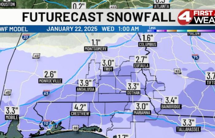
Here we are…two days away from an historic snow system across the Deep South! The strength of the cold air does look to be strong enough to keep much of the Wiregrass snow on Tuesday, with perhaps a sleet and/or freezing rain mix over parts of the Florida Panhandle and Southwest Georgia. I’m still favoring 1-4″ totals across the area, with some potential to get to 5″ or so.
The precipitation begins to develop across the Wiregrass midday Tuesday, heaviest into the evening hours, then departing around midnight. Here’s a look at 6 pm Tuesday. Travel will become difficult from Tuesday afternoon through…? Maybe Friday, in spots, as Wednesday and Thursday mornings will be in the upper 10s to around 20° with highs only in the 30s. This snow will not melt right away!
Use Sunday to prepare for the cold. Monday and early Tuesday will be okay to run errands. Then, grab those sticks and carrots! -David
-Subscribe to our News 4 newsletter and receive the latest local news and weather straight to your email every morning. Get instant notifications on top stories from News 4 by downloading our mobile apps.
Copyright 2025 WTVY. All rights reserved.


