If the start of the week still promises to be cold and gray in the northern regions, the weather conditions will change in the coming days, under the influence of the Garoe depression evolving in the vicinity of the Azores. It will rise by Wednesday towards the Bay of Biscay and will circulate a first disturbance accompanied by oceanic air which will chase away the cold air that has been in place for around ten days.
Temperatures rising significantly, both in the morning and in the afternoon
The frosts, which were still frequent on Monday and Tuesday, will fade on Wednesday, except in the far northeast where the cold air will still put up a little resistance. With the arrival of clouds from the Atlantic accompanied by ocean air, temperatures will become positive again with temperatures between 5 and 10°C in the morning in the south-western quarter of the country.
Rise in morning temperatures between Tuesday and Wednesday © The Weather Channel
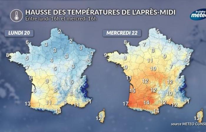
The rise in temperatures will be noticeable in the afternoons. Between Monday and Wednesday, temperatures will increase by 4 to 6°C in most regions, with the exception of the southeast. It is in Bordeaux that the rise in temperatures will be the most spectacular since it will go from 6°C on Monday to 15°C on Wednesday. The mild spell will also be very clear in the central-eastern plains such as in Lyon where it will go from 5°C on Monday to 12°C on Wednesday.
-
Increase in afternoon temperatures between Monday and Wednesday © The Weather Channel
A sweetness that could persist until the end of the month
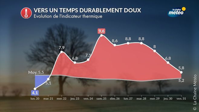
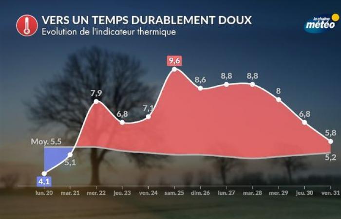
After the passage of the first oceanic disturbance on Wednesday, the west to southwest oceanic flow should persist for around ten days over France, linked to a very dynamic jet stream (powerful upper-altitude current) over the Atlantic. . The latter will carry the disturbances forming off the coast of North America to us. The mildness coming from the Atlantic will therefore prevail during this last decade of January, as shown by the evolution of the national thermal indicator (average of minimum and maximum temperatures over 30 reference cities). In the mountains, precipitation will most often be in the form of rain below 1600 meters altitude.

Towards lastingly mild weather © The Weather Channel


