The weather news has definitely been busy these last few days. After the freezing rains of the last weekend, then the passage of depression Floriane, the week promises to be just as hectic. With the passage of an active front on Wednesday, a conflict of air masses could arise over the country, where a risk of snow is not excluded in the north of France, particularly Hauts-de-France. .
A situation conducive to a conflict of air masses
From Tuesday, a depression will deepen off the coast of the English Channel, approaching the country from the west. Ahead, this depression will cause a warm spell at the end of the day from the southwest, with active rains which should wet a large part of the regions during the night from Tuesday to Wednesday. North of the Seine, the cold air will still resist with generally dry weather.
On Wednesday, the depression responsible for the bad weather will bring frequent rain to 3/4 of the country with significant southwesterly winds at 70 km/h gusty in the northwest. In this configuration, it will be necessary to monitor the level of watercourses, since it has already rained a lot in recent days in the same regions.
Air mass conflict © LCM
In the far north, the flow will be northeasterly since it is located in the upper part of the depression. In this occlusion, it is the cold air which will rush into Hauts-de-France. In contact with the disturbance coming up from the south, snow could occur as far as the plains near Belgium, since temperatures would remain close to the 0°C mark. A situation to therefore monitor closely.
Divergent scenarios depending on the models
In this context, snow forecasts are very difficult, since the depression only needs to shift by a few kilometers for the situation to no longer be the same. However, two scenarios are currently favored regarding the risk of snow for Wednesday until Thursday morning. Note that it is currently impossible to determine quantities, given the fragile situation of this snow conflict.
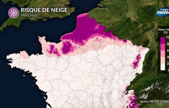
Scenario 1 – Snow north of the Seine
In this scenario, the depression would pass between Brittany and the Grand-East, letting cold air intrude from the northeast over part of the northern half. A large area between the north of Paris and Belgium would be affected by a snowy episode, notably Nord-Pas-de-Calais, with colder and possibly negative temperatures. In this situation, the snow could stick to the ground and accumulate near Belgium, with possible isothermal phenomena.
Risk of snow – Scenario 1 © LCM
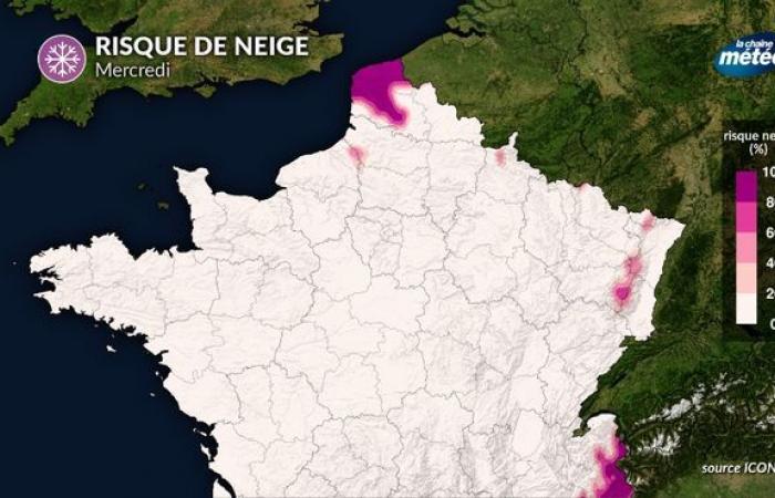
Scenario 2 – Snow restricted to the far north
In this second scenario, the depression would rise further to the north, not allowing the cold air to descend sufficiently over the north of the country. Mild air would therefore be in the majority and would rise to the north of the capital, causing temperatures to rise quite quickly for the day on Wednesday. The snow conflict would therefore be more limited, only affecting the northernmost part of the country. The hills of Artois and the Opal Coast would still be best placed to see the white gold fall this Wednesday.
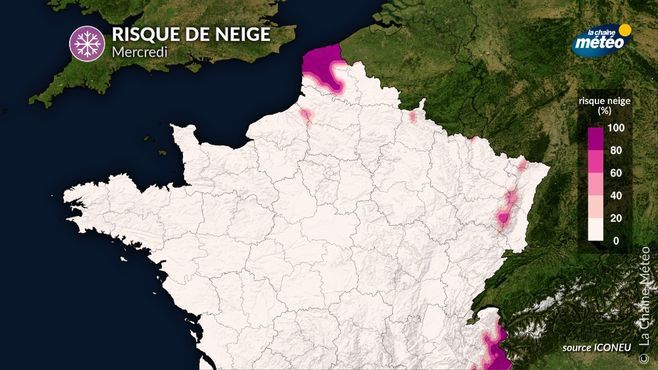
Risk of snow – Scenario 2 © LCM
The situation is therefore not yet finalized two days before the event. To see the snowflakes fall, you will have understood, you will have to go as far north as possible, towards Belgium which seems to be the best placed for this episode.
Afterwards, the temperatures will continue to play yo-yo until the end of the week, before the cold air wins the game, but under much calmer and drier weather a priori.

