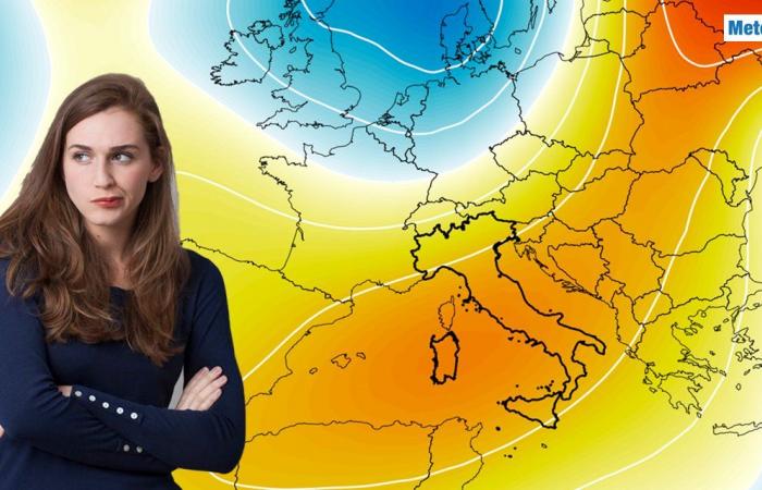
Starting this weekend there will be one High pressure area bring a period of atmospheric stability over Italy and ensure a significant improvement in weather conditions.
After the passage of a trough of cold air that will have influenced our country until Friday, the high pressure field is already beginning to dissipate Saturday the 23rd
November, although cold currents and strong winds will still be present on this day, especially along the Adriatic coast.
Ab Sunday the 24th
However, in November, the high pressure area, which is of subtropical origin, will cover most of the peninsula and stable and mostly sunny weather bring back. The arrival of this extensive high pressure area will mark the end of the instability and cause a gradual weakening of the winds, which will be weak or non-existent in many areas. Skies will be clear or at most slightly cloudy in the center-south of Italy, while in the north there will be a lot of cloudiness will be more widespread and dense, but without related phenomena.
Another effect will be on the temperatures, which will inevitably rise, especially the daily values, which will rise again from Sunday milder and reach up to 16-18 degrees in the central-southern regions. The duration of the high pressure phase could be short though: According to the current models will be between Tuesday 26th and Wednesday 27th
November a new one Low pressure area of North Atlantic origin move to Central Europe and gradually influence the meteorological picture of Italy.
The high pressure area could weaken, giving way to a possible unstable phase in some regions. The low pressure area could create a high-altitude trough, especially in the Central-North to a deterioration Rain and snowfall in the mountains could lead, accompanied by one again cooler climate due to the influx of air from northern directions.
In contrast, the southern regions appear to remain on the edge of this new disturbance and continue to be affected by one more stable and milder climate to benefit. Despite this first hypothesis, it is important to emphasize that we are still far from the possible deterioration in time and further updates are required to confirm the meteorological evolution.
The intensity and precise location of the low pressure trough will be crucial in determining the extent of deterioration and the areas most affected. Further updates will help to better outline the impact of this possible unstable phase; It will therefore be necessary to continue to monitor developments in order to understand how and where possible rainfall, snowfall and temperature drops could occur.
Our Meteo Giornale articles are on Google News, follow us for free!


Follow our feed!


