A depression will cross our country directly on Thursday, bringing a turbulent meteorological cocktail: heavy rain, stormy winds, and possibly snow all the way to the plains.
Snow in the plains: a very delicate forecast
Weather situation Thursday at 9 a.m. © The Weather Channel
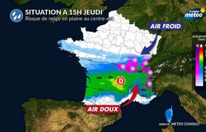
72 hours before the event, several scenarios remain possible due to uncertainty over the exact positioning of the center of the depression. However, the majority scenario predicts a snowy episode that could reach the central-eastern plains, in particular. From the end of the night from Wednesday to Thursday and until midday, snow could appear in regions such as Burgundy and the north of Auvergne-Rhône-Alpes. Early in the morning, flakes could also be observed from Brittany to Center-Val de Loire, although this snow is unlikely to stick to the ground.
The situation is particularly complex due to a conflict of air masses: mild air coming from the Atlantic and cold air coming from Northern Europe. A difference of a few dozen kilometers will be enough to switch between rain and snow. Finally, a mild spell is expected on Monday afternoon, but its exact extension still remains uncertain.
Weather situation Thursday at 3 p.m. © The Weather Channel
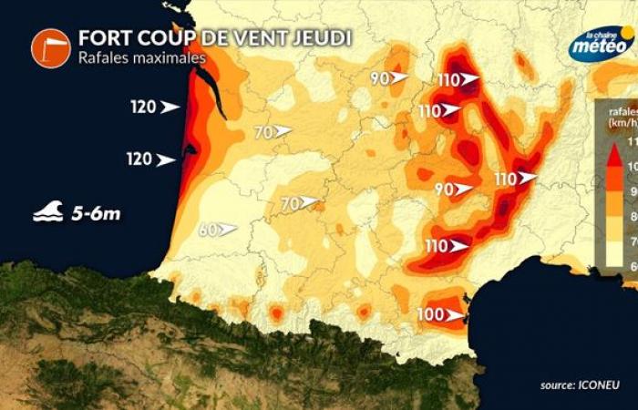
Strong gale: gusts up to 120 km/h
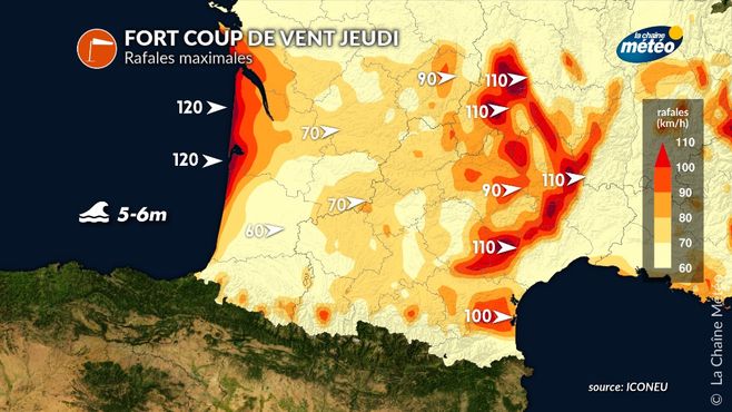
Strong gale this Thursday © The Weather Channel
South of the depression, strong winds are expected from the Atlantic coast to the Mediterranean.
Atlantic coast : The west-southwest wind will blow like a storm over New Aquitaine, with gusts of up to 120 km/h. This wind will be accompanied by waves of 5 to 6 meters, posing a risk of submersion, although the tidal coefficients are low.
In the lands : Gusts will generally be between 70 and 90 km/h, but will exceed 110 km/h on the peaks of the Massif Central.
Mediterranean : In the evening, the tramontane and the westerly wind will strengthen, increasing the risks in this region.
The weekend promises to be very hectic, with a forecast that will still require adjustments in the next 48 hours. However, this cold snap should quickly give way to a marked mild spell from the weekend, with the arrival of significantly milder air.

