

It was another beautiful day across Central and Eastern Kentucky Wednesday with plenty of sunshine and comfortable temperatures across the board. After starting out quite chilly again with temperatures in the mid-40s we rebounded nicely through the afternoon with most locations topping out in the mid-70s for highs, a few degrees warmer than what we’ve seen the last few days. Just ideal weather overall for this time of year.
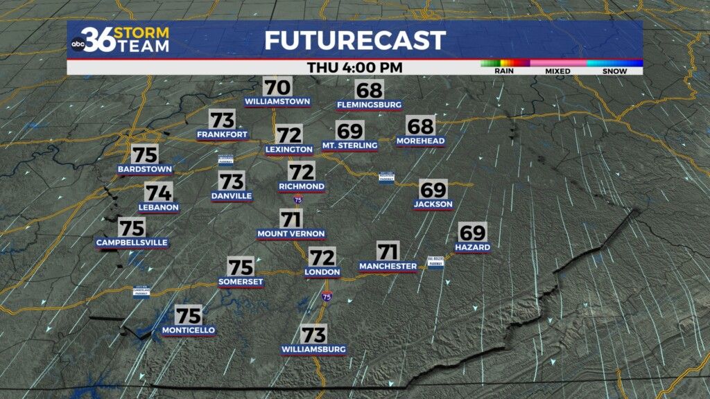
The splendid weather pattern will stay in place heading into the late week. The only change is a “back door” cold front that will slide through the area as it weakens out into early Thursday. With very dry air in place it will have very little impact on our weather other than dropping temperatures a few degrees for the day Thursday. With a light breeze out of the northeast as high pressure builds into the Great Lakes afternoon highs will reach the low 70s, which is right on par for early October with abundant sunshine expected.
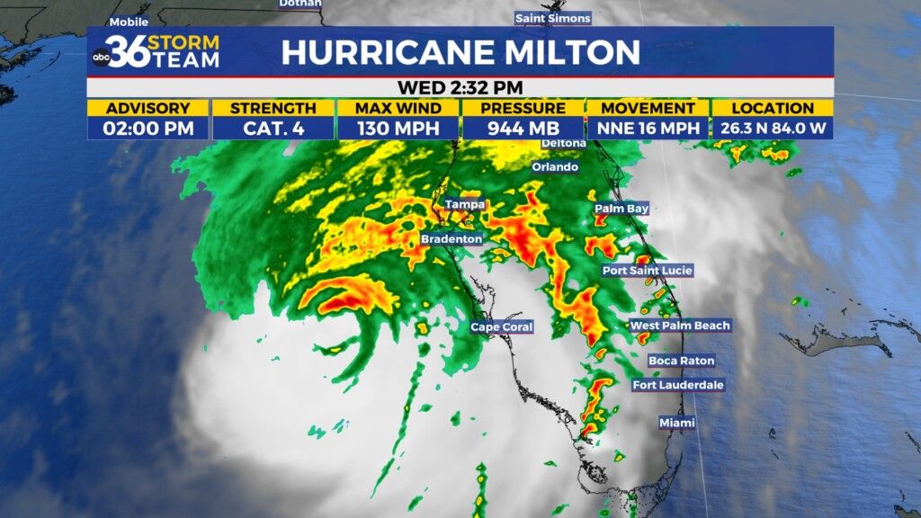
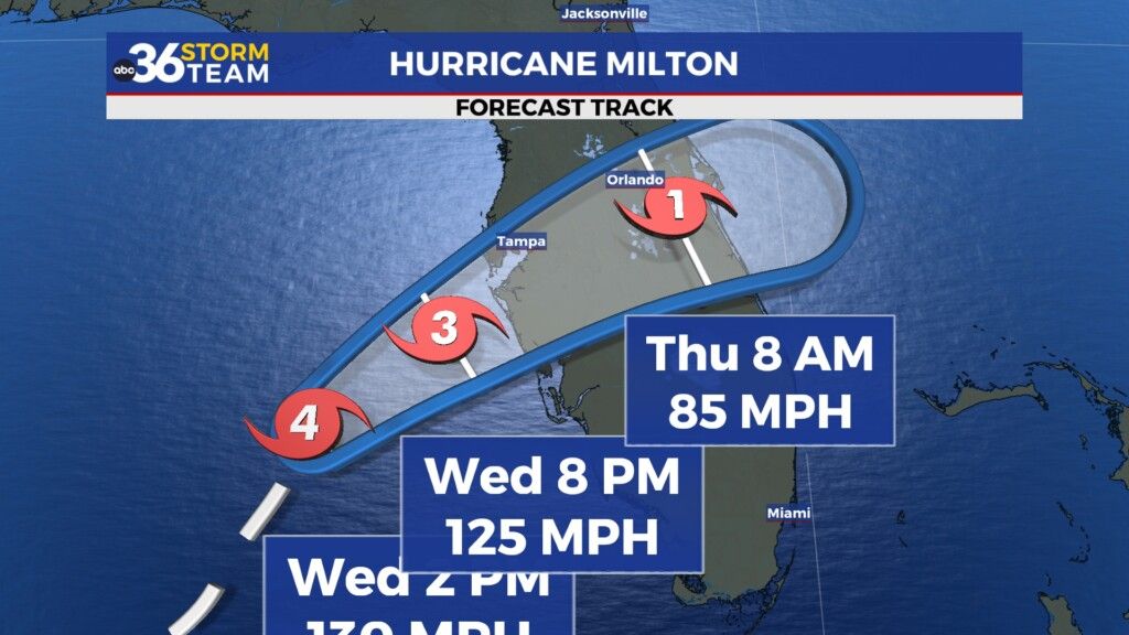
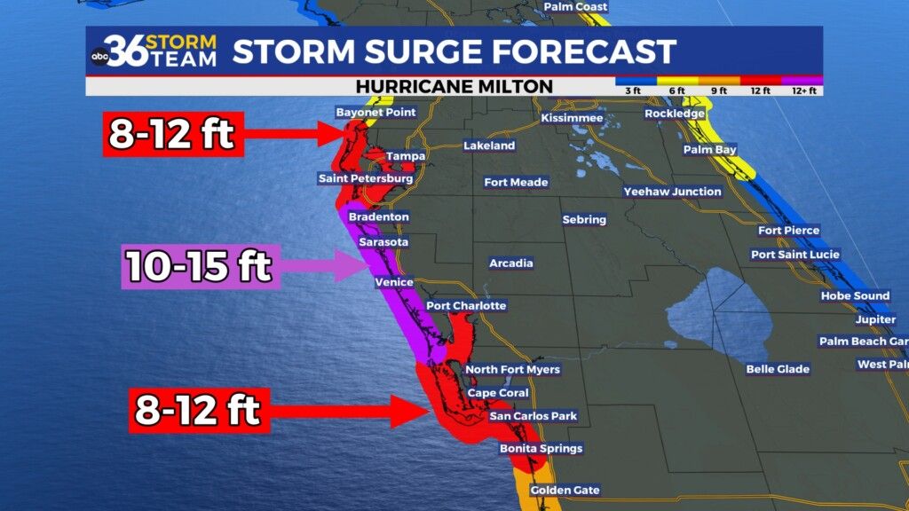
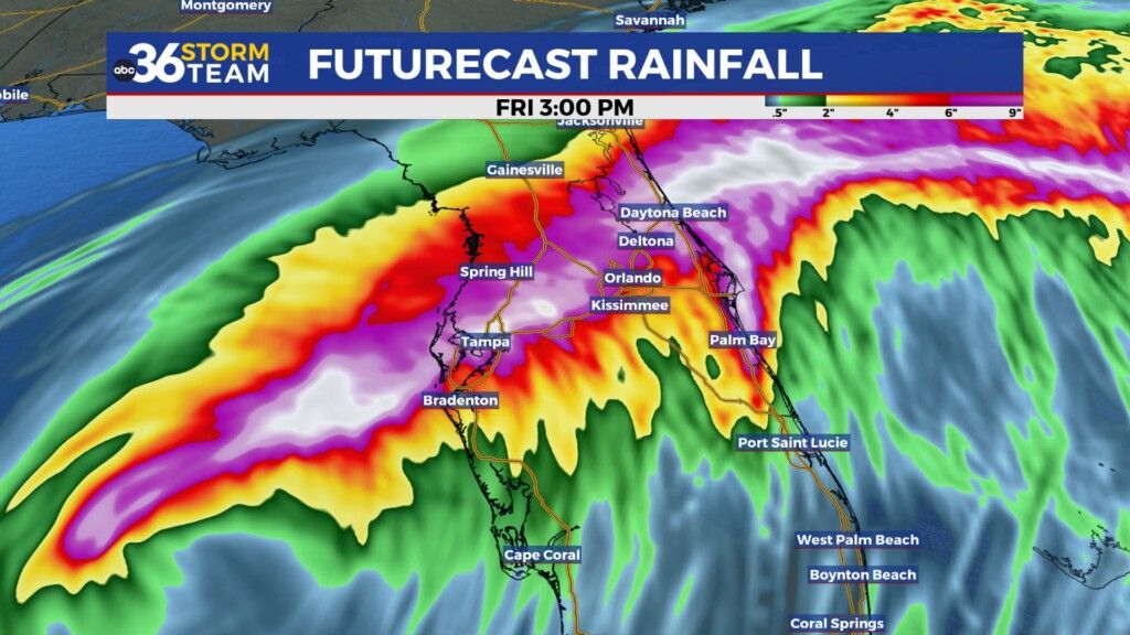
All eyes are on Florida as Hurricane Milton is forecast to roar across the Florida Peninsula into Thursday. It remained a category 4 hurricane with maximum winds around 130 miles per hour as of early Wednesday afternoon. Even if it does back down slightly with strength before landfall, it will still be a major hurricane as it comes on-shore into the early hours of Thursday bringing destructive winds and storm surge to BOTH the west and east coasts of Florida. Storm surge could be in the 10 to 15 feet range near Tampa pushed along by the destructive winds. With such a short distance across the Florida Peninsula Milton won’t have much time to weaken so there will be significant impacts and storm surge from the Space coast up toward Jacksonville on the east coast. In addition to lots of wind damage in the interior sections of the state, there is an elevated risk of a few strong tornadoes (which have already occurred in southwest Florida) as the system rolls through the heart of Florida. Just a horrible scenario all around.
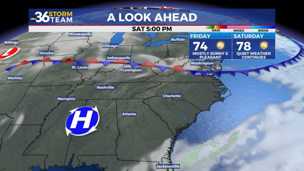
Back here at home conditions stay tranquil and super nice into the weekend with more sunshine each day and afternoon highs climbing back into the mid to upper 70s. It should be delightful for any outdoor activities including Keeneland and Kentucky’s game with Vanderbilt at Kroger Field on Saturday evening. Make some plans and get out and enjoy.
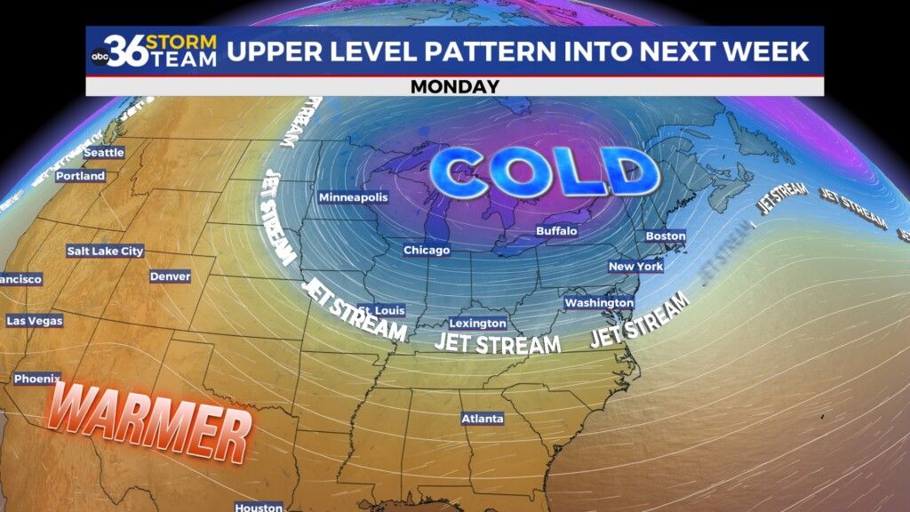
Looking ahead to next week a more significant front will arrive on Sunday night with just a small shower chance but the big story will be another chilly, fall-like air-mass that will move in behind the front. We could be looking at our first frost potential of the season with early morning lows dipping in the 30s and afternoon highs only in the upper 50s and low 60s.
ABC 36 HOUR FORECAST
WEDNESDAY NIGHT: Clear skies, still cool. Lows in the mid-40s.
THURSDAY: Lots of sunshine, very nice. Highs in the low-70s.
THURSDAY NIGHT: Fair skies, chilly again. Lows in the low-40s