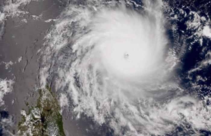
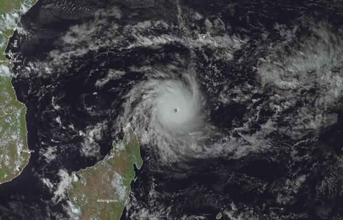
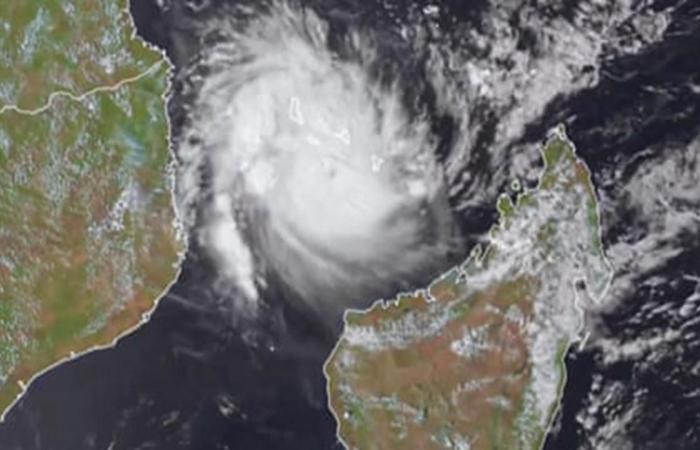
Accompanied by winds of nearly 226 km/h, Cyclone Chido hit the island of Mayotte on Saturday. An event described as exceptional and comparable to the historic cyclone which devastated the island in February 1934. The presence of warmer than normal waters on the surface of the ocean played an important role.
The cyclone season officially begins on November 15 and ends on April 30 over the southwest Indian Ocean. There are on average 10 events per year.
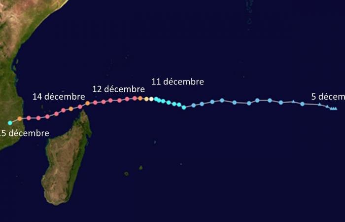
Monitoring of the cyclone begins on December 5 with the appearance of a disturbed area in the middle of the Indian Ocean. Immediately spotted by the Specialized Regional Meteorological Center of Reunion (CMRS), the system became a tropical depression on December 9 at 4:12 UTC, then a moderate to strong tropical storm the next day. He is then given the name Chido.
Continuing its course towards the east, Chido was the subject of the first warnings on December 10 and became an intense tropical cyclone the next day at 6 p.m. UTC, which is the equivalent of a category 3 hurricane on the scale. by Saffir-Simpson. In the evening and at night, it fell on the Agaléga archipelago, destroying most of the houses and schools and forcing residents to take refuge in the newly renovated airport.
Gusts of more than 220 km/h and numerous victims
Quickly moving into category 4, it then heads towards the north of Madagascar, which is also the subject of alerts for the province of Antsiranana, the Comoros and Mayotte. After this maximum, Chido noticeably loses its power as it passes about a hundred kilometers south of the Farquhar Islands.
On December 13, between 6 a.m. and 12 p.m. UTC, it passed 50 km east of Cap d’Ambre, which marks the far north of Madagascar, with winds of nearly 185 km/h. Mayotte and the Comoros are then placed on red and then purple alert.
On December 14 around 4 p.m. UTC, it approached the islands, exceeding in intensity the Kamisy cyclone of 1984. In Mayotte, rain and gusts, up to 220 km/h, caused widespread damage, leaving the 320,000 inhabitants deprived running water and more than 15,000 homes without electricity. Human losses are particularly high. You have to go back to 1934 to find a comparable event.
![Chido on Mayotte on December 14, 2024 [EUMETSAT] Chido on Mayotte on December 14, 2024 [EUMETSAT]](https://euro.dayfr.com/content/uploads/2024/12/16/e02e9d4b99.jpg)
In the Comoros, Chido affects the islands of Anjouan, Mohéli and Grande Comore. In Anjouan, five houses were destroyed, many buildings were also damaged. In Grande Comore, 11 fishermen are missing at sea, according to the General Directorate of Civil Security (DGSC).
Benefiting from the presence of warm waters in the Mozambique Channel, Chido subsequently intensifies again and heads towards the African coast, where cyclone warnings are issued.
On the 15th at 4:15 UTC, it hit Mozambique about 35 km south of the port city of Pemba in the province of Cabo Delgado. A sustained wind over 10 minutes at 205 km/h is still measured at this stage. The cyclone finally sinks inland and loses its power the following day.
![Track of Cyclone Chido between December 5 and 15, 2024. [Wikipedia] Track of Cyclone Chido between December 5 and 15, 2024. [Wikipedia]](https://euro.dayfr.com/content/uploads/2024/12/16/060e879359.jpg)
Favorable conditions for cyclonic activity in the Indian Ocean for several weeks
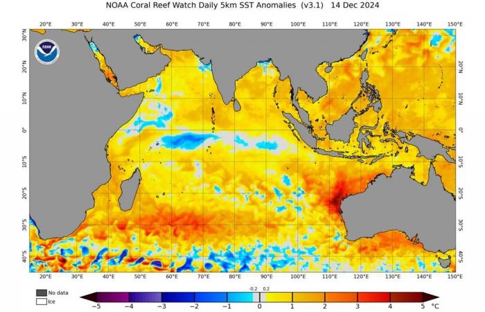
The number and intensity of tropical cyclones between Madagascar and Mozambique depend largely on sea temperature. For several months, the latter has been abnormally high near the Chagos Archipelago, located in the very center of the subtropical Indian Ocean, which favors the formation of cyclones. The activity even started quite early this year with the outbreak of three tropical systems between August and November.
![Temperature anomalies observed at the ocean surface on December 14, 2024. [NOAA] Temperature anomalies observed at the ocean surface on December 14, 2024. [NOAA]](https://euro.dayfr.com/content/uploads/2024/12/16/01a7d44c34.jpg)
Another significant factor is the absence of shear phenomena in the southwest of the Indian Ocean (changes in wind strength and direction at different altitudes), which are likely to disrupt the circulation of currents within the cyclones.
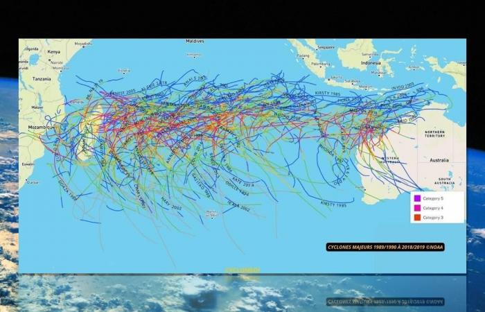
Finally, note that the trajectory of cyclones is quite variable from one year to the next in this region of the world but that it has often passed south of Mayotte in recent years (see below). It can also be quite erratic, like the events of Hyacinthe, who made at least three loops on himself in January 1980, returning to Reunion three times.
![Trajectories of major cyclones in the Indian Ocean from 1989 to 2019 [NOAA/NASA/Cyclonenoi.com] Trajectories of major cyclones in the Indian Ocean from 1989 to 2019 [NOAA/NASA/Cyclonenoi.com]](https://euro.dayfr.com/content/uploads/2024/12/16/13d842ac7b.jpg)
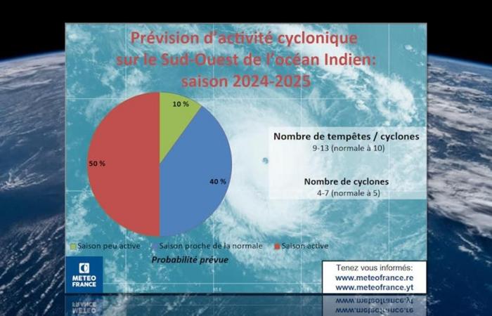
According to projections made by MétéoFrance in October, the upcoming cyclone season should be more intense than normal, with 9 to 13 storms or cyclones expected in the southwest of the Indian Ocean.
![Cyclone forecasts for the South-West Indian Ocean for the 2024-2025 season, carried out by Météofrance. [NASA/Météofrance] Cyclone forecasts for the South-West Indian Ocean for the 2024-2025 season, carried out by Météofrance. [NASA/Météofrance]](https://euro.dayfr.com/content/uploads/2024/12/16/b2c09df278.jpg)
Most often, cyclones form south of the equator, far offshore from any inhabited land, and move east toward Madagascar and the African coast. In this region of the world, monitoring of events is ensured by the Regional Meteorological Center specializing in cyclones in Réunion (CMRS), THE Mauritius Meteorological Services and the Joint Typhoon Warning Center (JTWC) Japanese.
Philippe Jeanneret

