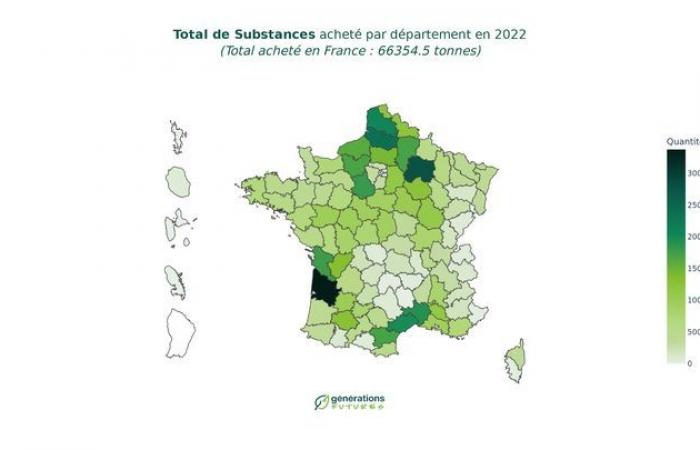
Based on pesticide purchase data, this interactive map allows you to know which substances are widespread in a department. Générations promises improvements in January to be able to go down to the postal code level.
Published on 09/01/2025 14:02
Reading time: 2min
The environmental defense association, Générations Futures, put online on Thursday January 9 an improved version of its “Géophyto” mapping, a tool which should make it possible to know which pesticide has been spread and where in France.
This map now makes it possible to sort the data by department, according to the year, the substances (herbicides, fungicides) and according to their danger to health (carcinogen, water pollutant, endocrine disruptor, toxic to the environment). It constitutes a “significant progress in transparency on the use of pesticides”affirms Générations Futures in its press release.
-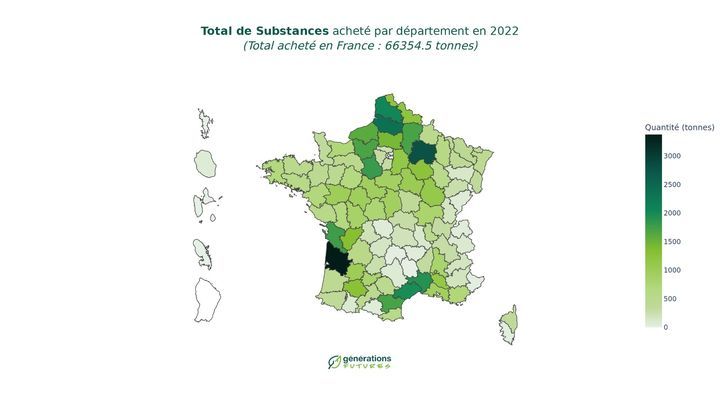

According to the association, this tool makes it possible to draw initial lessons, such as the significant purchase volumes of pesticides in departments with high agricultural activity such as departments with major cereal crops or wine-growing regions. Gironde is the department with the largest overall tonnage, but Eure-et-Loir, Marne and Somme appear to be the departments where purchases of substances of concern for human health and the environment are the greatest.
This interactive map is based on pesticide purchase data, available on the website of the National Bank of Distributor Sales (BNV-d), open data transmitted directly by distributors of plant protection products. However, it does not allow us to know the use of pesticides at the scale of a plot and “therefore likely to expose local populations”. “The available purchasing data does not allow us to go down to the municipal level either,” deplores Générations Futures which says it works “to a new level of cartography”with a new map, planned for January, to be able to go down to the postal code scale and the addition of new categories of substances.

