JEAN-PHILIPPE KSIAZEK / AFP
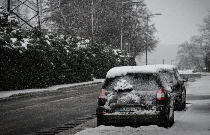
Snow will appear in the north of the country at the start of 2025, in relatively large proportions according to Météo-France forecasts.
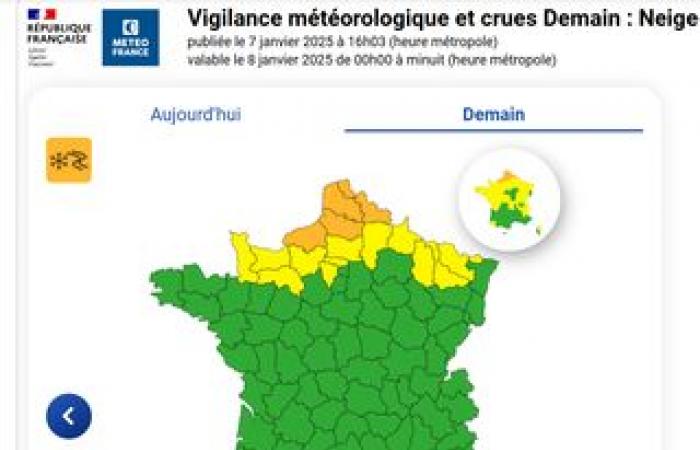
WEATHER – A “ hectic week “. France will experience serious snowfall in the northern part of the territory this week, as indicated – with some caution – Météo France this Tuesday, January 7. At this stage, orange vigilance for snow and ice has been triggered in four departments in the northern quarter (Pas-de-Calais, Nord, Somme and Seine-Maritime) from Wednesday afternoon.
In a bulletin dated this Tuesday morning, the French meteorological service explains that the appearance of “ two complex disturbances » will bring its share of rain and wind, and especially snowfall all the way to the plains in the north of the country in the coming days.
A depression should circulate over the far north of the country, generating an air mass conflict, and therefore causing snowfall from Upper Normandy to Hauts-de-France. If the forecasts still need to be refined due to the unpredictability of the disturbances, “ a layer of snow on the ground of 5 to 10 cm is entirely plausible in these regions “, advances Météo France. The most affected area of France should extend from Seine-Maritime to Picardy, as well as the south of Nord and Pas-de-Calais.
The departments concerned on Tuesday January 7 by the orange vigilance for snow and ice on Wednesday, while waiting for Météo-France to refine its forecasts, “when the location of the most intense falls will be more precise”.
This snowy episode is expected to continue over the following days. Météo France forecasts on Thursday a movement of the disturbance towards the East and the South, with rain and fairly strong wind from Aquitaine to the North-East. The north of France, still under the polar air mass, will remain under the snow. between eastern Picardy and northern Champagne and Lorraine ».
On Friday, the appearance of another disturbance causes for the time being “ uncertainty about the affected regions “, but the risk of snow all the way to the plain will always be present. And in the northernmost regions of the territory, Météo France expects negative minimum temperatures, around −5°C to −7°C.
Uncertainty for Île-de-France
For his part, The Parisian evokes “ weather models (which) do not yet all agree ”, but which suggest “ rather significant accumulations in the north of the country from Wednesday ». « The period from Wednesday afternoon to Thursday morning » is also considered to be the most conducive to snowfall.
For this, the journal relies on the representation below, shared by Keraunos. According to the French Observatory of Tornadoes and Violent Thunderstorms, “ snowfall is expected in the cold air, between Normandy and Hauts-de-France with a layer on the ground likely ” Wednesday.
Reading this content may result in cookies being placed by the third-party operator who hosts it. Taking into account the choices you have expressed regarding the deposit of cookies, we have blocked the display of this content. If you wish to access it, you must accept the “Third Party Content” category of cookies by clicking on the button below.
Play Video
In this scenario, will the Île-de-France region escape the snowflakes, with its position “ on the edge of the area likely to experience snowfall » ? Difficult to say at the moment, even if three neighboring departments are already placed on yellow alert by Météo France (Oise, and two Ile-de-France departments, Yvelines and Val-d'Oise). According to the map shared by La Chaîne Météo this Tuesday, Paris and its surroundings should be protected from snow, or experience it much more sporadically than the north of the country.
Reading this content may result in cookies being placed by the third-party operator who hosts it. Taking into account the choices you have expressed regarding the deposit of cookies, we have blocked the display of this content. If you wish to access it, you must accept the “Third Party Content” category of cookies by clicking on the button below.
Play Video
As Météo France explains, referring to its unpredictability, the phenomenon could very well appear further north or further south. With, in the latter case, more serious consequences for Île-de-France. For the moment, the models envisaged by Météo France and the German forecasting service DWD do not make it possible to rule out either of these two scenarios.
Also see on HuffPost :
Reading this content may result in cookies being placed by the third-party operator who hosts it. Taking into account the choices you have expressed regarding the deposit of cookies, we have blocked the display of this content. If you wish to access it, you must accept the “Third Party Content” category of cookies by clicking on the button below.
Play Video


