A new wave of storms will develop from the South-West to the Massif Central this Saturday before continuing towards the centre-east and north-east of France, reports Météo France, which is forecasting episodes “sometimes violent, accompanied by strong gusts and rain.”
The meteorological agency is considering a possible move to orange alert in several departments, particularly in Nouvelle-Aquitaine and the North-East.
Read also: Thunderstorm asthma: be careful, the risk increases this weekend almost everywhere in France
“Dangerous phenomena” to fear
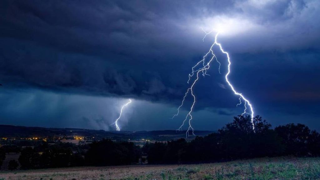
A significant stormy deterioration will affect most of the country on Saturday with a risk of violent storms in the South-West and then in the North-East at the end of the day. These regions should experience episodes of intense rain, large hail and strong gusts of wind, meteorologists warn.
The disturbances are linked to a “powerful conflict of air masses” about the country, explains The Weather Channel, pointing to a depression, named “Dana”, coming from the south of Spain which is moving up towards France. It “will be responsible for the powerful storm offensive from tonight in the South-West and then tomorrow across the whole of France”indicates the specialized media, announcing “supercell” type storms which will cause “dangerous phenomena, hail, gusts of wind and torrential rain”.
The most violent storms expected in the Northeast
From the morning, the stormy wave will approach the Pyrénées-Atlantiques and will quickly spread to the Massif Central, indicates Météo France. The deterioration will move in the afternoon from the east of the Pyrenees to Limousin, then to Auvergne Rhône-Alpes. “The storms become strong and multiply, giving high intensities of rain, sometimes hail and powerful gusts of wind”the weather agency said. At the end of the afternoon, the storm wave will head towards the Centre-Val-de-Loire, the east of the Île de France and Bourgogne-Franche-Comté, to reach the Grand Est during the evening, accompanied by heavy rain, violent gusts of wind and hail.
The Weather Channel, for its part, does not rule out a move to maximum alert level red in certain departments in the north-east of France, where the most violent storms are expected at the end of the day on Saturday.
Only the regions from Brittany to Nord-Pas-de-Calais, the south-east of the Paca region and Corsica are spared, summarizes Météo France. They will keep a calmer, but cloudy weather, while the South-East wind will blow quite strongly until the beginning of the afternoon from the Paca region to the Massif Central, continues the meteorological agency.
What about temperatures?
Météo France also announces morning temperatures that should be between 8 and 13 degrees from Brittany to Belgium, 15 to 20 degrees elsewhere, up to 21 to 22 degrees in Corsica. Saturday afternoon, it will be 18 to 23 degrees near the Channel and the Atlantic, 23 to 28 degrees elsewhere, but up to 27 to 32 degrees from the Grand Est to Berry, Rhône-Alpes and PACA, and in Corsica, locally 34 in the Alsace plain and on the Isle of Beauty.


