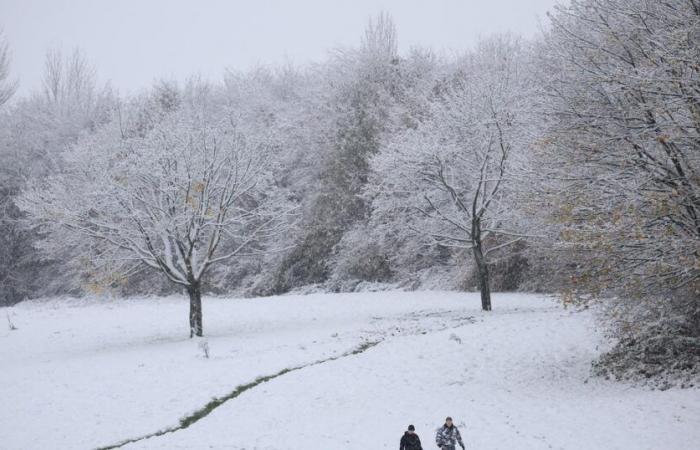
Thursday morning, the Caetano depression will cross France, causing heavy snowfall and ice. Gusts could exceed 100 to 120 km/h on the Atlantic coast.
According to the national vigilance bulletin published by Météo France this Wednesday, November 20, a major snow episode affects a large part of France from Thursday morning. The Caetano depression, which crosses the country from west to east, causes significant snowfall on an axis going from northern Brittany and Normandy to the Grand Est. In total, 52 departments were placed by Météo-France on orange alert from Thursday morning, 33 for snow and ice on an axis going from North Brittany to the Grand-Est, 19 for strong winds further south. Le Figaro takes stock.
How will this early winter episode unfold?
“Thursday, a very hollow depression named Caetano arrives in the morning on the Brittany and crosses France from west to east.alerts the Weather Channel*. “It is associated with a significant conflict between the mild Atlantic air and the much colder air present in the north of France. In contact with these two air masses, the samples are intense and occur in the form of snow from northern Brittany and Normandy to Burgundy-Franche-Comté, via Centre-Val de Loire,Île-de-France and the south of the Grand Est region.”
Snowfall is forecast “between the end of the night from Wednesday to Thursday and the evening of Thursday” and could make traffic conditions “difficult”for its part Météo-France is moving forward, which has led several departments to take measures to limit road traffic.
Depression “will give snow, 1 to 3 cm possible in Paris and the inner suburbs, up to 7 cm in Essonne and more in the regions further east and at altitude (up to 20 cm on the Belfort side) »warns the forecaster. Snow will also affect northern and central Brittany and Normandy.
Which departments are on orange snow-ice alert?
On Wednesday, Météo France placed four new departments on orange alert for risks of snow and ice on Thursday, bringing the total to 33 departments, while 19 others are on orange wind alert, according to a bulletin published Wednesday afternoon. In Île-de-France, the eight departments are concerned:
- Paris (75),
- Seine-et-Marne (77),
- Yvelines (78),
- Essonne (91),
- Hauts-de-Seine (92),
- Seine-Saint-Denis (93),
- Val-de-Marne (94)
- Val-d’Oise (95).
In the west and north-central, the affected departments are:
- Ille-et-Vilaine (35),
- the Channel (50),
- Calvados (14),
- l’Orne (61),
- Eure (27),
- Seine-Maritime (76),
- Mayenne (53),
- Sarthe (72),
- Eure-et-Loir (28),
- Loir-et-Cher (41),
- the Côte d’Armor (22),
- the Loiret (45).
Finally, in the east of the country, vigilance extends to
- Dawn (10),
- Yonne (89),
- Haute-Marne (52),
- the Gold Coast (21),
- the Vosges (88),
- Haute-Saône (70),
- the Doubs (25),
- the Territory of Belfort (90),
- the Alpes-de-Haute-Provence (04),
- the Hautes-Alpes (05),
- the Cher (18),
- Nièvre (58),
- the Haut-Rhin (68).
These regions could record snow accumulations reaching up to 5 cm in the plains, or even locally 10 cm in areas located above 200 to 300 meters above sea level. In the east of Franche-Comté, accumulations could reach 15 to 20 cm.
Which departments are affected by wind vigilance?
If the departments located to the north of the depression are mainly affected by snow, those located further south must face violent winds. Gusts, which can exceed 100 km/h, particularly affect the Atlantic coasts from Aquitaine to Pays-de-la-Loire, up to the Massif Central. Météo France indicates that a change to orange vigilance for «vent violent» is likely in future updates.
Wind orange vigilance affects:
- Loire-Atlantique (44),
- Vendée (85),
- Finistère (29),
- Morbihan (56),
- Savoy (73),
- Haute-Savoie (74),
- Isère (38),
- Ain (01),
- the Rhône (69),
- the Loire (42),
- Puy-de-Dôme (63),
- Allier (03),
- Creuse (23),
- Haute-Vienne (87),
- Vienna (86),
- Charente (16),
- Gironde (33),
- Charente-Maritime (17),
- Deux-Sèvres (79)
How do communities react and organize themselves?
In Île-de-France, the speed limit will be lowered by 20 km/h and trucks weighing more than 7.5 tonnes will not be able to “perform an overtaking maneuver” on certain roads from 11:00 a.m., the police headquarters said. The same in Loiret, the prefecture said. The ADP group, manager of Paris airports, announced on Wednesday evening that “all of (its) resources are ready to be mobilized if necessary” to clear snow from the slopes.
The Normandy region has “decided to suspend school and commercial transport lines” in the departments of Orne, Manche, Calvados and Eure. In Eure-et-Loir, where expected snow depths could reach up to 10 cm in the hilliest areas of Perche, school transport will also be suspended on Thursday. It will be the same in the agglomeration of Saint-Lô in La Manche.
The A84 will be prohibited for vehicles over 7.5 tonnes in Calvados, as well as between Fougères and Caen in Manche. In Loire-Atlantique, the Saint-Nazaire bridge will be closed to traffic in the event of wind gusts of more than 120 km/h.
Strong winds could also cause avalanches in the Alps. “Extreme vigilance is required when practicing all mountain activities and mainly ski or snowshoe hikes” and Haute-Savoie “4 out of 5 avalanche risk on the Mont-Blanc massif”indicated the prefecture.
What will happen in the coming days?
The passage of this depression occurs within the framework of a “early winter episode” with the arrival this Wednesday of a “polar air mass” causing temperatures to drop. The cold is expected to persist on Friday before a “powerful redoux” expected during the day on Saturday.
It is advisable to limit travel in the areas concerned, to check winter equipment for vehicles and to keep informed of the instructions of local authorities.
*The Weather Channel is a property of the Le Figaro group.


