Par
Maxence Dourlen
Published on
Oct. 16 2024 at 5:02 p.m
See my news
Follow Occitanie News
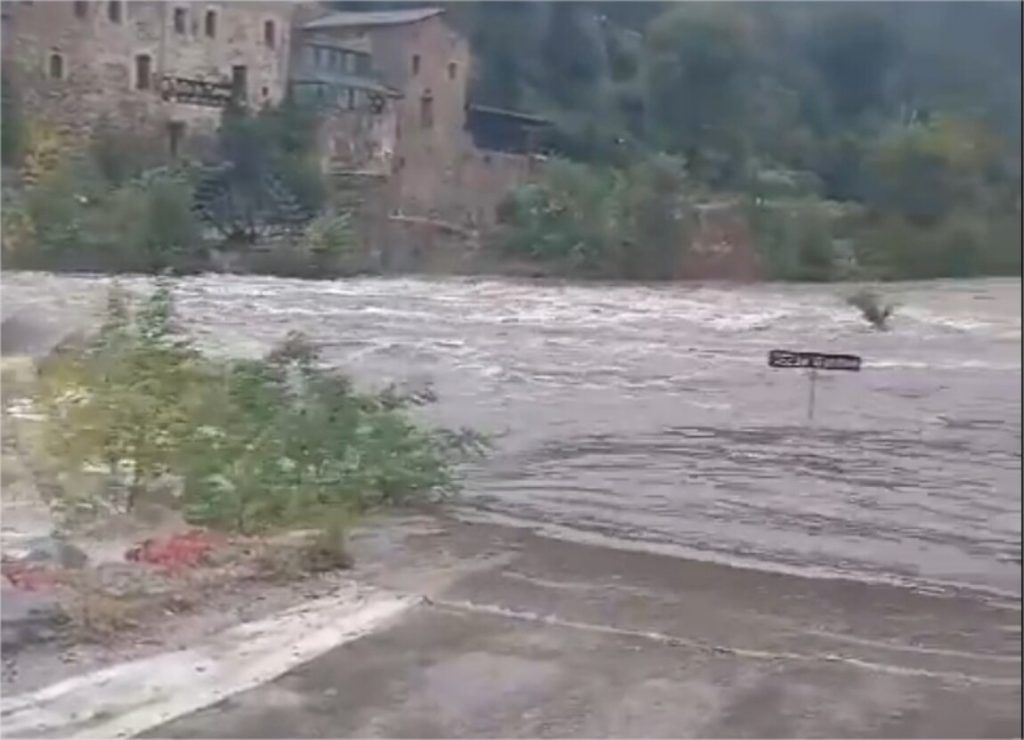
It doesn’t stop… For almost 24 hours, real torrential rain affect several sectors of Occitanie and in particular the Cévennes. Already placed on orange rain-flood and thunderstorm vigilance by Météo France, the departments of Gard and the Lozere will remain Thursday October 17, 2024. For the moment, this vigilance lasts until 10 p.m., but this could change in the coming hours.
A peak this Thursday?
After a very rainy morning this Wednesday, then a slight lull during the day, Weather Languedoc specifies that a peak could be reached in a few hours.
This Thursday, the low pressure anomaly is getting closer and we are even witnessing the formation of a small meso-depression off the coast of Aude. Between the second part of next night, during the morning and generally until the beginning of the afternoon of this Thursday, the rains remain sustained in the Cévennes and only very little affect our plains.
Rain is therefore expected in Audebut also in the Pyrenees-Orientalesbut it’s nothing compared to what (still) awaits the Lozerethe Gard et Hérault. Intensities of 20 to 30 mm/h are even expected in the Cévennes.
Other departments concerned
In its latest bulletin, Météo France also places Tarn, Lot and Aveyron on orange rain-flood alert. All other departments of Occitanie are on yellow alert.
Significant rainfall in the Cévennes
Further significant amounts of rain are therefore expected throughout the day in the Cévennes. “Frequently 100 to 200 mm more since the morning, perhaps 250 mm in the south of Mont-Lozère,” continues the specialist site. This means that in 48 hours, accumulations will often reach 300 to 350 mm and locally 450/500 mm.
On the south-eastern slope of Mont-Lozère, the accumulation could even reach 500 mm !
Extreme vigilance
Vigilance remains essential this Thursday. The Facebook page Weather Gard does not fail to remind us: “If there is a lull in the plains where some clearings may have appeared, the episode is not over in the Cévennes where the rivers continue to flood! It is important to remember that after the tragedies that our department experienced last March with several victims in the Gardons, that it is common sense not to engage on submersible bridges.
In Gard, several bridges remain closed. School transport is also suspended over a large northern half of the department.
On the side of BeaucaireMayor Nelson Chaudon announced the closing the seat doors this Wednesday to anticipate a possible flood of the Rhône.
“Indeed, the rains that have already occurred and the significant rains announced upstream would cause a potential overflow of the Rhône,” specifies the City. Vehicles parked at the Fairgrounds, in the Casino parking lot and in the arena parking lot are requested to be removed and not parked there during the entire time the gates are closed. »
Follow all the news from your favorite cities and media by subscribing to Mon Actu.