In a still very gentle southerly flow, we must expect unstable rises in the region this afternoon. As for the mildness mentioned, the minimum temperatures this morning are 7 degrees above normal. Happy birthday to the Baudouins and the Zélies.
The essentials of the day: our exclusive selection
Every day, our editorial team reserves the best regional news for you. A selection just for you, to stay in touch with your regions.
France Télévisions uses your email address to send you the newsletter “The essentials of the day: our exclusive selection”. You can unsubscribe at any time via the link at the bottom of this newsletter. Our privacy policy
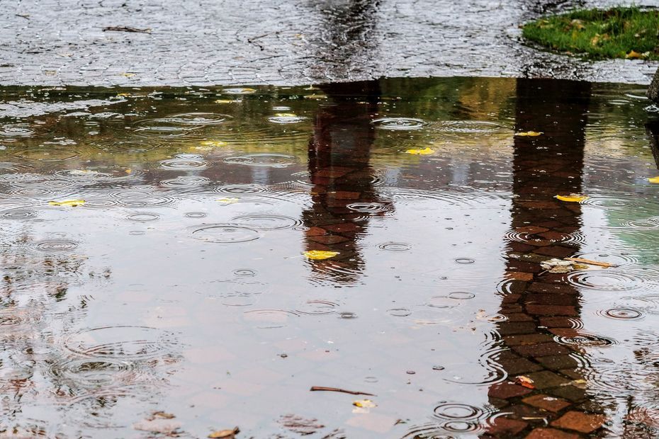
The cloudy fields present this morning allow clearings from time to time but can also give light rain or showers. This gray and particularly mild weather is accompanied by a southerly wind which remains weak.
The clouds leave little room for the sun this morning
•
© France Télévisions
If the mild weather persists this afternoon, the weather could get a little, or even a lot, more complicated! In fact, rainy spells are announced by Météo France. These rains can be heavy and locally stormy.
Arrival from the south of sometimes heavy rain in the afternoon
•
© France Télévisions
As we told you, great gentleness still reigns this morning. At daybreak the thermometers display values 7 degrees higher than the temperatures generally observed at this time of year. At the “lowest” this morning we expect 14°C in Berck-sur-Mer for example and at the highest 17°C in Saint-Saulve or even Gauchy.
Minimums worthy of the start of September
•
© France Télévisions
Although down compared to yesterday, the maximums are still 4 to 5 degrees above normal, the day’s range going from 17 to 20 degrees.
The sweet air is still present
•
© France Télévisions
Rain every day until Sunday ?
Friday : Arrival of a disturbance. The sky will remain overcast and it will be rainy in the east. The rain should subside by late afternoon. Further west, a sky with a dense but normally dry veil should accompany you. The wind from the west-northwest will be weak. Minimum temperatures: 11 to 14°C (4 to 5°C above normal), maximum temperatures: 16 to 18°C (2 to 3°C above normal).
SATURDAY : For the start of the school holidays, disrupted weather awaits us. A disturbance will indeed arrive from the coast in the morning, it will reach the east of the region in the afternoon. The improvement will be felt on the west facade with the return of clearings. The southerly wind will be moderate to fairly strong. Today’s temperatures : 9 to 11°C for mini, 16 to 18°C for maxi.
Sunday : The parade of disruptions will continue. The one that will concern us on Sunday should arrive at midday bringing again overcast skies and rain. It will be accompanied by a moderate to strong south-southwest wind (gusts of 50 to 80 km/h from the interior towards the coast). Minimum temperatures: 9 to 12°C. Maximum temperatures: 15 to 17°C.
One day, a disturbance
•
© France Télévisions
It’s been a long time since this happened! Indeed, ATMO Hauts-de-France informs us that with weaker winds, lower temperatures as well as greater cloud cover will allow a reduction in ozone levels: the air quality index should be good across the region. Little tip of the day: For your outings, choosing walking or cycling instead of the car helps reduce pollution and reduces the risk of respiratory and cardiovascular diseases by 40%. It’s worth getting some fresh air! Moreover, please note that this week ATMO Hauts-de-France launched a free “Air to go” mobile application. This can help you when traveling, walking, doing sports, etc. Just download it to your smartphones.
The index is good in the region today
•
© France Télévisions
This October 17 is the 291th day of the year (75 remaining). It is the International Day for the Eradication of Poverty.
We wish you a pleasant day and tomorrow, don’t forget to celebrate Luc.
4 minutes less daylight
•
© France Télévisions