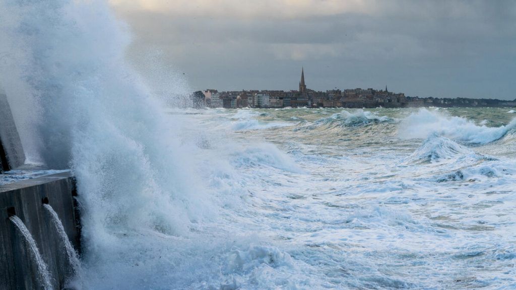
Be careful in the north of the country and along the Channel coast. A gale sets in this Monday afternoon, according to Météo France forecasts. This means the wind will be strong and gusty, but normally less than storm level.
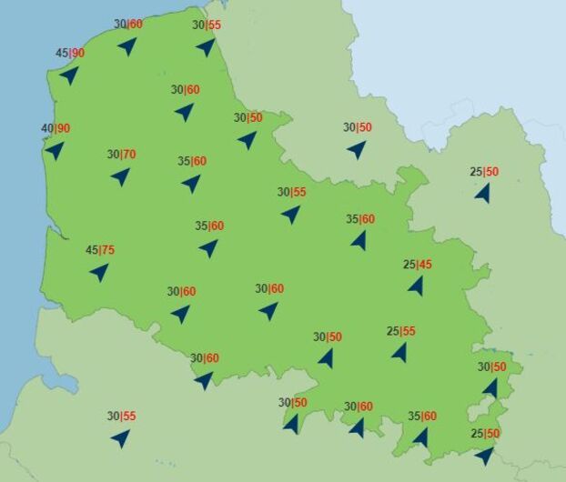
There is no precise definition of storm. But the meteorological organization recalls that “custom dictates that meteorologists name storms wind gusts approaching 100 km/h inland and 120 km/h, even 130 km/h, on the coasts. This wind map for this Monday afternoon, where average speeds are indicated in black and gusts in red, shows that the northern half of France will experience a situation far from stormy with 50 km/h to 60 km/h. h. However, such speed requires a certain amount of caution, particularly because falling objects are possible.
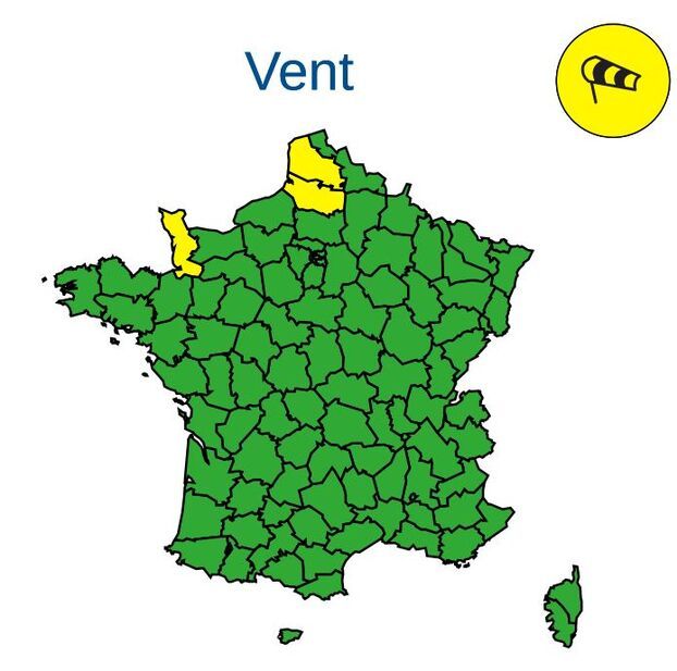
Near the Channel coast, the wind will blow stronger, often 70 km/h. But, locally, the situation will be more degraded. Gusts of between 90 km/h and 100 km/h are possible. This is how Manche, Somme and Pas-de-Calais were placed on yellow alert (level 2 out of 4) due to the wind.
It is in Pas-de-Calais that the gusts of this wind coming from the South-West should be the most virulent. By the sea, it is the sector of Boulogne-sur-Mer and Wissant which is the most exposed.
This situation is classic at the beginning of autumn, a time of year when gales and storms begin to increase. This Monday evening, the wind will gradually weaken. The weather channel, for its part, issues a reservation for the situation in the Nord department, between Dunkirk and Lille, where significant gusts could continue to occur during the evening. As the hours pass through the night, the wind will gradually disappear.


