Key facts
– Hot weather on the eastern coast: up to 35°C in Corsica
– Violent storms from Occitania to Auvergne
– Heavy rains in Brittany: up to 1 month of rain
Matin
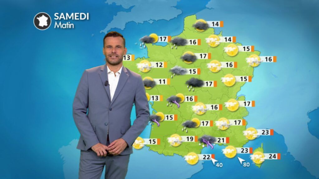
Heavy rains affect Limousin with some thunderstorms. Showers affect the Pyrenees and maritime inlets the Gulf of Lion. The sky is clear in the east with a very mild morning.
Minimum temperatures: 12 to 23°C
Afternoon
Of violent storms break out on the Massif Central, while heavy rain affects Brittany and the Cévennes. The easterly wind strengthens along the Côte d’Azur, reaching 80 km/h in gusts. The heat is heavy on the eastern coast before the arrival of the storms.
Maximum temperatures: 18 to 35°C
Cumulative figures for this Saturday © The Weather Channel
Evening
Violent storms break out from Languedoc to the Ardennes, passing through Dijon and Lyon. The Rhone Valley and the Cévennes are particularly exposed. Showers affect the northwest. Elsewhere, between the Ile-de-France and the southwest, the sky is clearer and the weather drier.
Weather trend: what you need to know for the next few days
On Sunday, the weather will remain very unsettled with heavy, lasting rain in the northwest and violent storms between the Alps and Corsica. Next week will be very cool for the season with a parade of disturbance in a northwesterly flow.
