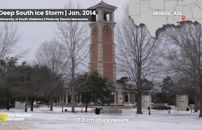
This is an impressive cold snap, especially when we talk about the possibility of snow in Florida.
A powerful surge of Arctic air from Canada is set to surge across the southern United States, bringing dangerously low temperatures to the Gulf of Mexico region by early next week.
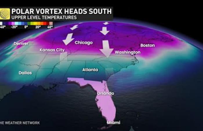
Polar vortex in the southern United States
DON’T MISS: Polar vortex set to invade Canada and the United States with dangerously cold temperatures
A bitter cold extends to the south
We are entering the early stages of one of the most notable cold spells of the last decade. A lobe of the polar vortex, originating from the Arctic, will allow frigid air to extend towards southern latitudes, almost reaching the tropics in the coming days.
Monday, January 20 could be one of the coldest days the United States has seen in years. It will be so cold that the presidential inauguration in Washington, D.C., will be held indoors for the first time in 40 years.
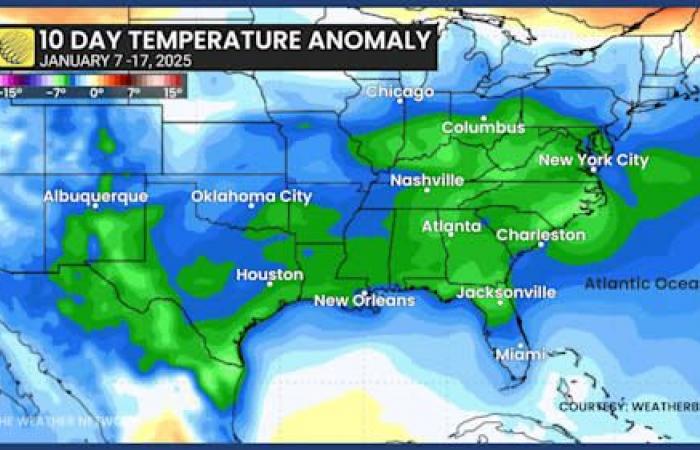
Temperature anomaly in the southern United States
Most communities east of the Rockies will remain below freezing throughout the day. The worst of the cold will head to the east coast mid-week.
Subzero temperatures will even reach the Gulf Coast in the heart of this cold snap Monday and Tuesday.
Daytime high temperatures in Atlanta, Georgia will remain below freezing on Monday, January 20, with temperatures barely above freezing on Tuesday and Wednesday. The average temperature during this time in Atlanta is around 12°C.
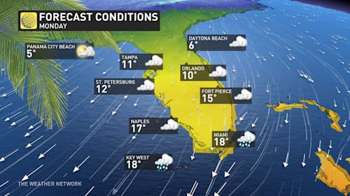
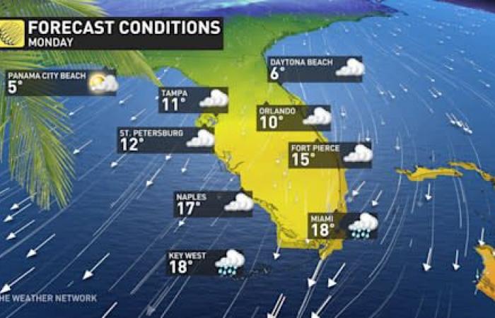
Florida Forecast Monday
We will even see relatively cool temperatures in Florida.
Freezing temperatures are expected in parts of North Florida this Monday evening and Tuesday evening. The maximum temperature in Orlando on Monday will not exceed 10°C, far from the city’s normal of around 22°C for this time of year.
-Winter storm potential increases with colder weather
Forecasters are also monitoring the potential for a winter storm in the Deep South in connection with this cold snap.
An active storm track in the Gulf of Mexico could cause a disturbance in Texas late Monday, which will move along the northern Gulf Coast on Tuesday.
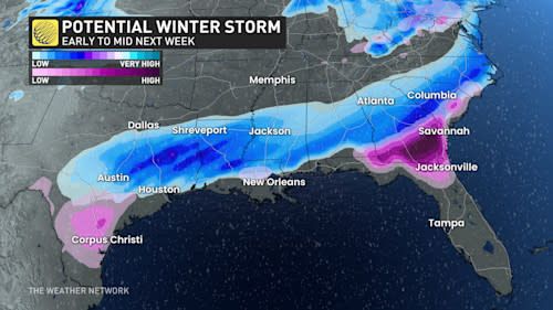
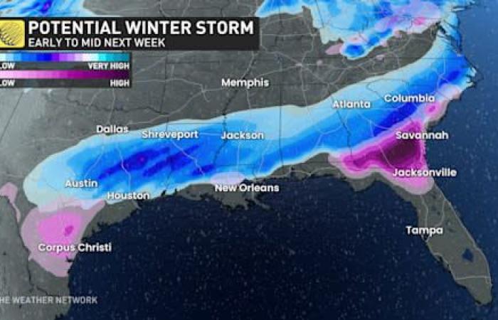
Winter storm potential in the South
Models suggest a possibility of snow, freezing rain and ice pellets extending from Central Texas to portions of northern Florida.
Although the pattern appears favorable for snow and ice, it is extremely difficult for such winter precipitation to occur in this region.
Houston, Texas, has not experienced measurable snow since a historic cold spell in February 2021. Mobile, Alabama, and Tallahassee, Florida, recorded only a light dusting of snow in January 2018.
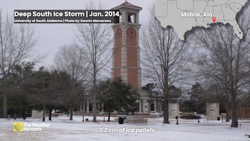
Ice storm in the Deep South, January 2014
Mobile suffered a disruptive ice storm in January 2014. Tallahassee hasn’t seen a snowfall of 2 cm since December 1989, a cold spell when it was colder in Miami than in Calgary.
Even a small amount of winter precipitation along or near the Gulf Coast would have a strong impact. Most municipalities in this region are not equipped to handle snow removal or road treatment.
WATCH: Recognizing the Signs of Frostbite and Hypothermia
Click here to watch the video
This unprecedented cold snap could challenge our preconceptions about the climate in normally temperate regions. How can we prepare for climate change which can bring such surprises, even in areas known for their mild climate?
- --
