Published on November 1, 2024 at 10:00 p.m.
A region in the Tropics worries meteorologists. Forecast.
Action in the Tropics
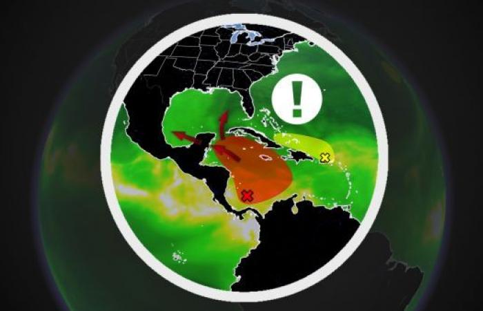
Hurricane season is coming to an end, but it is still possible for a storm to originate in the Tropics. Currently, meteorologists are monitoring an area particularly prone to cyclone formation in the southern Caribbean Sea. This tropical wave would have a 70% chance of being named within the next seven days.
Favorable conditions
Over the next few days, this region of the Atlantic will become increasingly favorable for storm formation based on three criteria: water temperature, low wind shear and the presence of abundant humidity. The tropical wave that we are currently monitoring could take two trajectories. The Yucatan region would be targeted, but also the southern United States. It is again Florida and Louisiana, but also Mississippi and Alabama which could find themselves in the crosshairs of the system.

The Atlantic still active
In early November, tropical activity tends to slow considerably. However, in addition to the disturbance which has a good chance of intensifying and becoming a named storm within a week, two others are to watch. The first is located north of the Lesser Antilles, the other near the Azores. The next name on the list is Patty.

With the collaboration of Kevin Cloutier, meteorologist.
SEE ALSO: Massive hail damages cars
World


