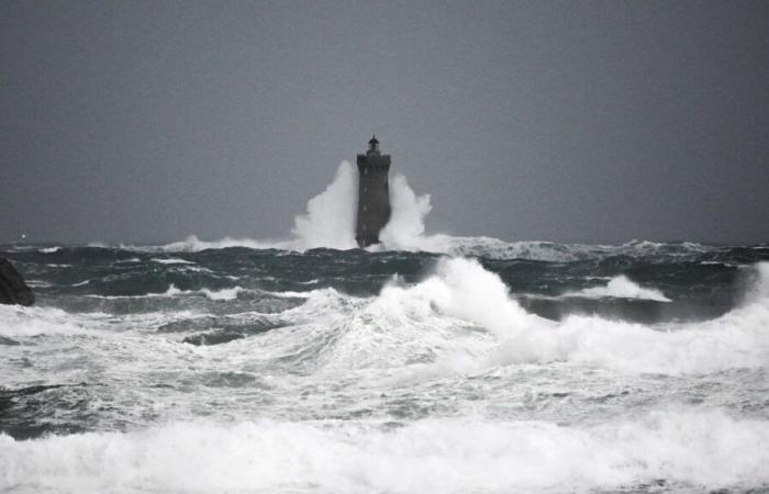
Ireland and part of the United Kingdom were placed in “red alert” this Friday, January 24, as the Eowyn storm approaches, while strong winds are expected on the French coast.
The Eowyn storm sweeps Ireland. Gusts of wind up to 170km/h have been recorded on the west coast of Ireland placed in red vigilance, just like part of the United Kingdom. “It will be a dangerous, destructive meteorological event, which will cause damage,” warned the head of the emergency coordination group Keith Leonard as Eowyn approaches.
In the United Kingdom, the entire country is placed in a state of vigilance, but the Meteorological Agency Met Office has declared a rare red alert for Northern Ireland and certain regions of the South and Center of Scotland. This is the first time that such an alert has been decreed in Northern Ireland since the implementation of this system in 2011.
Connemara is on the front line with gusts expected at more than 170, possibly up to 200 km/h. Beyond gusts, the winds will approach 120 km/h.
Scotland and northern England will also be affected in the second half of the day, with waves that can exceed 10 meters. You have to go up at least 15 years to find winds at more than 170 km/h in Ireland. It is the equivalent of a hurricane on the British islands, far from the tropics.
-Strong winds expected in France
Strong winds are also expected in France, especially near the English Channel and in the northwest of the country, where gusts of up to 100km/h are expected by the sea. Morbihan has been placed in orange rain alert -Inondation this Friday morning.
On its site, in its 6 -hour bulletin, Météo France alerts on “durable and temporarily supported rains, especially this evening”. If it is a usual rainy episode for the season, it requires “special vigilance, due to saturated floors.”
The rains associated with the Eowyn storm will give substantial accumulation by Saturday on Brittany, Hauts-de-France and Normandy. We wait up to a month of rain in places and the levels of the rivers could quickly go up on the edges of the Oise, the Somme and on the edges of the Eure which remain under surveillance.
Loïc Rivières with Lucie Valais and AFP


