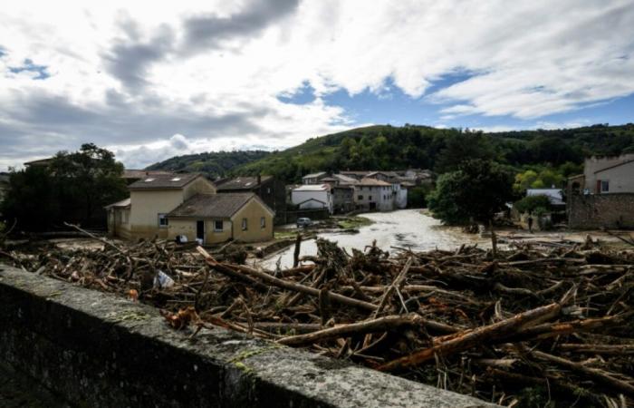
Flood damage in the village of Limony, in the Ardèche department, October 18, 2024 (AFP / JEFF PACHOUD)
Dams and bridges certainly, but above all probes and alarms: a month after major floods in the center-east, all the actors emphasize that no territorial planning will protect populations as effectively as a system of efficient alert.
“We always hammer home this message: we can do work, but not eliminate the risk,” underlines Betty Cachot, director of the Brévenne-Turdine river union (Rhône).
Since 2006, his union has carried out numerous developments on these two rivers which cross the Monts du Lyonnais. Presented as models in flood prevention, they received a visit at the end of October from Prime Minister Michel Barnier.
On the Turdine, two flood control dams, similar to small bridges, have been installed. “When the river flows normally, it passes underneath. As soon as it starts to swell, the water is retained” according to a “funnel” system, explains Ms. Cachot. “This allows us time to evacuate” populations, “or even completely contain the flood.”
The bed of the Brévenne has seen its old dikes removed. “We are giving as much space as possible to the river” so that it can grow without overflowing into habitable areas, explains Ms. Cachot.
“It’s still engineering, but based on nature,” explains Valérie November, researcher at the CNRS, for whom large structures, conversely, can prove counterproductive by “displacing the problem,” like dikes. which create erosion and increase downstream risks.
– Multiplication of risk –
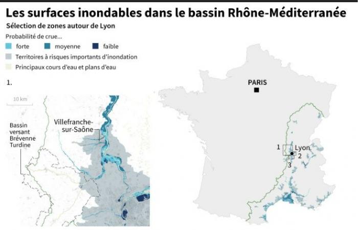
Of the 16.8 million French people who live in flood zones in a scenario of extreme flooding in mainland France, 2.5 million live in Auvergne-Rhône-Alpes, according to estimates from the Regional Directorate for the Environment and Planning. and housing (Dreal).
Map of France showing floodable areas and areas at significant risk of flooding in the Rhône-Mediterranean basin and zooms on the Brévenne Turdine, Lyon and Givors watershed (AFP / Cléa PECULIER)
The Rhône-Mediterranean basin is in fact confronted with floods in winter (linked to long periods of rain), spring (rain and melting snow), as well as episodes of intense, more punctual precipitation, such as the events Cévennes.
“No part of the basin is completely protected from the risk of flooding,” notes Hervé Piégay, research director at the CNRS.
In urban areas, in addition to overflowing rivers, water runs off artificial surfaces and flows quickly downstream, amplifying flood peaks.
“In Lyon, there is a whole history of waterproofing,” indicates the geographer. “Now, we are trying to reopen the asphalt wherever possible, to encourage infiltration phenomena” and to install retention basins to store water.
For 50 years, underlines the researcher at ENS, “we have tended to increase our vulnerability” by building closer and closer to waterways, thinking we are protected by developments. But when these works prove insufficient, the damage is disastrous.
– “Deprived” –
Different arrangements are designed for different flood levels, explains Thomas Adeline, expert consultant in flood prevention: bridges are generally designed to contain thirty-year floods (which have a one in thirty chance of occurring in a year), plans for urban planning to resist 100-year floods.

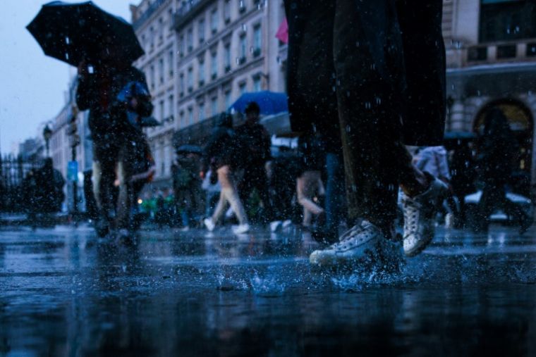
In Paris, October 17, 2024 (AFP / JOEL SAGET)
When they exceed these thresholds, “we are quite helpless”, summarizes Mr. Piégay.
At that time, “the only question is forecasting and warning”, he says, that is to say having efficient meteorological services and a system to warn populations, minimize damage and save lives.
In Valencia in Spain, where more than 220 people died in floods on October 29, the authorities were also accused of delaying sending a warning message to the population.
But climate change, which makes precipitation more intense and unpredictable, complicates the mission of those who must anticipate risks. “We don’t know how to model what a 100-year flood will look like in 40 years,” notes Romaric Vallaud of Dreal.
In the Brévenne Turdine basin, the river union has set up small radars which measure the height of the water in real time, and ensures that the population remains aware of the risk, in particular through awareness workshops.
“In a way, I think we were lucky to have floods” in the past, concedes Ms. Cachot, because when we talk to local residents about projects “they don’t question the fact that it 'is useful, they remember.'


