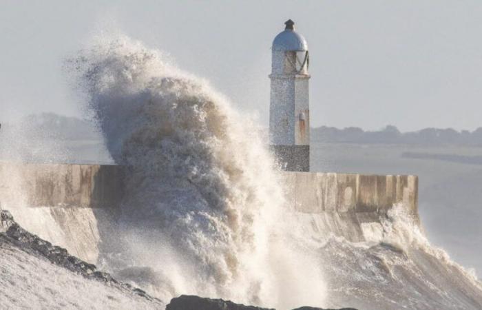
After Floriane, here is Éowyn. This storm will circulate very quickly and intensely this weekend over Ireland, the north of England and Scotland, announces Météo France. France should be affected to a lesser extent. We'll explain it to you.
What should we expect?
Storm Eowyn will arrive in Ireland from late Thursday night to Friday then during the morning and day of Friday, also quickly affecting the north of England and Scotland. Violent gusts of wind, between 130 and 150 km/h, are expected, estimates the forecasting organization.
And in France?
France will not be affected by strong winds, but we will have rain. In addition to “a clear mild spell in many regions of the northern half, there will be the return of rainy spells in the coming days” specifies Météo France. On Friday, the cold front linked to Éowyn will water the northwest in particular. Wind level, gusts could reach 80 to 90 km/h along the coasts. « Ustrong gust of wind will touch the coasts of the Some this Friday with gusts of up to 110 km/h on the coasts and 90 km/h inland” completes La Chaîne Météo.
This content is blocked because you have not accepted cookies and other trackers.
By clicking on “I accept”cookies and other trackers will be placed and you will be able to view the contents (more information).
By clicking on “I accept all cookies”you authorize the storage of cookies and other trackers for the storage of your data on our sites and applications for personalization and advertising targeting purposes.
You can withdraw your consent at any time by consulting our data protection policy.
Manage my choices
I accept
I accept all cookies
Can we talk about a “weather bomb”?
Certain depressions have the particularity of deepening very quickly and very strongly, and this is the case of Éowyn. “We can talk about a weather bomb since Éowyn will lose more than 24 hPa in 24 hours, it will go from 975 hPa on Thursday to 936 hPa on Friday. Éowyn could therefore be the most violent storm in the United Kingdom since Ciaran” predicts The Weather Channel.
-This content is blocked because you have not accepted cookies and other trackers.
By clicking on “I accept”cookies and other trackers will be placed and you will be able to view the contents (more information).
By clicking on “I accept all cookies”you authorize the storage of cookies and other trackers for the storage of your data on our sites and applications for personalization and advertising targeting purposes.
You can withdraw your consent at any time by consulting our data protection policy.
Manage my choices
I accept
I accept all cookies
“The heart of the storm will pass mid-morning over the north of Ireland and peak wind intensity will then be reached with gusts of over 170 km/h on the west coast of Ireland and 120 to 150 km/h inland (…). Please note that the sea will be raging with waves of 7 to 10 meters to the west of Ireland.adds the bulletin.
France


