It’s looking more and more likely that very cold air will drop into Southeast Louisiana and New Orleans next week along with chances of snow or a wintry mix.Radar | Download our app | Sign up for weather alerts | Send us your photosOVERVIEW:A piece of the Polar Vortex will dip through Canada and into the Central U.S. dropping in extremely cold arctic air all across the country east of the Rocky Mountains.TEMPERATURE FORECAST:Temperatures will plummet from the 70s to the 40s from Saturday to Sunday, but the first day of the coldest air drops in by Monday morning with lows in the 20s for much of Southeast Louisiana.Strong northerly winds will make it feel even colder!Cold Advisories will be issued by then. This very cold air will last through Tuesday and Wednesday too.It’s possible the first Extreme Cold Warnings could be issued next week too.PRECIPITATION FORECAST:We’ve been tracking the potential of wintry weather and snow around Tuesday of next week. The forecast data have been extremely inconsistent in the placement, forecast type, and amounts of possible wintry weather. They have been consistent suggesting the likeliest time for wintry precipitation across Southeast Louisiana is around Tuesday. Here’s the latest data.GFS (Global Forecast System – U.S.)The forecast out the U.S. has been the most inconsistent. Just a day or two before, it was calling for a large swath of mixed wintry precipitation or rain, freezing rain (ice), sleet (ice pellets), and snow. For an in depth look at what these different types of precipitation are, scroll down to the bottom of the article.On Wednesday, it took out all the precipitation all together.By Thursday afternoon, it flipped back into bringing in snow across the area during the day Tuesday of next week, and ending with a round of mixed wintry precipitation.As you can see, this is a very inconsistent forecast BUT this is typical for a “deterministic computer forecast”. A “deterministic” forecast is one that’s performed at one exact time depicting what the atmosphere is at that moment, and projecting it forward in time from there. These forecasts are notorious to change with most every run and flip-flop back and forth with varying solutions.Over the past 15 years, we’ve developed a much better method for forecasting by taking a computer forecast, making a few changes to the current conditions outside, and perform multiple forecasts. In the U.S., we do this 21 times. In the European forecast, there are 50 different forecasts that are run.Meteorologists and forecasters have found these “ensemble forecasts” to be much more reliable in forecasts beyond 2-3 days out. Here’s what the last few GFS ensemble forecasts have shown.- 18z GFS Ensemble Thursday 1-16- 12z GFS Ensemble Thursday 1-16- 06 z GFS Ensemble Thursday 1-16THE TAKEAWAYSWhile the deterministic GFS forecasts have flipped back and forth between varying solutions, the ensemble forecast has been consistent in breaking out wintry weather across Southeast Louisiana. It’s also been consistent in showing mixed wintry weather and not just snow. However, in the latest run it brings the precipitation farther south towards the coast and outputs more snow than mixed.I want to see more data heading into the weekend before I’m confident that wintry weather will happen next Tuesday, but the ensembles have been consistent in their showing of wintry weather.ECMWF (European Centre for Medium-Range Weather Forecasts – Europe)The ECMWF has been fairly consistent in its operational runs in brining wintry weather to Southeast Louisiana next Tuesday. Here’s what its latest deterministic runs looked like on Thursday.The ECMWF ensemble forecasts have been pretty consistent over the last several runs.- 18z Thursday 1-16- 12z Thursday 1-16- 06 Thursday 1-16TAKEAWAYWith the exception of the 06z run, the ECMWF Ensemble has also been consistent in breaking out wintry weather across all of Southeast Louisiana. Note, it has also trended in taking wintry weather farther south towards the coast too.ANALYSIS:It is still way too early to definitively call that wintry weather is likely across the region. Even the Weather prediction Center (WPC) still has very low chances of wintry weather at 10% and 30% chances.We’ll need to consistently follow the ensemble data, and hopefully over the weekend begin to get a clearer picture of what could be in store for next Tuesday.PRECIPITATION TYPES:When the atmosphere gets cold enough, the clouds are actually comprised of ice crystals. When the precipitation first falls, it falls in the form of snow. However, here along the coast the snow usually runs into a layer of air warmer than freezing and melts into rain. If the rain meets temperatures below freezing at ground level and doesn’t have enough time to refreeze, it is called “freezing rain” where the rain drops instantly freeze up into a sheet of ice on the roads and cover the trees, brushes, and fences with a glaze of ice. This is the most dangerous form of wintry weather! If the once snowflake raindrops encounter a deep enough layer of sub freezing air at ground level, it will refreeze into an ice pellet, or sleet. And if the snow never meets a point falling to the ground where the air temperature rises above freezing, it will fall as snow. Here’s a diagram of what this looks like.Be sure to stay with the WDSU First Warning Weather Team for all the latest on next week’s possible wintry weather.
It’s looking more and more likely that very cold air will drop into Southeast Louisiana and New Orleans next week along with chances of snow or a wintry mix.
Radar | Download our app | Sign up for weather alerts | Send us your photos
OVERVIEW:
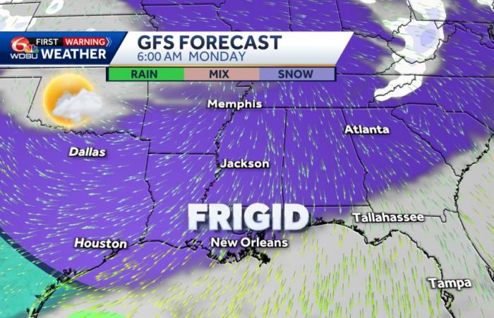
A piece of the Polar Vortex will dip through Canada and into the Central U.S. dropping in extremely cold arctic air all across the country east of the Rocky Mountains.
TEMPERATURE FORECAST:
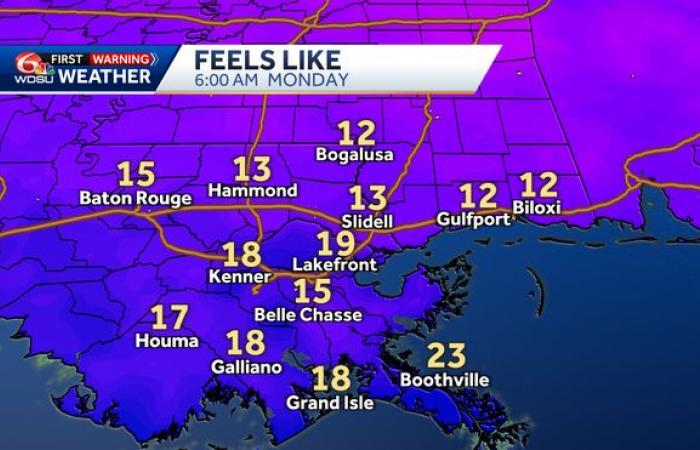
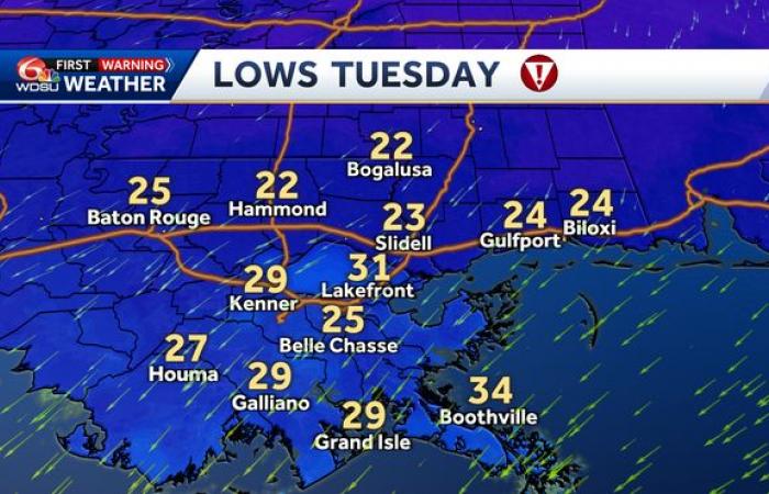
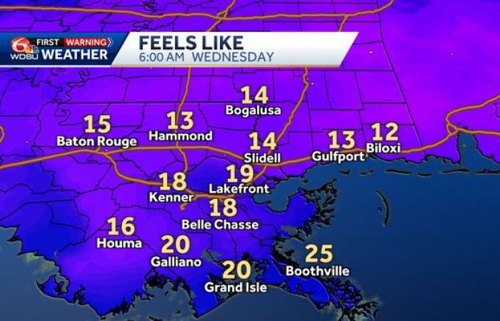
Temperatures will plummet from the 70s to the 40s from Saturday to Sunday, but the first day of the coldest air drops in by Monday morning with lows in the 20s for much of Southeast Louisiana.
Strong northerly winds will make it feel even colder!
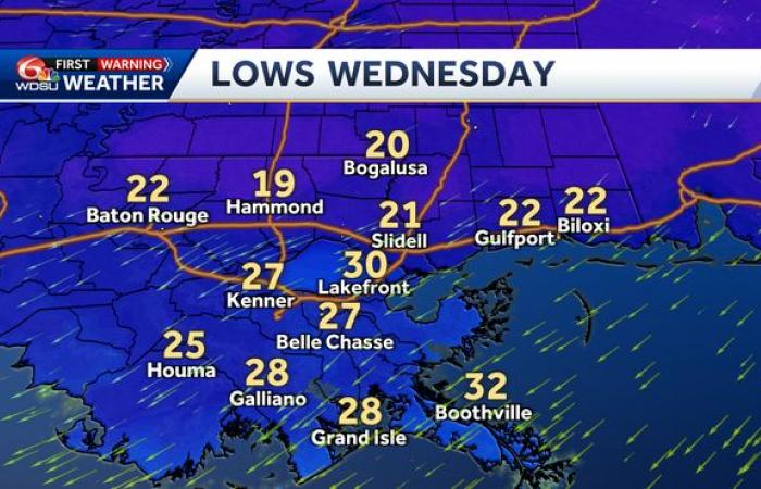
Cold Advisories will be issued by then. This very cold air will last through Tuesday and Wednesday too.
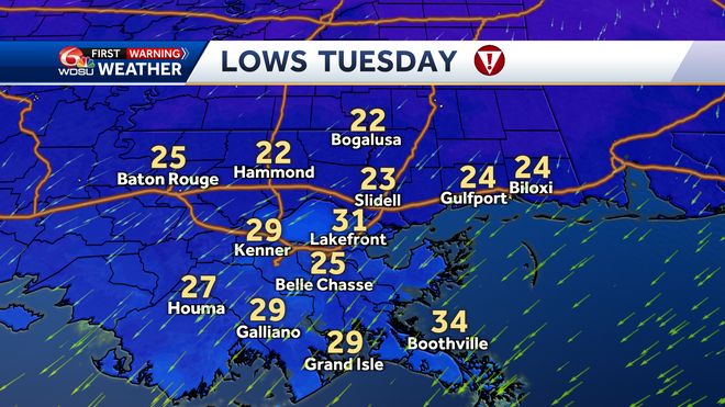
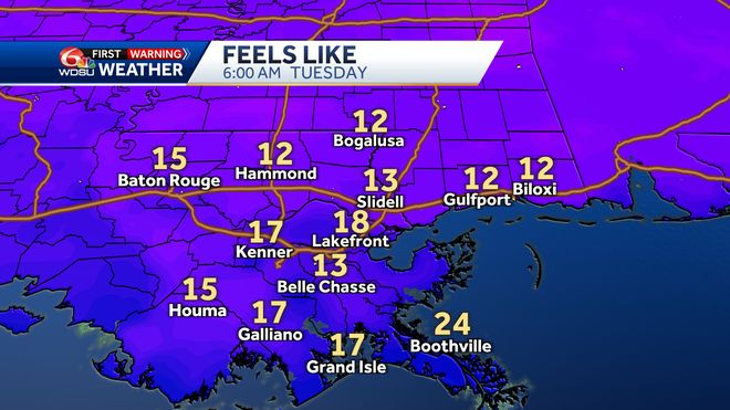

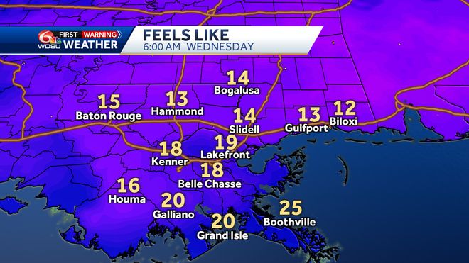
It’s possible the first Extreme Cold Warnings could be issued next week too.
PRECIPITATION FORECAST:
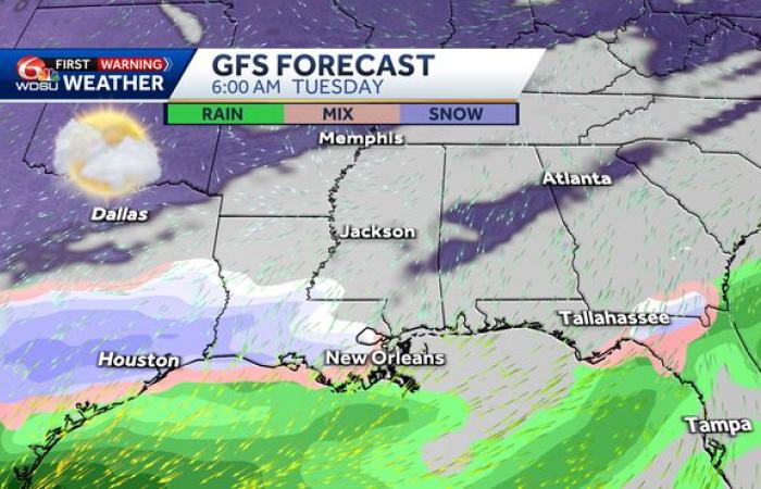
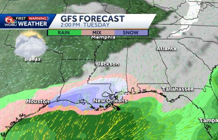
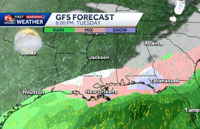
We’ve been tracking the potential of wintry weather and snow around Tuesday of next week. The forecast data have been extremely inconsistent in the placement, forecast type, and amounts of possible wintry weather. They have been consistent suggesting the likeliest time for wintry precipitation across Southeast Louisiana is around Tuesday. Here’s the latest data.
GFS (Global Forecast System – U.S.)
The forecast out the U.S. has been the most inconsistent. Just a day or two before, it was calling for a large swath of mixed wintry precipitation or rain, freezing rain (ice), sleet (ice pellets), and snow. For an in depth look at what these different types of precipitation are, scroll down to the bottom of the article.
On Wednesday, it took out all the precipitation all together.
By Thursday afternoon, it flipped back into bringing in snow across the area during the day Tuesday of next week, and ending with a round of mixed wintry precipitation.
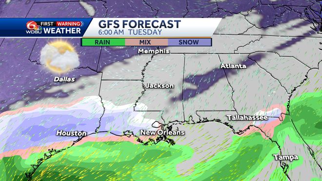

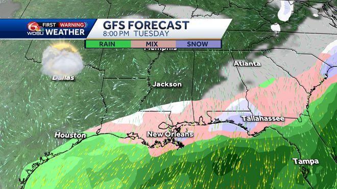
As you can see, this is a very inconsistent forecast BUT this is typical for a “deterministic computer forecast”. A “deterministic” forecast is one that’s performed at one exact time depicting what the atmosphere is at that moment, and projecting it forward in time from there. These forecasts are notorious to change with most every run and flip-flop back and forth with varying solutions.
Over the past 15 years, we’ve developed a much better method for forecasting by taking a computer forecast, making a few changes to the current conditions outside, and perform multiple forecasts. In the U.S., we do this 21 times. In the European forecast, there are 50 different forecasts that are run.
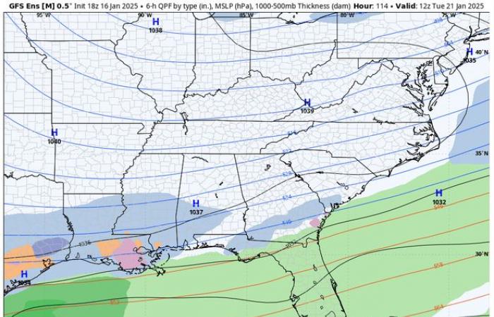
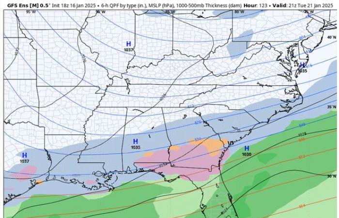
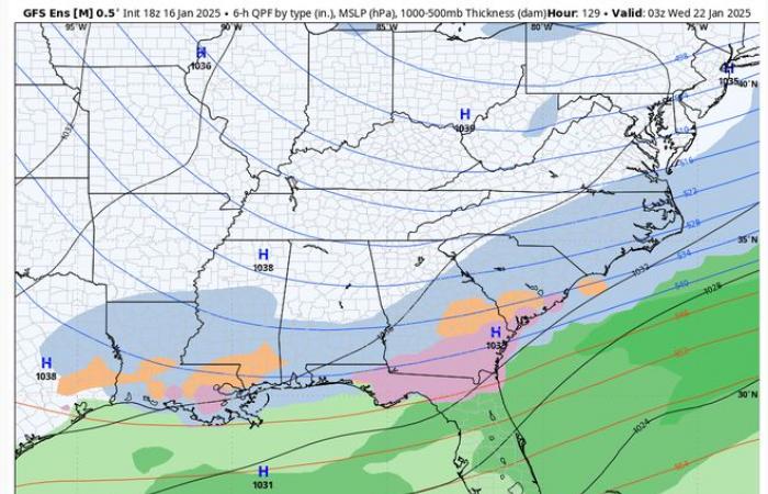
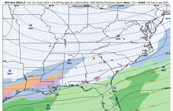
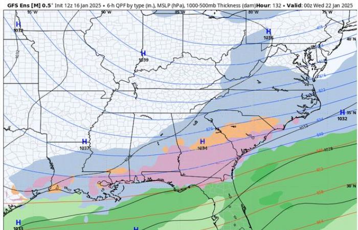
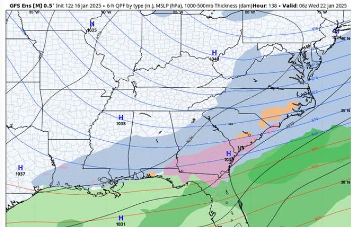
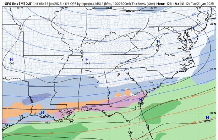
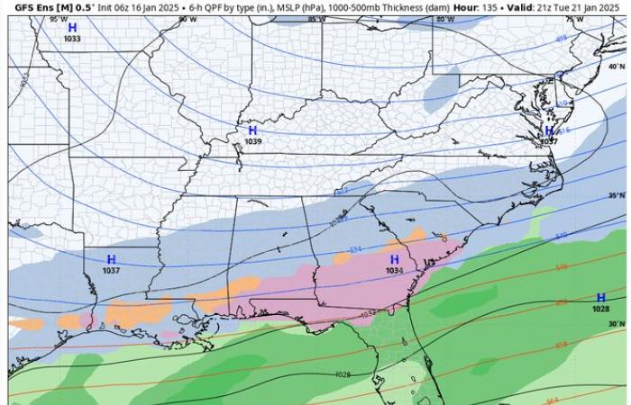
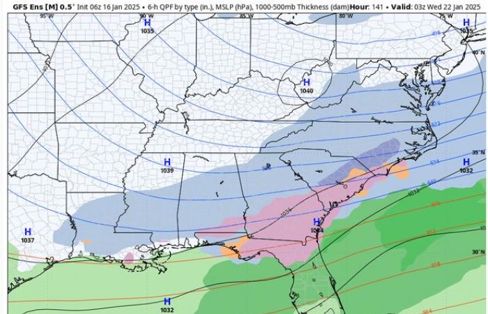
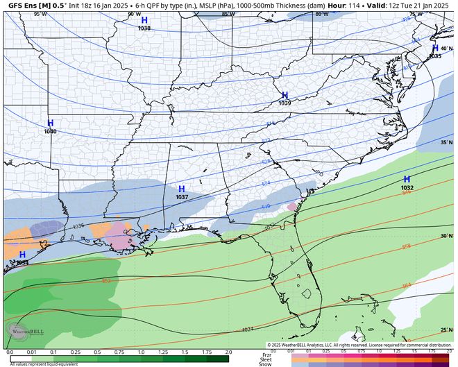
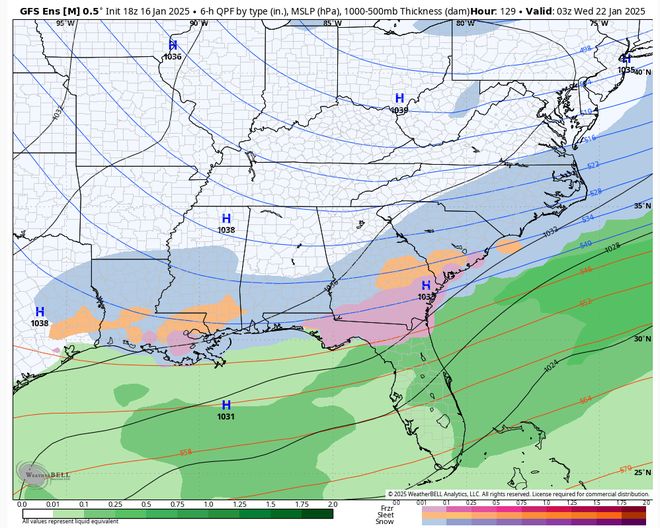
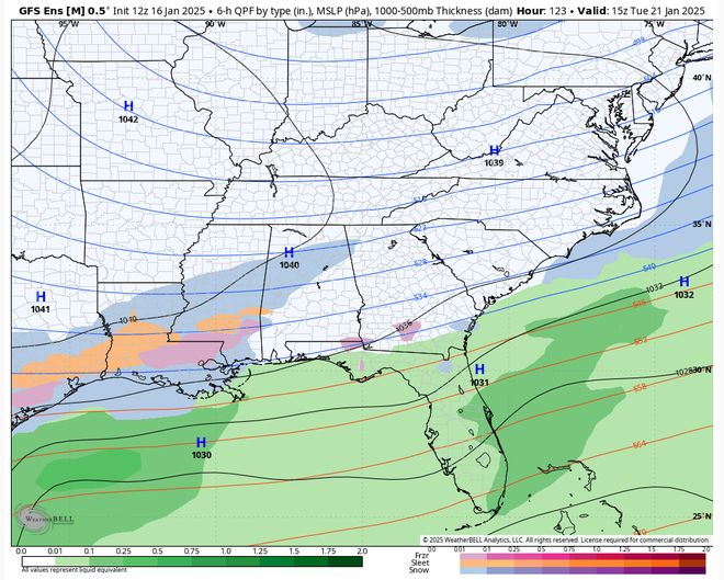
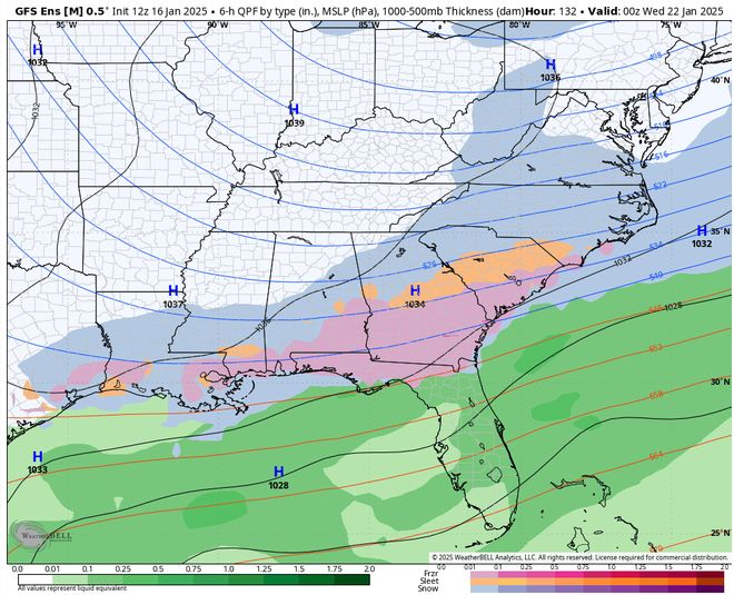
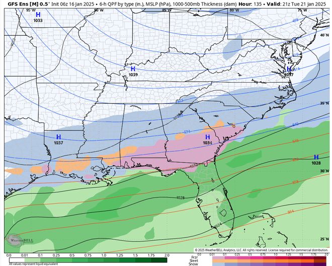
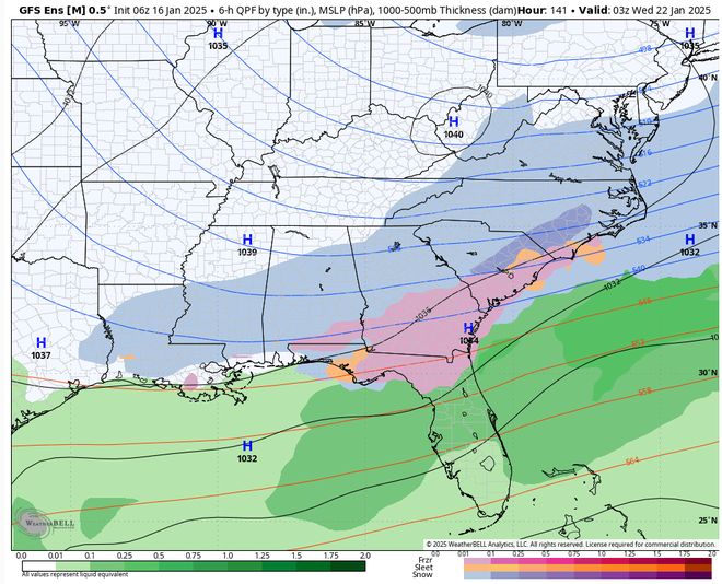
Meteorologists and forecasters have found these “ensemble forecasts” to be much more reliable in forecasts beyond 2-3 days out. Here’s what the last few GFS ensemble forecasts have shown.
– 18z GFS Ensemble Thursday 1-16
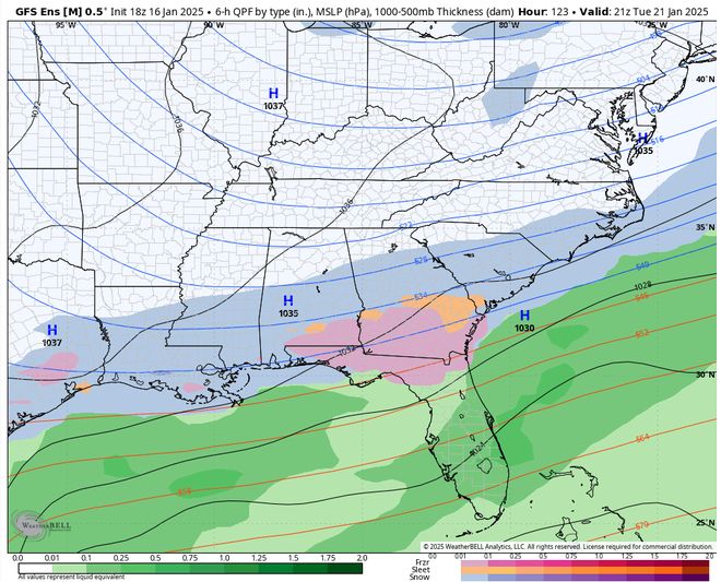
– 12z GFS Ensemble Thursday 1-16
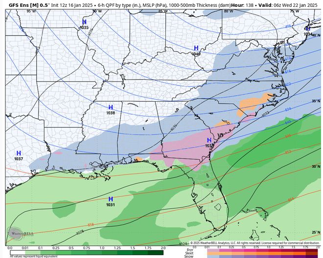
– 06 z GFS Ensemble Thursday 1-16
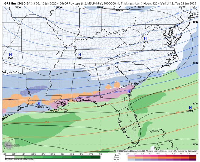
THE TAKEAWAYS
While the deterministic GFS forecasts have flipped back and forth between varying solutions, the ensemble forecast has been consistent in breaking out wintry weather across Southeast Louisiana. It’s also been consistent in showing mixed wintry weather and not just snow. However, in the latest run it brings the precipitation farther south towards the coast and outputs more snow than mixed.
I want to see more data heading into the weekend before I’m confident that wintry weather will happen next Tuesday, but the ensembles have been consistent in their showing of wintry weather.
ECMWF (European Centre for Medium-Range Weather Forecasts – Europe)
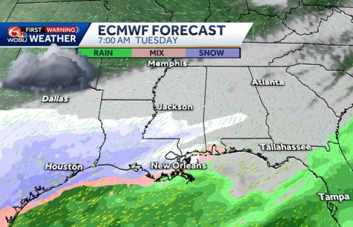
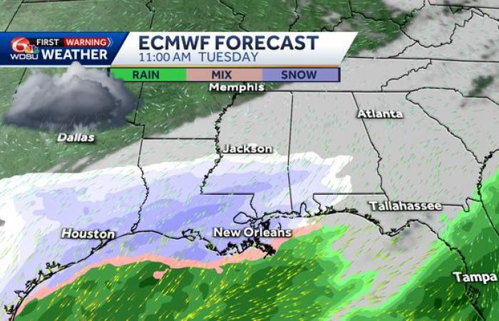
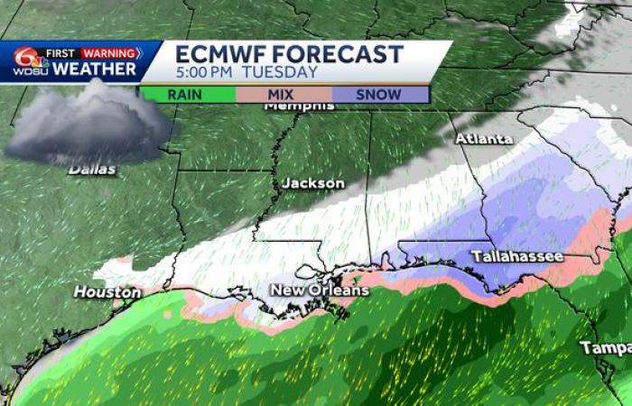
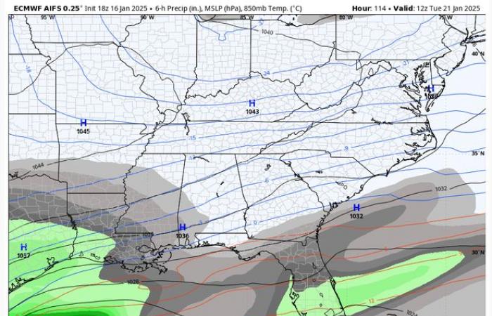
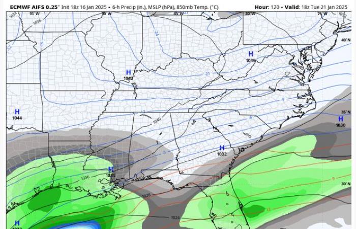
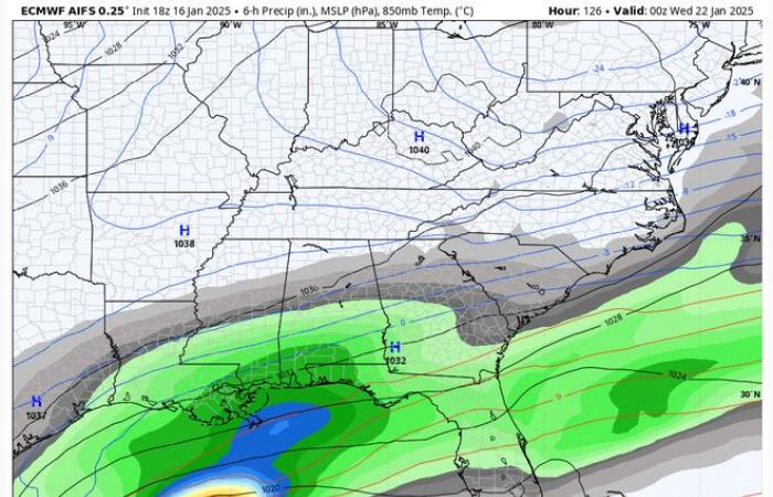
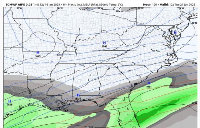
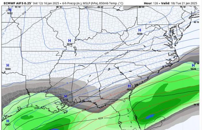
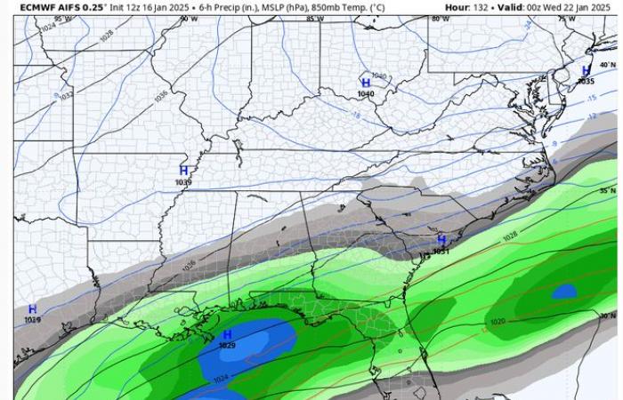
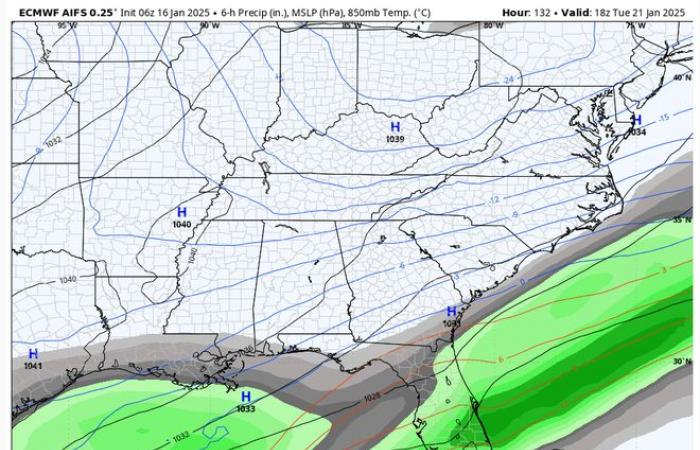
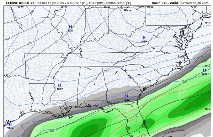
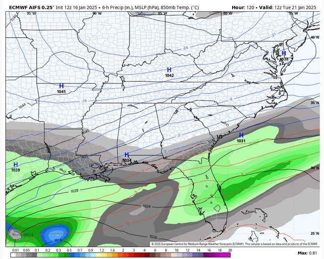
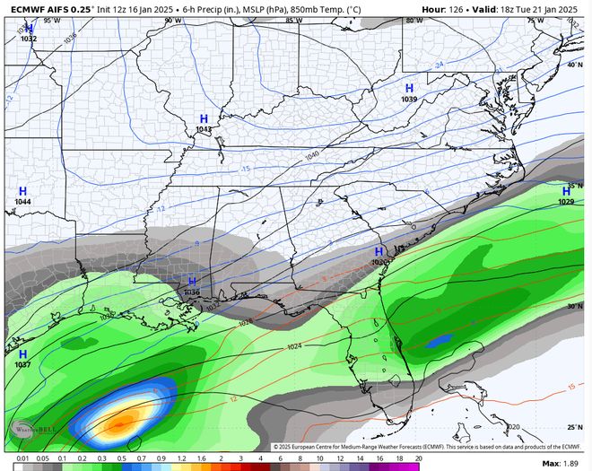
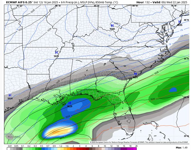
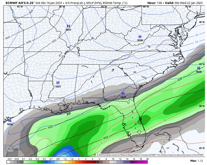
The ECMWF has been fairly consistent in its operational runs in brining wintry weather to Southeast Louisiana next Tuesday. Here’s what its latest deterministic runs looked like on Thursday.
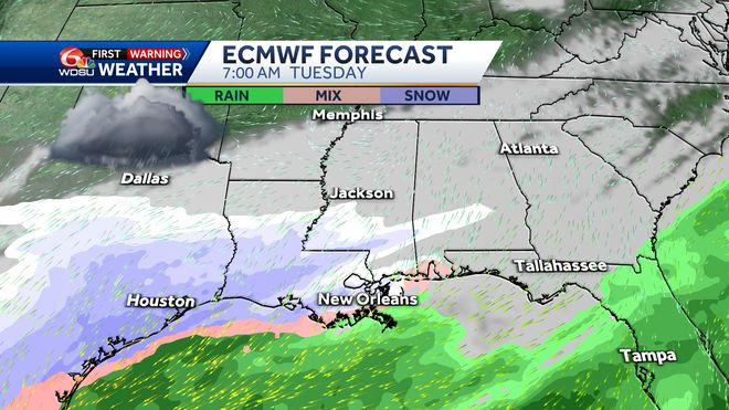
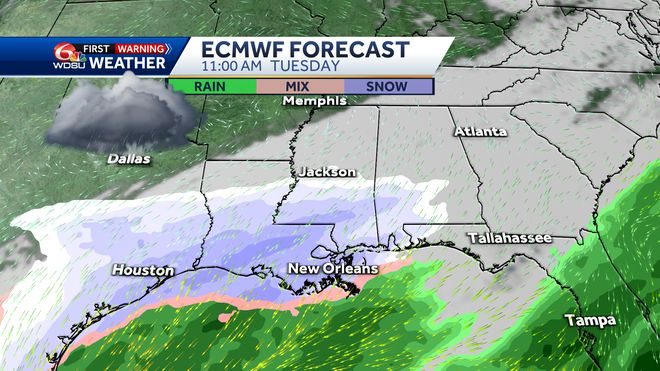
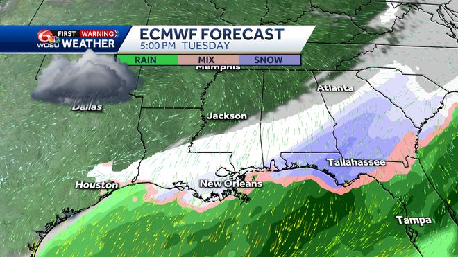
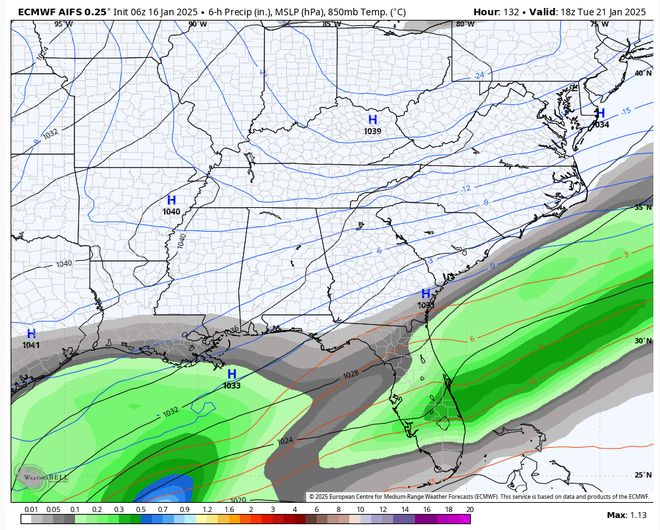
The ECMWF ensemble forecasts have been pretty consistent over the last several runs.
– 18z Thursday 1-16
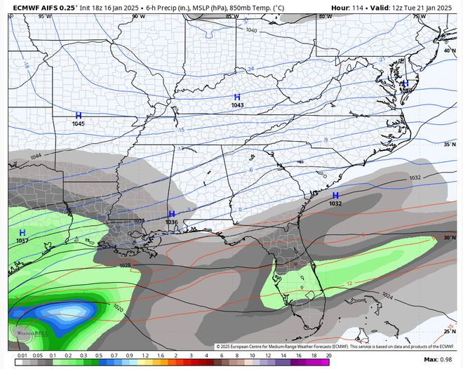
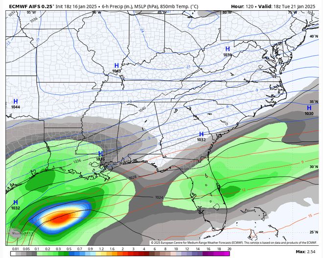
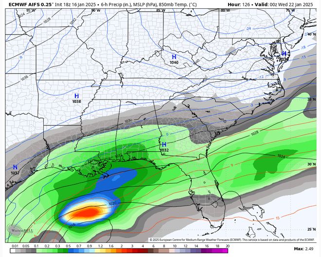
– 12z Thursday 1-16
– 06 Thursday 1-16
TAKEAWAY
With the exception of the 06z run, the ECMWF Ensemble has also been consistent in breaking out wintry weather across all of Southeast Louisiana. Note, it has also trended in taking wintry weather farther south towards the coast too.
ANALYSIS:
It is still way too early to definitively call that wintry weather is likely across the region. Even the Weather prediction Center (WPC) still has very low chances of wintry weather at 10% and 30% chances.
We’ll need to consistently follow the ensemble data, and hopefully over the weekend begin to get a clearer picture of what could be in store for next Tuesday.
PRECIPITATION TYPES:
When the atmosphere gets cold enough, the clouds are actually comprised of ice crystals. When the precipitation first falls, it falls in the form of snow. However, here along the coast the snow usually runs into a layer of air warmer than freezing and melts into rain. If the rain meets temperatures below freezing at ground level and doesn’t have enough time to refreeze, it is called “freezing rain” where the rain drops instantly freeze up into a sheet of ice on the roads and cover the trees, brushes, and fences with a glaze of ice. This is the most dangerous form of wintry weather! If the once snowflake raindrops encounter a deep enough layer of sub freezing air at ground level, it will refreeze into an ice pellet, or sleet. And if the snow never meets a point falling to the ground where the air temperature rises above freezing, it will fall as snow. Here’s a diagram of what this looks like.
Be sure to stay with the WDSU First Warning Weather Team for all the latest on next week’s possible wintry weather.
Morocco

