Light snow is in the forecast for South-Central Pennsylvania tonight into tomorrow. The WGAL News 8 Storm Team has designated Friday night as an Impact Night, which means the weather could disrupt your normal daily schedule or routine. WGAL Chief Meteorologist Christine Ferreira said roads could be snow-covered overnight.Susquehanna Valley snow timing10 P.M. TO 1 A.M. | Light snow will begin from west to east. OVERNIGHT | Steady, light snow will fall overnight, amounting to a coating to one inch for most of the area. There could be a few spots that get two inches of snow.SATURDAY MORNING | Snow will end from west to east by 8 a.m.Because temperatures will be in the 20s as snow falls, it will stick to all surfaces, including the roads. Drivers are urged to use caution when traveling.Temperatures stay cold. However, it looks like there will be a slight warm-up next week. The full forecast is here.SOUTH-CENTRAL PA WEATHER RESOURCES: INTERACTIVE RADAR | ACTIVE WEATHER ALERTS | CURRENT CONDITIONS | HOURLY FORECAST | 10-DAY FORECAST | WEEKEND FORECAST | MAP ROOM | DOWNLOAD THE APP | WEATHER EMAILS
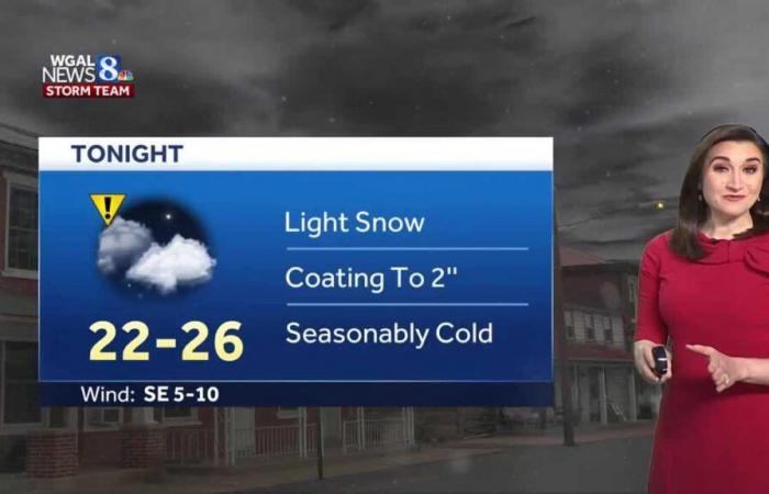
Light snow is in the forecast for South-Central Pennsylvania tonight into tomorrow.
The WGAL News 8 Storm Team has designated Friday night as an Impact Night, which means the weather could disrupt your normal daily schedule or routine.
WGAL Chief Meteorologist Christine Ferreira said roads could be snow-covered overnight.
Susquehanna Valley snow timing
10 P.M. TO 1 A.M. | Light snow will begin from west to east.
OVERNIGHT | Steady, light snow will fall overnight, amounting to a coating to one inch for most of the area. There could be a few spots that get two inches of snow.
-SATURDAY MORNING | Snow will end from west to east by 8 a.m.
Because temperatures will be in the 20s as snow falls, it will stick to all surfaces, including the roads. Drivers are urged to use caution when traveling.
Temperatures stay cold. However, it looks like there will be a slight warm-up next week. The full forecast is here.
SOUTH-CENTRAL PA WEATHER RESOURCES: INTERACTIVE RADAR | ACTIVE WEATHER ALERTS | CURRENT CONDITIONS | HOURLY FORECAST | 10-DAY FORECAST | WEEKEND FORECAST | MAP ROOM | DOWNLOAD THE APP | WEATHER EMAILS


