STATEN ISLAND, N.Y. — With January officially underway, the threat of snow and frigid temperatures in New York City is a real possibility. Although only a few days into 2025, the first snowfall of the year will be making its way to the city early next week.
A disruption in the polar vortex will allow for Arctic air to seep southward into the U.S. this weekend. With freezing temperatures in place, any precipitation-packed system could produce snowfall in the five boroughs.
As previously reported, meteorologists have been monitoring a winter storm with the potential of delivering several inches of snow to New York City. With the forecast becoming a bit clearer, AccuWeather now believes that while New York City will still receive snow, it may not exceed an inch of accumulation.
The latest on ‘cross-country’ storm
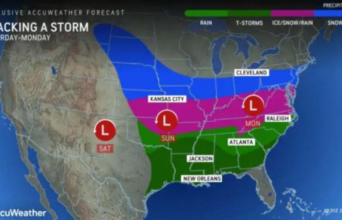
This “widespread cross-country” storm capable of producing plowable snow will extend for about 1,000 miles from western Nebraska to West Virginia, according to AccuWeather.
While this weather could trigger hazardous conditions in many parts of the country, here in New York City, the situation may not be as impactful.
The winter storm is expected to bring snow to the city sometime late Sunday night into early Monday morning, as detailed by Tom Kines, a senior meteorologist with AccuWeather.
“The way things look right now, we’d be on the northern fringes of the snow. So we wouldn’t get much, if any,” said Kines. “But, if by chance the storm happened to track 50 miles farther north that’d be trouble for us, we’d get more snow.”
On the other hand, if the storm were to track 50 miles south, the city would get nothing from this storm. By the time this storm moves away on Monday, Kines believes the city will have received an inch or less of snow. Still, the senior meteorologist warns that these conditions could make for a messy Monday morning commute.
“If you get up into the Hudson Valley, the way it looks now, they would get nothing,” Kines added. “Whereas, if you go farther south, maybe into central and southern New Jersey, they could at least get a few inches if not several inches down there.”
Although the forecast may show dwindling chances of intense snow in the city, Kines indicates that if the storm were to strengthen, it could ultimately track farther north and result in heavier snowfall.
On the heels of the storm, elevated wind speeds of around 15-30 mph will settle into the New York City area for a “day or two” Monday night into Tuesday, Kines explained.
“We’re likely to stay in a weather pattern where temperatures are averaging at or below normal, so you factor in the wind and it’s probably going to feel 10 degrees colder than what the actual temperature is,” Kines said.
As of Thursday afternoon, Monday will feature a low of 25 degrees, while Tuesday will bring a low of 24 degrees Fahrenheit to New York City, according to AccuWeather.


