Highlights of the day
– widespread deterioration in ¾ of the country before evening
– fairly strong winds over a large part of the country with gusts to 60-70 km/h
– sustained rains in central regions
– snow on all massifs except the Pyrenees at increasingly lower altitudes in the evening
– snow up to the plain in the northeast
– return of nice clearings in the northwest after the rains
– drop in temperatures
Matin
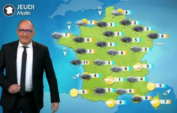
The rains near the Channel at the end of the night are replaced by calmer weather with clearings. From the Loire" rel="tag">Pays de la Loire to the Ardennes via the Paris basin, the umbrella is useful at the start of the morning, then the weather becomes drier. From Poitou and the Charentes to the Grand Est via the Loire Valley, the rains are quite sustained under a fairly strong wind blowing at 60-80 km/h in gusts. Between Champagne and Alsace, snow replaces rain and begins to hold at an altitude of 400 meters. Everywhere else, the weather is dry under cloudy skies.
Temperatures range from 1 to 5°C on average, 6 to 8° near the coasts.
Fairly strong winds Thursday © the weather channel
Afternoon
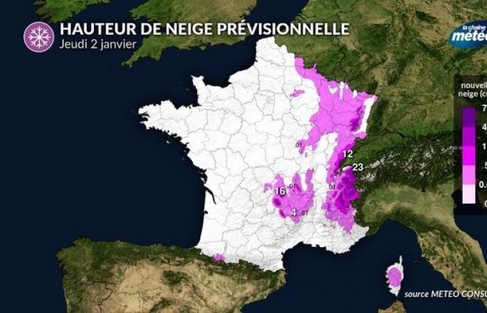
The disturbance continues to progress and stretches from northern Aquitaine to northern Rhône-Alpes to Burgundy and the Jura to the Grand Est with rain and wind. The rain/snow limit drops quickly to around 500 meters at the end of the afternoon in the Center-East. It snows in Alsace and Lorraine all the way to the plains. Be careful on mountain roads as the snow on the ground can reach several centimeters. From the Aquitaine basin to the central Alps via Auvergne, the sky becomes cloudy and the rain arrives around 5 p.m. Near the Mediterranean, the weather is calm, but quite cloudy. Showers affect Corsica.
Temperatures fluctuate around 3 to 7°C north of the Loire. South of a Bordeaux / Montélimar line, they hover around 10°C to 15°C near the Mediterranean.
Snow expected Thursday © the weather channel
Soirée
Be careful in the Center-East with snow all the way to the plains in the Auvergne valley, Rhône-Alpes and Burgundy-Franche-Comté. The layer can reach 10 to 20 cm on the Vosges, the Jura above 600 meters. In the Grand Est, in cooled air, watch out for the formation of black ice during the night from Thursday to Friday. In the South-West, it rains lightly while the weather remains dry near the Mediterranean. Over a good northern and western half of the country, the weather is also drier. The last showers over Hauts-de-France in the early evening are fading.

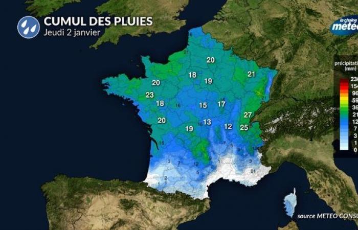
Total rainfall Thursday, January 2 © the weather channel
Things to remember over the next few days
After a cold Friday, the weather begins to change for the weekend. Indeed, a disturbance rises from the Bay of Biscay on Saturday towards the north of France on Sunday, accompanied by a risk of snow on Saturday followed by a rainy and windy spell on Sunday.


