Hide summary
To end the year, the weather plays the card of tranquility in France. Under the influence of high pressure, the sky remains generally calm, leaving little room for disruption. Be careful, however, at nights and mornings, where some slippery phenomena could surprise you, especially on wet roads.
If this wintery mildness seems to linger for the last days of December, a change is already on the horizon. Here are the latest forecast according to the bulletin of Tameteo.com.
The weather forecast announces the return of cold weather
The start of the year promises to be lively weather-wise, with an atmosphere oscillating between deceptive mildness and predicted cold spells. A depression coming from the northwest is about to strike.
It will bring in its wake a cocktail of rain and sustained winds. A few stormy gusts may even land on the coast. Inland, the wind will be more moderate, but its presence will not go unnoticed.
To have
Weather: towards a return to calm? These forecasts forecast for 4 weeks in France
A flow from the southwest will allow break of sweetness throughout France. However, the picture remains largely dominated by omnipresent clouds, relegating the sun to the background. This relative calm will only precede a more marked change in the weather conditions.
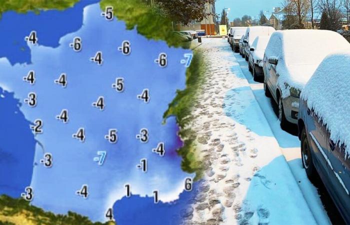
The first days of January will see a distinct change in the air. A mass of cold air gradually descends from England and the North Atlanticready to settle in France. This icy current will soon cause temperatures to drop, bringing back a real winter feeling that had until then been in the background.
Increasingly wintry weather
From Thursday and Friday, the weather will take a much more wintry turn. This shift is explained by a flow coming from the north to the northwest, propelled by a anticyclone positioned over the Atlantic and one sliding depression towards Northern Europe. Result ? A marked drop in temperatures and an expected return of snow to all areas.
Lovers of snowy landscapes could be served, because even the plains could see a few snowflakes fall. However, their precise location still remains uncertain, with weather models refining their forecasts as the days go by.
This refresh does not appear to be a simple passing episode. Temperatures are expected to remain below seasonal norms at least until the first weekend in January. Some scenarios even envisage an extension of this winter weather until mid-January. However, this hypothesis seems to lose credibility as forecasts progress.
To have
Weather: snow and bad weather? What to expect for the Christmas holidays
A change in the weather around mid-January
From mid-January, the weather forecasts announce a change of course with the arrival of a flow from the southwest. This shift would lead to a return of a more moderate low-pressure regime, accompanied by new rainy disturbances. Mildness would then return to a large part of the country, offering a respite from the cold waves.
This alternation between cold periods and milder times remains characteristic of the French climate. However, what is striking today is the speed and intensity of these weather transitions. They are increasingly experiencing sudden changes, a phenomenon which undoubtedly illustrates the impact of global warming.
While winter seems to want to put down its bags for a while, let's not forget that weather developments can still surprise us.


