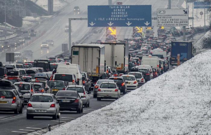
Three departments in the Auvergne-Rhône-Alpes region – Haute-Savoie, Savoie and Isère – have been placed on orange alert for the risk of snowfall and ice and the risk of avalanches for the days of Monday 23 and until Tuesday, December 24, 10 a.m., by Météo-France. The Ain department has been placed on orange alert for snow and ice until Tuesday morning as well.
“The snowfall has subsided but the refreezing is significant in certain valleys,” reports the forecaster in his Tuesday bulletin at 6 a.m.
Snow has fallen heavily since Sunday morning in the region, causing slowdowns and accidents on certain roads, some TER line interruptions and power cuts. These snowfalls, on the other hand, delighted the ski resorts, a few days before the holidays.
The thickness of the snow on the ground generally exceeds 10 centimeters from an altitude of 600 or 700 meters. Between 800 and 1,000 meters above sea level, there are now 31 centimeters in Bourg-Saint-Maurice (Savoie), 37 centimeters in Chamonix (Haute-Savoie) and 44 centimeters in Villard-de-Lans (Isère), according to Météo- France.
“In the high mountains, we sometimes reach a meter of fresh snow. But this snow, strongly blown by the wind, created local accumulations of nearly two meters”adds Météo-France.
Motorists are called to “great vigilance” on the roads by State services, and to drive equipped with winter tires or chains. Throughout the Northern Alps, the snow cover is unstable, and off-piste skiing is strongly discouraged.
In the Hautes-Alpes (yellow alert), the closure of the Col du Lautaret has been extended by the prefecture until Tuesday 9 a.m., the road being “impractical” due to snowfall and strong gusts of wind.
Read the explanation (2022): Snow at Christmas, an endangered species in Europe
Read later


