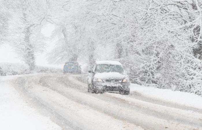
It’s December and this is definitely the question we get asked the most; ‘Will it be a white Christmas?’
We actually start getting questioned about this in October (sometimes before), but the short and disappointing answer is; it is still too early to say. It’s not until the week before Christmas that we should start to have an idea about the chances of seeing any flurries on the big day.
But headlines are talking about Arctic blasts, snow bombs and snowstorms already
Yes. And these excitable headlines occur all year round. Literally, come rain, shine or snow. But they often use one-off, individual forecasting model runs to suggest what weather ‘might’ be on the way. However, the truth is that single model runs are not reliable enough to work out a detailed forecast, they are just one part of the wide range of information needed to provide a full forecast picture.
Met Office Meteorologist Aidan McGivern said: “What meteorologists actually do, is rather than cherry pick one computer model run for more than two weeks’ time, the computer models are run lots and lots of times and then we can pick out areas where they are agreeing and areas where they are disagreeing. Then we can talk about likely weather patterns and less-likely weather patterns, common themes and so on.”
Aidan explains more in this week’s Met Office Deep Dive video about what the various models are saying. This is also available on the Met Office App and Met Office YouTube channel.
What about your long-range forecast?
Yes, our long-range forecast now covers the festive period but, it isn’t a detailed forecast like our five-day forecasts.
The long-range forecast gives a broad description of the weather that is likely to be affecting the UK. It gives an indication of ‘how’ the weather might change or be different from normal (like getting warmer, colder, wetter or drier for example), but it doesn’t go into too much detail as the story is always changing.
This is because when looking at forecasts beyond five days into the future, the chaotic nature of the atmosphere begins to play a larger part. Even small events currently over the Atlantic can have potentially significant impacts on our weather in the UK in several days’ time. Therefore, whilst our long-range forecast gives a prediction as to what the weather may be doing over the Christmas period, we have to acknowledge that many outcomes remain possible, and it won’t be until much closer to the time that we can say with any more certainty.
Find out more about our long-range forecast.
Why is snow so difficult to forecast?
Forecasting impactful snow is famously tricky in the UK. There are a number of factors that our expert meteorologists look for and numerous competing elements that all have to be exact for snow to actually fall. Sometimes, just a fraction of a degree in temperature can make the difference between the chance to build a beautifully formed snowman, and the joys of a sleety slushy day. That’s why forecasting snow weeks in advance is extremely tricky.
Here’s Aidan to explain more:
How likely is a white Christmas?
For the Met Office to declare a ‘white Christmas’, a single snowflake has to be observed falling on the 24 hours of 25 December, by either an official Met Office observer or by a Met Office automated weather station. This is because it needs to be officially verified both for our climate records, and also to provide consistency and certainty.
Climatologically, Christmas Day is like other winter days in the UK, where the weather is strongly driven by the air mass we are influenced by at the time and the behaviour of the jet stream.
Since 1960, around half of the years have seen at least 5% of the station network record snow falling on Christmas Day. This means we can probably expect more than half of all Christmas Days to be a ‘white Christmas’.
However, the Dickensian scene of widespread snow lying on the ground on Christmas Day is much rarer. There has only been a widespread covering of snow on the ground (where more than 40% of stations in the UK reported snow on the ground at 9 am) four times since 1960 – in 1981, 1995, 2009 and 2010.
When was the last white Christmas?
Technically, 2023 was the last white Christmas in the UK with 11% of stations recording snow falling, although none reported any snow lying on the ground.
Before that, 2022 saw 9% of weather stations recording falling snow, but none with any snow settling. 2021 and 2020 were also technically white Christmases, both with 6% of weather stations recording snow falling, but in these years, less than 1% of stations reported any snow lying on the ground in 2021 and only 4% in 2020.
There was no record of snow falling at any station in the UK in 2018, or in 2019.
The last widespread white Christmas in the UK was in 2010. It was extremely unusual, as not only was there snow on the ground at 83% of stations (the highest amount ever recorded) but snow or sleet also fell at 19% of stations.
We also had a white Christmas in 2009, when 13% of stations recorded snow or sleet falling, and 57% reported snow lying on the ground.
Want to know more about snow?
Watch: Four things you may not know about snow
Find out more about how snow forms
Find out 10 facts about snow
Find out how to prepare for winter weather with WeatherReady.
Where to get your Met Office weather forecast
You can find the latest forecast on our website, on YouTube, by following us on X and Facebook, as well as on our mobile app which is available for iPhone from the App store and for Android from the Google Play store.


