The U.S. East Coast braced for a turbulent stretch of weather on Wednesday, marked by heavy rain, strong winds, and potentially hazardous conditions. This unusual weather pattern, influenced by an atmospheric river and the development of a bomb cyclone, promised a dramatic shift in conditions for the region.
Meteorologists warned that the combination of these powerful systems could bring localized flooding, power outages, and travel disruptions while residents prepared for the volatile system to strike.
Western Maine and other parts of the U.S. East Coast could experience a whirlwind of extreme weather in just a single day, according to Derek Schroeter, a forecaster with the National Weather Service based in Gray, Maine. The region is bracing for freezing rain, heavy downpours, unseasonably warm temperatures, and damaging winds.
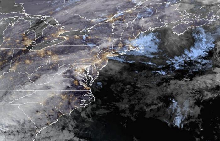
This image shows the U.S. Atlantic east coast on Dec. 10, 2024. The U.S. East Coast braced for a turbulent stretch of weather on Wednesday, marked by heavy rain, strong winds, and potentially hazardous conditions.
More
NOAA/AP
What Is a Bomb Cyclone and When Will It Hit?
Forecasters predict that the intense rainfall and strong winds will persist through Wednesday night in many areas, with localized flooding a significant concern. Wind gusts exceeding 60 mph could lead to widespread damage, prompting utilities to prepare for potential power outages while crews stand by to respond to expected disruptions.
Meteorologists have warned that the storm may undergo bombogenesis, also known as a “bomb cyclone,” a phenomenon involving the rapid intensification of a cyclone over a short period. This process can lead to severe rainfall and heightened storm impacts.
Similar conditions had been possible elsewhere from Tuesday night to Wednesday night.
“We’re looking at the risk of slick travel (Tuesday night) with the freezing rain,” Schroeter said, “and we are going to be watching for the potential for flash flooding and sharp rises on streams as temperatures rise into the 50s.”
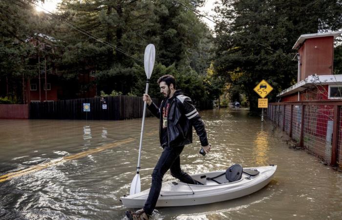
Tristan Millstone reacts as he steps in water after kayaking across a flooded section of Neely Road to buy groceries after a major storm in Guerneville, Calif., Saturday, Nov. 23, 2024. Meteorologists warned that the combination of powerful weather systems could bring localized flooding, power outages, and travel disruptions while residents prepared for the volatile forecast.
More
Stephen Lam/San Francisco Chronicle/AP
What Is the Difference Between a Bomb Cyclone and Atmospheric River?
An atmospheric river—a lengthy band of water vapor capable of moving moisture from the tropics to northern regions—is one of the primary drivers of the East Coast’s dramatic weather, explained Schroeter.
This storm poses a particular threat to New England, because it can draw moisture from the Atlantic Ocean near the southeastern U.S. and deliver it to areas such as Maine. Schroeter described the system as a “multifaceted storm,” warning that some parts of the state could see two to three inches of rainfall, adding to the potential for flooding and other weather-related impacts.
Parts of the Northeast were already bracing for the storm’s effects. In Maine, some schools started Tuesday with delayed openings following a few inches of snow earlier in the day. Meanwhile, Vermont issued a flood watch from Wednesday afternoon through Thursday morning while the region prepared for heavy rainfall and potential flooding.
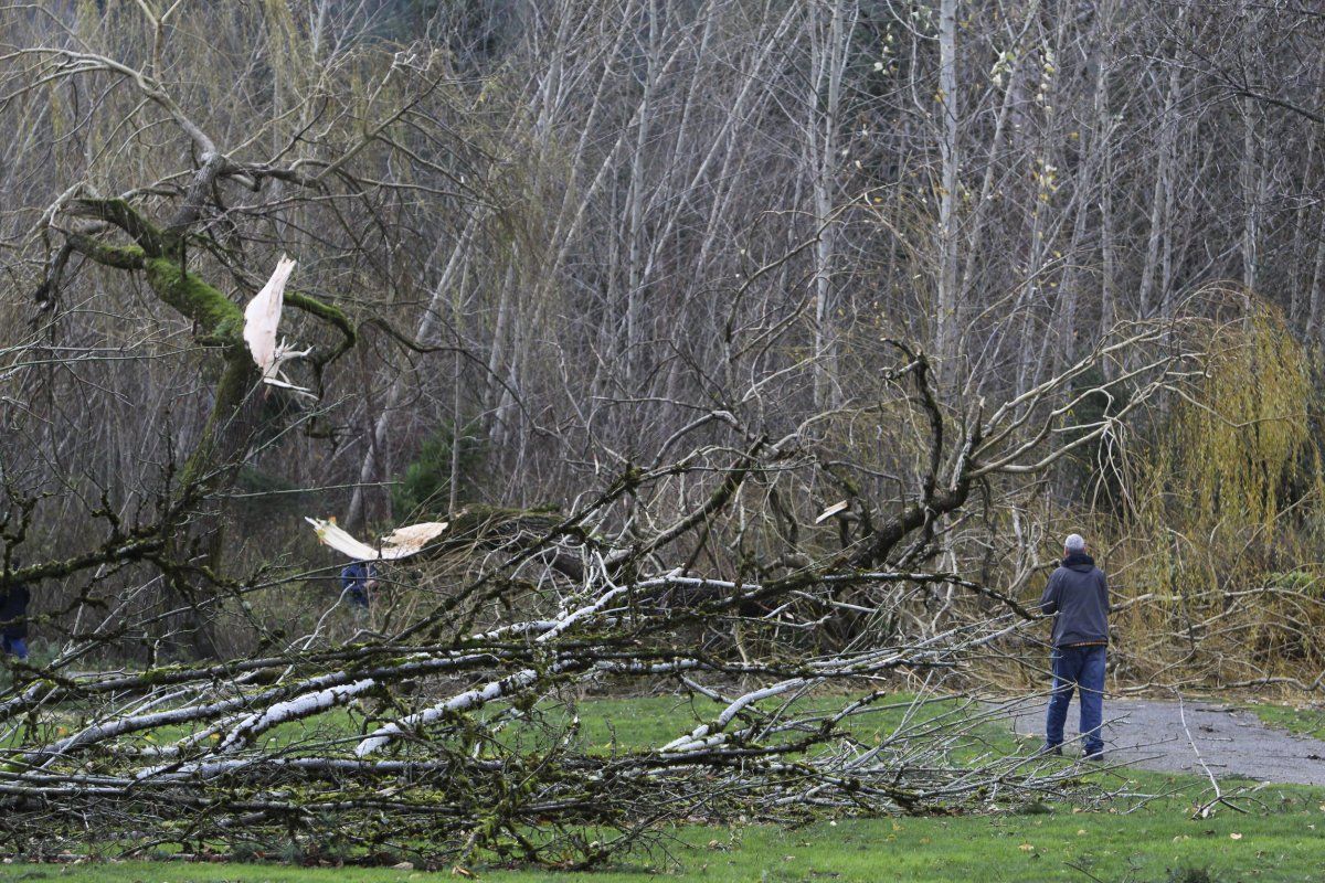
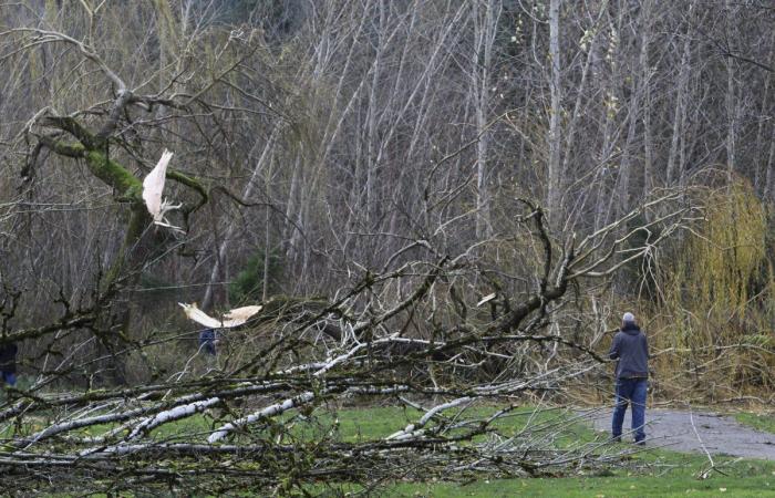
A man walks by fallen trees after a “bomb cyclone” storm brought heavy winds to Issaquah, Wash., Nov. 20, 2024. Western Maine and other parts of the U.S. East Coast could experience a whirlwind of extreme weather in just a single day.
More
Manuel Valdes/AP
How Do I Prepare for a Bomb Cyclone?
In Montpelier, Vermont, city officials were urging residents to prepare for potential mild flooding. Advisories included elevating items in basements and low-lying areas prone to water intrusion. The city emphasized ongoing communication with the National Weather Service and Vermont Dam Safety, assuring residents it would “actively monitor the river levels as this storm passes through.”
Meanwhile, ski resorts across the Northeast braced for a soggy day. Stratton Mountain Resort in southern Vermont alerted visitors on its website to expect wet conditions, advising them to “make sure to pack your Gore-Tex gear because it’s going to be a wet one.” The storm’s affect threatened to dampen midweek plans for skiers and snowboarders alike.
This article includes reporting from The Associated Press

