Highlights of this day
– general mildness throughout the country, up to 20°C in the Basque country in the afternoon
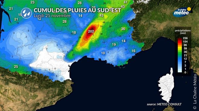
– the return of rain in Languedoc, heavy in the Cévennes
– strong winds in the Channel, on the Pyrenees which become widespread in the Center-East in the afternoon
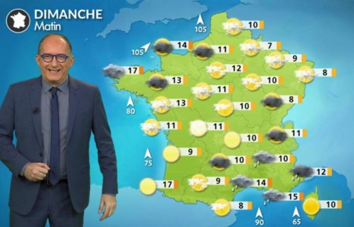
Increase in maximum temperatures © gmatricon
This morning
You have rain and wind in Brittany and very cloudy skies from Pays de la Loire to Hauts-de-France with a few rare showers. You also have rain between Provence-Alpes Côte d'Azur, the south of Rhône-Alpes and Languedoc-Roussillon in a windy atmosphere. Everywhere else, your morning passes in dry conditions under a hazy sky.
We no longer talk about frosts in the morning. It ranges from 6°C in the Ardennes to 17°C in the Basque country at daybreak.
This afternoon
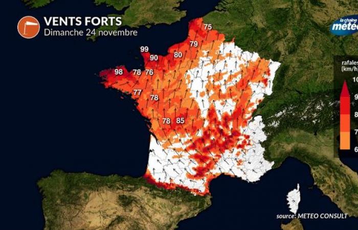
It continues to rain in Brittany with winds reaching 100 km/h in gusts along the seaside. From Pays de la Loire to Hauts-de-France, the sky remains very cloudy in a windy and mild atmosphere. In the south-east, you maintain humid and strongly windy weather, particularly in Languedoc, in the Cévennes. You also have wind in the Pyrenees which reaches more than 120 km/h in the high mountains where it is stormy. Everywhere else, you enjoy spring weather, under a hazy sun, very mild and strong wind.
The mildness is remarkable, all the more remarkable as it occurs 48 hours after the cold snap. Maximum temperatures range from 16°C in Lille to 23°C on the Basque coast. It is cooler on the Côte d'Azur with 15°C in Nice under the clouds.
Strong winds on Sunday © the weather channel
Evening and night
Be careful near the Atlantic as far as the Channel coast where the wind blows strongly with the rain which becomes widespread during the night. It rains in Languedoc with increasing intensity as the hours go by. A southerly wind storm affects the Pyrenees. Everywhere else, the evening and night are mild, but strongly windy.

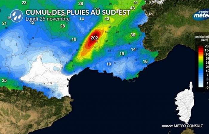
Heavy rains in Languedoc © the weather channel
Developments in the coming days
The weather is very choppy on Monday with the passage of a rainy and strongly windy disturbance. The wind blows like a storm in the Rhône valley, in the south of the Massif Central and in the Pyrenees just before the passage of heavy, occasionally stormy rain. Tuesday, the weather improves, except in the northwest where a new disturbance brings a little rain. On Wednesday, the weather is mixed, between rains in the northwest and clearings in the south. Subsequently, the anticyclonic conditions could be imposed throughout the country in an atmosphere that remains mild for the season.


