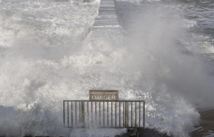
When the winds blow strongly, we often hear about a “storm”. However, this term does not apply to all episodes of strong winds. In meteorology, several criteria make it possible to distinguish a simple gust from a real storm, which depends on wind speed, their originet the extent of the phenomenon.
Strong winds, gales and storms: what are the differences?
Strong winds can result from several phenomena, such as thunderstorms, waterspouts or tornadoes. The latter generate very strong gusts but limited in duration and geographical area. In these cases, we are talking about violent windsbut no storm.
The editorial team advises you
So that there is a storm, a hollow atmospheric depression is necessary. This is what characterizes “classic” storms which affect land and coastlines, particularly in winter.
Classification thresholds according to the Beaufort scale
Gale : Average wind between 62 and 74 km/h (force 8).
Strong gust of wind : Average wind between 75 and 88 km/h (force 9).
Storm : Average wind greater than 89 km/h (force 10).
Inland, we speak of a storm when the gusts exceed 100 km/hwhile on the coasts, this threshold rises to 120 or 130 km/h. However, these values must be generated by a very hollow depression for them to qualify as a storm.
The editorial team advises you
Determining the Severity of a Storm
The power of a storm depends on several factors:
Maximum burst speed.
The duration of strong winds.
The area affected by winds greater than 100 km/h.
Storms like Martin (1999) or Klaus (2009) are distinguished by record gusts reaching 198 km/h in Saint-Denis-d’Oléron or 191 km/h in Perpignan, but also by their longevity and the scale of the impacted areas.
Memorable storms in France
Martin (1999) : Exceptional winds affected the South-West, reaching 198 km/h in Saint-Denis-d'Oléron.
Klaus (2009) : Marked by persistent winds, with gusts to 173 km/h in Biscarrosse.
Xynthia (2010) : A combination of strong winds, high tides and deadly waves caused 53 deaths in Charente-Maritime and Vendée.
Where do storms hit the most in France?
Météo France distinguishes between two types of storms:
Oceanic : They mainly concern the North-West regions (Normandy, Brittany) and, to a lesser extent, the South-West.
Mediterranean : Less frequent, they mainly affect the South-East and the Massif Central.
The Atlantic coast is often exposed, but the coasts of the English Channel et the Mediterranean coast experience the most intense winds. The interior, particularly in the South-West, is generally less affected.
Caetano is indeed a storm
Storm Caetano, which crosses France this Thursday, November 21, meets the criteria defining a storm rather than a simple episode of violent winds. According to Météo-France, a storm is characterized by average winds exceeding 89 km/h, with gusts that can reach or exceed 100 km/h inland and 120 km/h on the coasts.
During the passage of Caetano, significant gusts were recorded:
Limousin and Poitou-Charentes : falling trees, power outages and canceled trains reported.
Isère : gusts reaching 110 km/h in Bourgoin-Jallieu, leading to the closure of parks and gardens in Grenoble.
These observations indicate that Caetano generated winds consistent with storm thresholds, with gusts exceeding 100 km/h inland. Thus, it is appropriate to refer to Caetano as a storm rather than simply an episode of high winds.
In the event of a storm: caution and vigilance
Faced with winds exceeding 100 km/h, safety instructions are essential: limit movement, secure objects outside and stay informed thanks to weather alerts.


