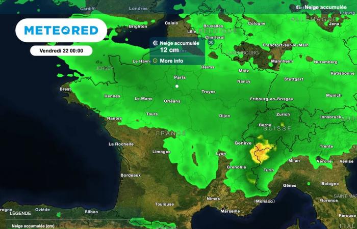
Snowfall is confirmed for the next few hours in France, with quantities on the ground which could locally be significant. Where exactly is snow expected? Find all our latest information in this article.
As expected, the Caetano storm crosses France, bringing its share of disruptions. 54 departments are placed on orange alert by Météo-France, due to snowfall expected in the north of the country and strong winds expected between Finistère, Gironde and the Alps.
Snowfall is expected to be significant locally, including in the plains, and should greatly complicate traffic conditions over the coming hours. School transport has been canceled in several departments. Heavy goods vehicles weighing more than 7.5 tonnes are also prohibited from driving in many departments this morning.
The first snowflakes were observed this morning in the interior of Côtes-d’Armor. How will this snow disturbance evolve in the coming hours? What time is snow expected where you live? Find our latest forecasts in this article.
Which regions will be affected by snow this Thursday?
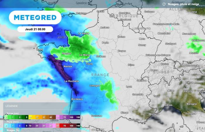
Many departments will be affected by sometimes heavy snowfall this Thursday.
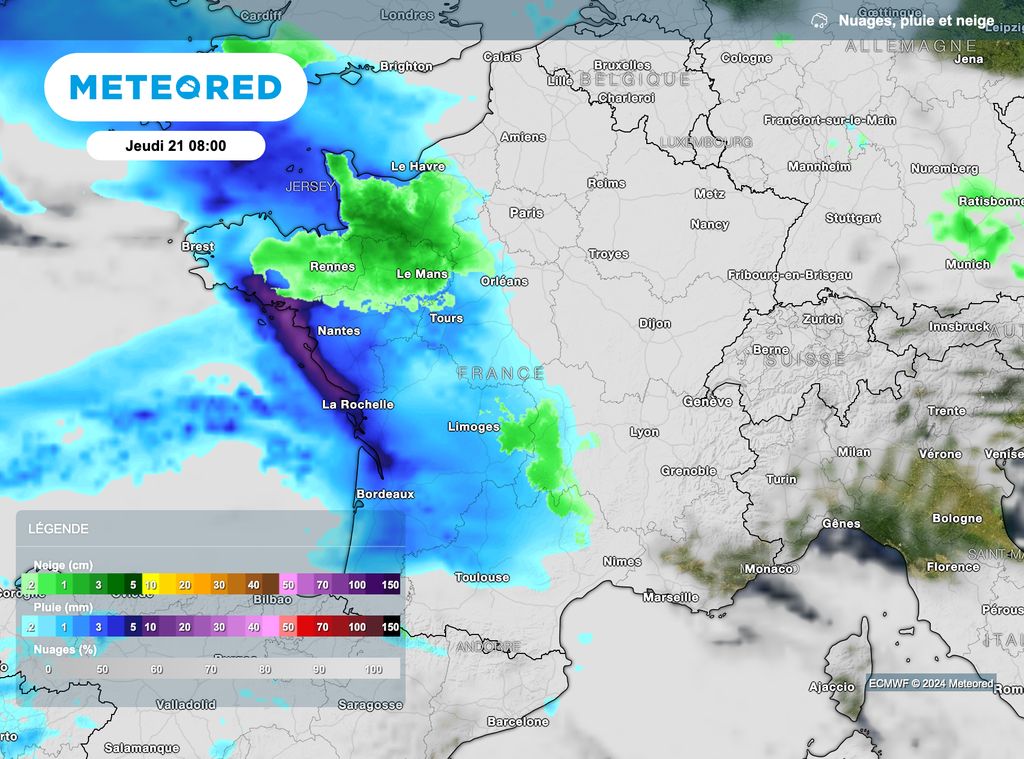
At 8 o’clock this morning, snowfall will affect the interior of Brittany, the north of Loire" rel="tag">Pays de la Loire and Lower Normandy.
In the plains, between 2 and 5 centimeters of snow are expected, while accumulations could locally reach around ten centimeters from 200 to 300 meters altitude.
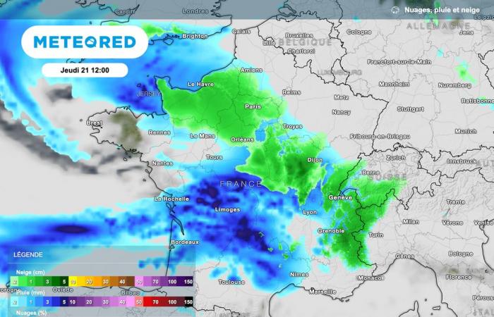
Snow expected in Île-de-France at the end of the morning
At the end of the morning, the disturbance will reach the west of the Paris basin. The whole of Île-de-France has been placed on orange snow-ice alert by Météo-France.
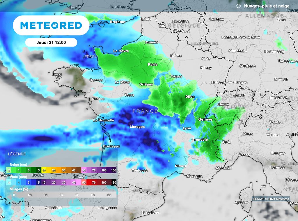
At the end of the morning, Snowfall will affect Normandy, the Paris region and the Centre-Val de Loire region.
Accumulations could be locally significant, particularly in the interior of Brittany, on the Normandy heights and the south of Île-de-France.
Traffic conditions are likely to be very difficult in Île-de-France, because the snowfall, which will begin at the end of the morning, will continue throughout the afternoon.
Snow reaches the north-east of France this afternoon
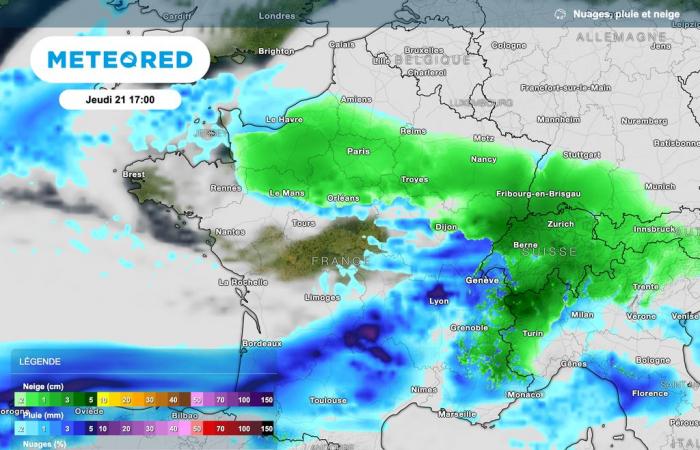
This afternoon, the snow will progress towards the north-east of France, particularly affecting the Burgundy-Franche-Comté region.
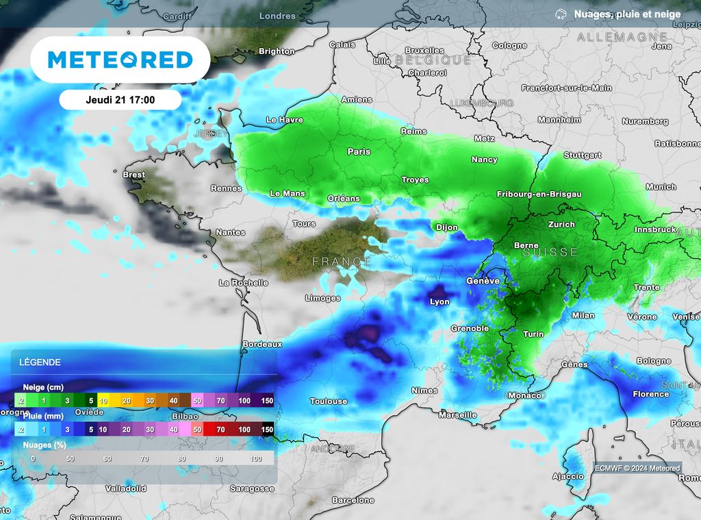
At the end of the day, as shown in the map above, many regions will be affected by sometimes sustained snowfall, notably Normandy, Île-de-France, part of the Grand Est region as well as Burgundy-Franche-Comté.
15 to 20 centimeters in the northeast
The quantities of snow are sometimes expected to be significant in the north-east of France, particularly in Franche-Comté.
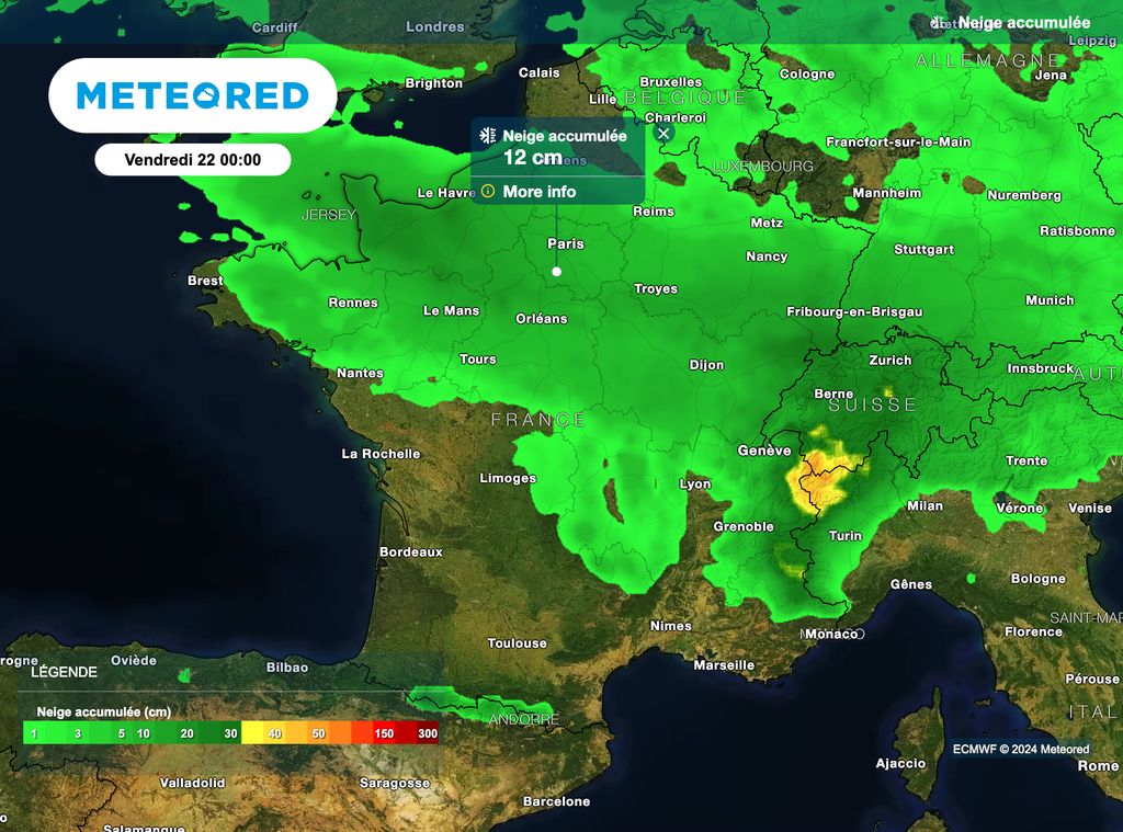
The Alps will also receive significant amounts of snow, with forecasts ranging from 30 to 50 centimeters, even up to 70 centimeters above 1500 meters altitude!
Watch out for the wind!
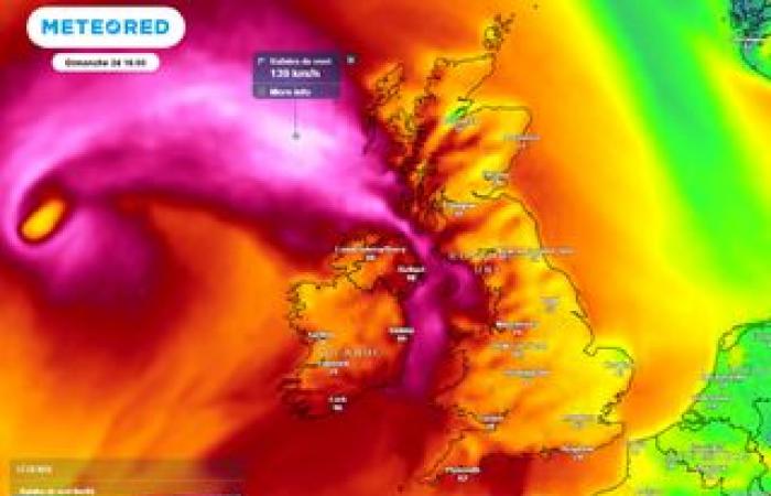
If many departments are placed on orange snow-ice alert, those located between Finistère and Gironde, as well as those crossing the central regions of France, Vendée and Charente-Maritime up to the Alps, are placed on orange alert for violent gusts of wind.
The gusts could approach, or even exceed locally, 130 km/h on the coast. Inland, they could reach or exceed 100 to 110 km/h.


