the essential
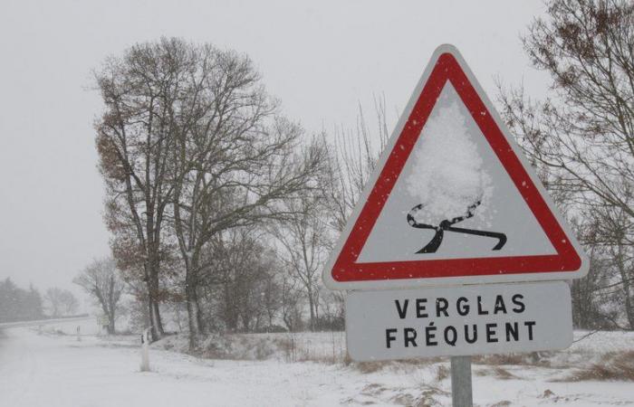
Snow, strong wind, risk of ice. The Caetano depression will bring very turbulent weather, all day, to France, this Thursday, November 21. More than half of the departments are placed on orange vigilance.
Winter is coming in 1 month on the calendar. However, real winter weather is forecast for France this Thursday, November 21, 2024, with snowfall on the plains from northern Brittany to the Grand Est and strong winds from the Atlantic to the Alps. Due to the Caetano depression, Météo France places 54 departments on orange alert for the day, 33 for snow and ice and 19 for wind.
The departments on orange snow-ice alert are: 04, 05, 10, 14, 18, 21, 22, 25, 27, 28, 35, 41, 45, 50, 52, 53, 58, 68, 70, 72, 75, 76, 77, 78, 88, 89, 90, 91, 92, 93, 94 and 95
The departments on wind alert are: 01, 03, 16, 17, 2A, 2B, 23, 29, 33, 38, 42, 44, 56, 63, 69, 73, 74, 79, 85, 86, 87.
What is planned for this Thursday morning
From the start of the morning, it is snowing in the plains in northern Brittany, Lower Normandy and the north of the Loire" rel="tag">Pays de la Loire and this snow will stick to the ground in a cold atmosphere. During the morning, snowfall will spread to Upper Normandy, the Paris region, Center-Val-de-Loire and Burgundy. 3 to 6 cm of powder could fall on the hills, according to La Chaîne Météo. In urban areas, the snow will have difficulty holding, no more than 1 to 3 cm.
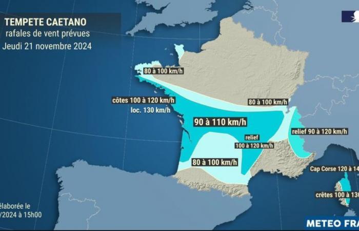
From the south of Brittany to New Aquitaine and the north of Occitanie, the rains are sometimes marked in the morning with a gust of wind coming from the west on the coast. On the coasts of Charente-Maritime and Aquitaine, the strongest winds are already blowing up to 100-120 km/h. This rainy weather will quickly spread towards Auvergne Rhône-Alpes and the north of Paca. In the Massif Central, it should snow above 400 meters above sea level but this snow will quickly be replaced by rain.
Infog. Weather France
Infog. Weather France
What is planned for this Thursday afternoon
In the afternoon, it will snow from Normandy to the north of Burgundy Franche Compté and to the south of the Grand Est region. The layer of snow on the ground could reach 1 to 3 cm below 150 m altitude, 3 to 8 cm from 150 m and more than 10 cm above 300 m, according to La Chaîne Météo.
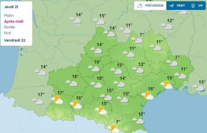
In the south of Occitanie and in Paca, sometimes moderate rain and a fairly strong wind are forecast for the afternoon. The wind will shift to the west and blow up to 100 – 120 km/h on the coast from Vendée to Aquitaine, 80 to 100 km/h inland between the Atlantic and the Alps, or even 100-110 km/h from Poitou-Charentes and Gironde to Limousin, Auvergne and the Alps.
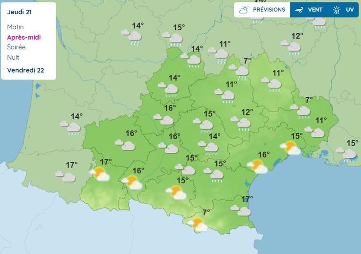
Infog. Weather France
What is planned for this Thursday evening
In the evening, snowfall will be limited from the north of Burgundy Franche-Comté to the south of Alsace. In Auvergne Rhône-Alpes, it will still snow above 800 meters above sea level. The southwest wind will strengthen significantly from the Alps to Corsica. From the relief of the Alps to the north of Corsica, gusts could reach more than 100 km/h.
During the night of this Thursday to Friday, the Caetano depression will evacuate towards Central Europe. Only the Mediterranean regions will maintain strong winds on Friday morning.
A feeling of spring this weekend
On Saturday, beautiful clearings are forecast from the south of Aquitaine to the Alps while the north-western third of France will still be under showers. The cold will still resist from the Vosges to the north of the Alps. Around the Mediterranean, the sky will remain variable on Saturday.
On Sunday, more rain will arrive via Brittany. The sky will be variable from the Pyrenees to the Jura, the Alps and Alsace with even beautiful clearings in New Aquitaine and Alsace. Up to 22°C in the Basque Country! In the Mediterranean regions, the sea wind will bring very cloudy skies with rain in Languedoc. The Autan wind will blow across the Toulouse region.

