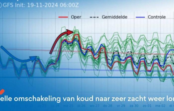
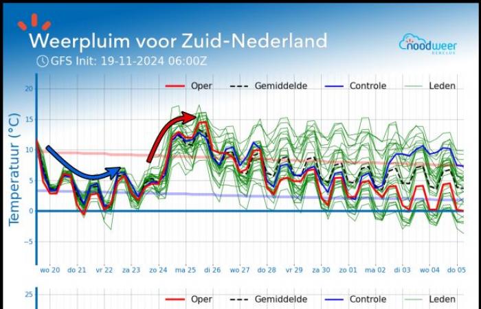
In the coming days we can get a taste of winter. Due to a supply of cold polar air over a warm North Sea, we are experiencing real winter showers. We might even be treated to an early winter surprise here and there. In the Ardennes there will be a snow cover anyway. But for the time being it seems to remain a ‘flash winter’, because next weekend we will irrevocably switch to extremely mild weather for this time of year. But where does this rapid switch suddenly come from? And what exactly can we expect?
Participate in discussion? Are you interested in participating in the weather forum as a weather amateur or weather enthusiast? At the bottom of this article you get lightning-fast & free access to all responses. You can also upload your own weather photos.
Harsh winter weather in the coming days
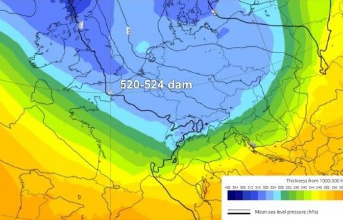
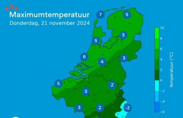
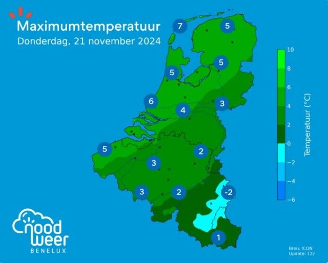
A deep trough in the jet stream will drop quite far south over Western Europe in the coming days. As a result, the Benelux will also have to deal with an influx of cold polar sea air. This air type is characterized by cold upper air. At an altitude of 5.5 kilometers the mercury drops to -36 to -38°C and at an altitude of 1.5 kilometers the temperatures also drop to a cold -4 to -6°C. The cold upper air is in stark contrast to the warm North Sea, and this will regularly trigger winter showers in the coming days, which will sometimes pass in showers.
In addition to rain, the showers can also contain grain hail, and at times even melting snow. In the Ardennes there is snow anyway with accumulation and temperatures around and below freezing point. In the lowlands, temperatures are usually a few degrees above freezing. Only when a rain street continues to drag over the same region for a long time with high precipitation intensity (and processes such as isothermal) can snow fall temporarily with some accumulation. The mercury then quickly drops to freezing point.
It may be just too mild along the coast with rain showers or showers with mixed fractions (rain, grain hail or wet snow). A clap of thunder is also possible. Inland, where there is less influence from the warm North Sea, showers of grain hail or snow may occur more often. The extreme south-west of the Benelux generally remains drier due to the shadow of England.
Due to the chilly west to northwest winds, the wind chill factor will become more important. The perceived temperatures therefore drop to around and even below freezing point. In short: a bleak period. Until Friday we will remain in the polar air with sometimes winter showers, but also drier periods in between.
Quick change to extremely mild autumn weather
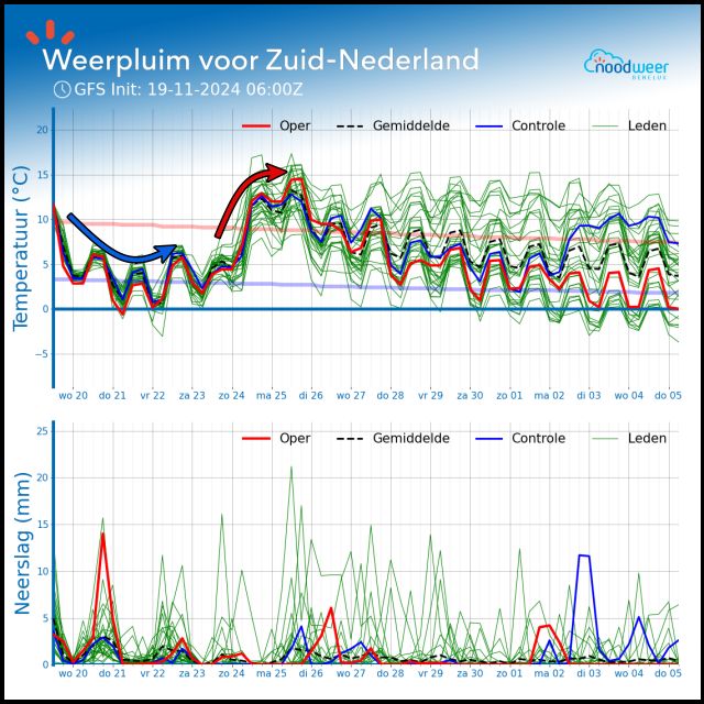
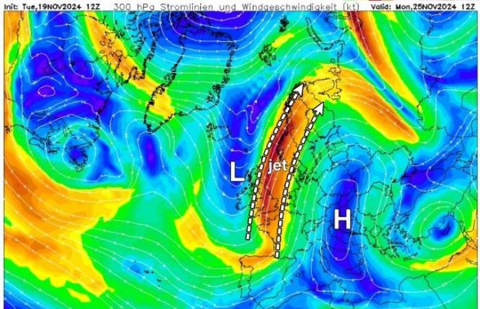
From next weekend we will gradually switch to a completely different weather type. The jet stream will start to reorient itself, showing a strongly wavy pattern. Since we are still on the ‘cold’ side of the jet stream, we will end up on the ‘warm’ side of it by the weekend and Monday. The ascending branch of the jet stream is then oriented south-north from Spain towards Scandinavia. This opens the door for a strong heat transport from south to north that will arise between a high-pressure area that is building up over Southern Europe on the one hand and a deeply deepened storm depression that will settle west of the British Isles on the other.
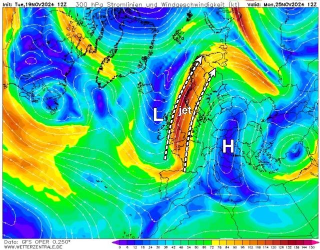
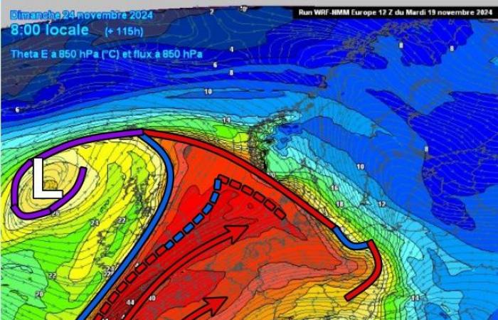
During Saturday, a warm front associated with the storm depression will cross from west to east across the Benelux. That will also temporarily bring some rain. Behind this we enter a broad warm sector with a completely different air type, which is of subtropical origin.
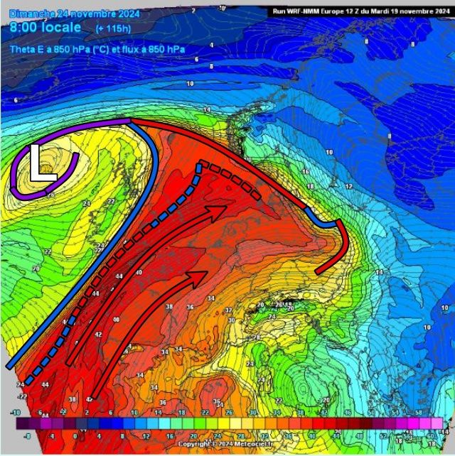
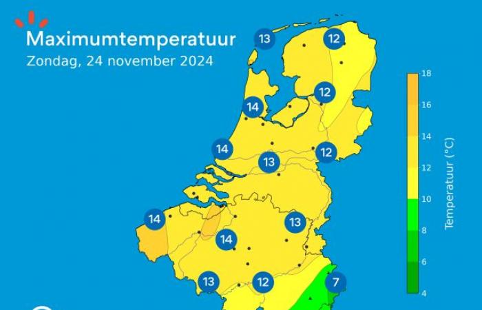
With a strong southwest wind, extremely soft air is brought to our region. We will clearly notice this in the temperatures. Saturday will still be a transition day, but on Sunday the mercury will rise to 12 and possibly even 15°C locally. It would be mostly dry on Sunday. then we get a rather beautiful and mild, but windy autumn day. It will also remain very mild on Monday with similar maximum temperatures. Then another rain zone would pass through.
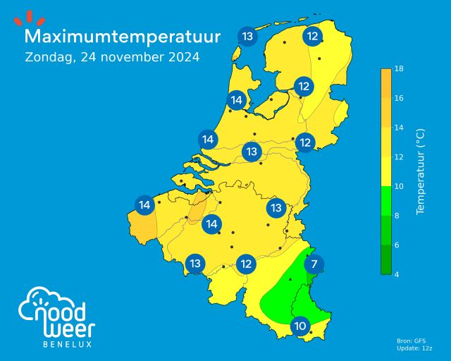
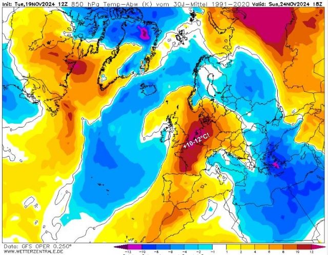
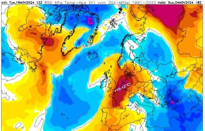
The heat transport is clearly visible on the temperature maps at a height of 1.5 kilometers (850 hPa). The mercury there on Sunday showed a deviation of no less than +10-12°C compared to the long-term average! This week we will be faced with a very erratic weather pattern and a rapid change from a hint of winter to extremely mild autumn weather in a few days. However, a pattern that is typical for the autumn period. The subtropical regions are still mild, the polar regions are cooling down and we are on the dividing line between the two air types. Small shifts in the jet stream and associated pressure areas can therefore quickly mean a world of difference!
