Much colder air at altitude will appear and with it disturbances. Snow could even appear at very low altitudes or even in the plains. Is it real?
As of the end of this weekend, weather conditions will change in France. Much more wintry weather should set in in France. But the risk of first snowflakes reaching the plain is it real? Discover the latest trends updated through these new lines.
Arrival of depression
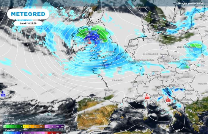
It is a depression initially positioned over the British Isles which will bring this clear change in weather. After several weeks of anticyclonic dominance (with lots of low clouds and fog), the agitation will therefore return.
At the start of next week, sensitive to strong winds will blow from the west with the added bonus of the arrival of precipitation in the northern half of France. These will tend to persist into the evening and night from Monday to Tuesday.
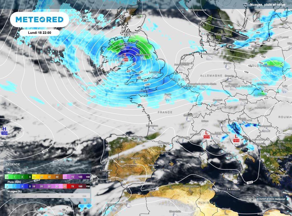
Gradually, this depression will shift towards the Scandinavian countries. We will then monitor the risk of windy periods sometimes marked over France as well as a drop in temperatures. Note that the bad weather will progress towards the southern half of France with snow on all the massifs.
Net cooling
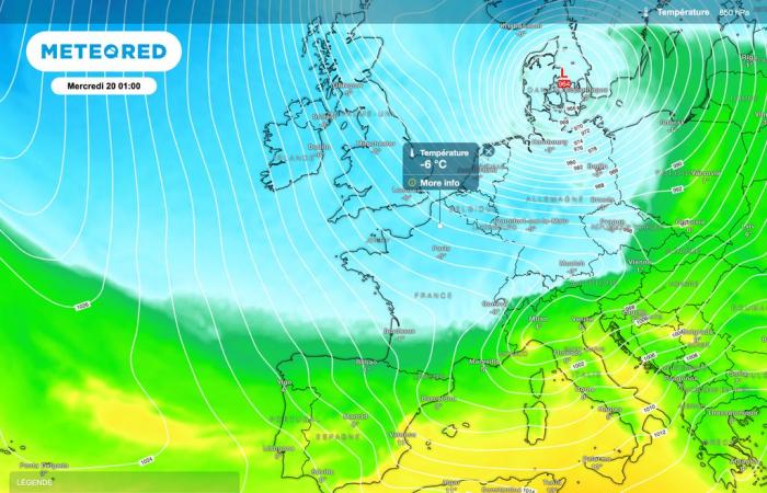
At altitude, around 1500m, the air mass will cool significantly. And for good reason, we should observe values below -5°C. Nothing very marked for this altitude. However, this clearly shows that conditions will become wintery up to the mid-mountains. To see what quantities of snow will be permitted with these temperatures and the passage of disturbances.
For the plains, the uncertainty will relate to the type of precipitation. Indeed, although several models opt for a risk of snowfall all the way to the plains, it will be advisable to be cautious.

Indeed, the air mass, although colder at altitude, will still be mixed in the lower levels. In fact, it will be more difficult to have continuous and lasting snowfall.
However, the winter signals are indeed present throughout the coming week. A large eastern and north-eastern half of France is exposed to this risk of snowfall down to very low altitude (400-500m) or even in the plains. According to the latest atmospheric projections, this risk would be especially present between Wednesday evening and Friday in eight.
Concerning a possible hold, this is not on the agenda but it will again be necessary to monitor the next atmospheric models. On the western half, showers sometimes snowy snow can appear in this disturbed context.

