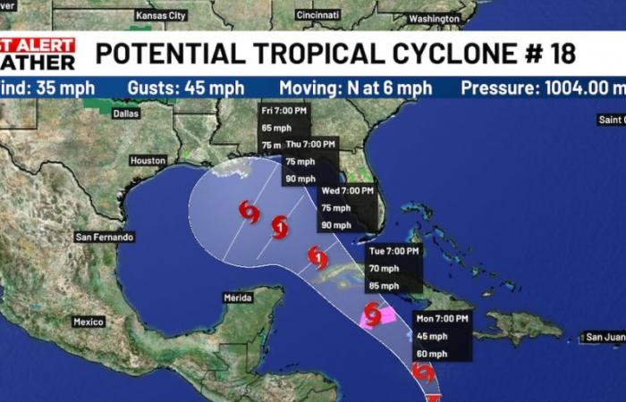
SARASOTA, Fla. (WWSB) – Potential Tropical Cyclone 18 remains a disorganized system, with maximum sustained winds of 35 mph. Thunderstorm activity has not yet organized enough to meet the criteria of a tropical cyclone, but further development is expected, and it will likely become Tropical Storm Rafael within the next 12 hours or so.
The official forecast cone continues to show PTC 18 strengthening into a Category 1 hurricane before making landfall in Cuba. Dry air and wind shear should induce some weakening once it enters the Gulf of Mexico. However, it is still expected to be a hurricane through Thursday.
The center of the storm will stay offshore in the Gulf, but it will be close enough that showers and thunderstorms could affect the Suncoast during the middle of the week. The exact timing and severity of any impacts is still uncertain, but the worst weather currently looks to move through Wednesday night and Thursday.
Significant wind and storm surge threats are very unlikely from this system under the current forecast, but given the disorganized nature of this system, the track can still change over the next few days. The most recent cone shifted slightly away from the coast, but you should still be prepared in case it moves closer to the Suncoast.
After the system enters the Gulf, it is forecast to gradually weaken as it moves to the northwest before making landfall somewhere along the central Gulf Coast, although this part of the forecast remains very uncertain.
Copyright 2024 WWSB. All rights reserved.
Belgium


