On Wednesday night and in the early hours of the morning, a severe storm front had northern Italy firmly in its grip. In Milan, the Lambro River overflowed its banks. This led to local flooding. The Vasca di Laminazione flood retention basin on the Seveso River was also activated to prevent major flooding.
The Liguria region was particularly badly affected, where landslides occurred. In the province of Genoa alone, 100 millimeters of rain fell within an hour. In parts of Liguria and Lombardy, the red alert applies – the highest warning level. In six other regions the second highest warning level is orange.
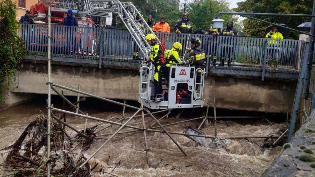
The situation in Tuscany also remains tense. In the province of Siena, firefighters in the village of Radicondoli had to rescue a couple trapped on their property by floodwaters from an overflowing stream. The two were brought to safety and accommodated in an emergency shelter overnight, Rai News reports. There were also numerous fire brigade operations due to fallen trees and flooding in the rest of the province.
In Veneto, the water of the Bacchiglione river in Vicenza rose rapidly. The first floods were reported in the city area. In the municipality of Monte di Malo, the Rana stream overflowed its banks.
Torrential rain also caused chaos in southern regions such as Tuscany and Umbria. In Orvieto, streets were flooded with water and mud. In the Garfagnana mountain landscape, over 160 millimeters of rain was measured within a very short period of time. The situation in Liguria remains particularly critical as further flooding of the Magra and Vara rivers is expected in the coming hours.
The weather forecast for the coming days suggests that the worst is not over yet. Although there will be a brief calming down in the weather this Wednesday, heavy rain is expected again from Thursday – especially again in the north and in parts of Tuscany.
This is what the weather will be like in Switzerland
Heavy rainfall was also recorded in the south of Switzerland on Tuesday. Between 60 and 80 mm fell widely, locally even over 100 mm, as MeteoNews reports. The weather will calm down on Wednesday, but new precipitation is expected to follow the next night.
On Wednesday the weather in Switzerland will be partly sunny in the lowlands with medium and high cloud fields. Fields of fog or high fog may form in the morning. Near the Jura and in the north of Switzerland it will be more cloudy, with occasional rain possible, as Meteo Switzerland forecasts. It stays quite sunny in the Alps. In the afternoon the temperatures in the lowlands rise to around 18 degrees, and in the foehn valleys even up to 24 degrees. It will become increasingly windy, with strong to stormy foehn in the Alpine valleys and stormy southwesterly winds in the mountains. In the evening and on Thursday night there will be increasing amounts of rain from the west and south, accompanied by strong westerly winds in the lowlands.
Have you been following on Whatsapp for 20 minutes?
A news overview in the morning and at the end of the day, surprising stories and breaking news: Subscribe to the 20 Minutes WhatsApp channel and you will receive regular updates with our best stories directly to your cell phone.