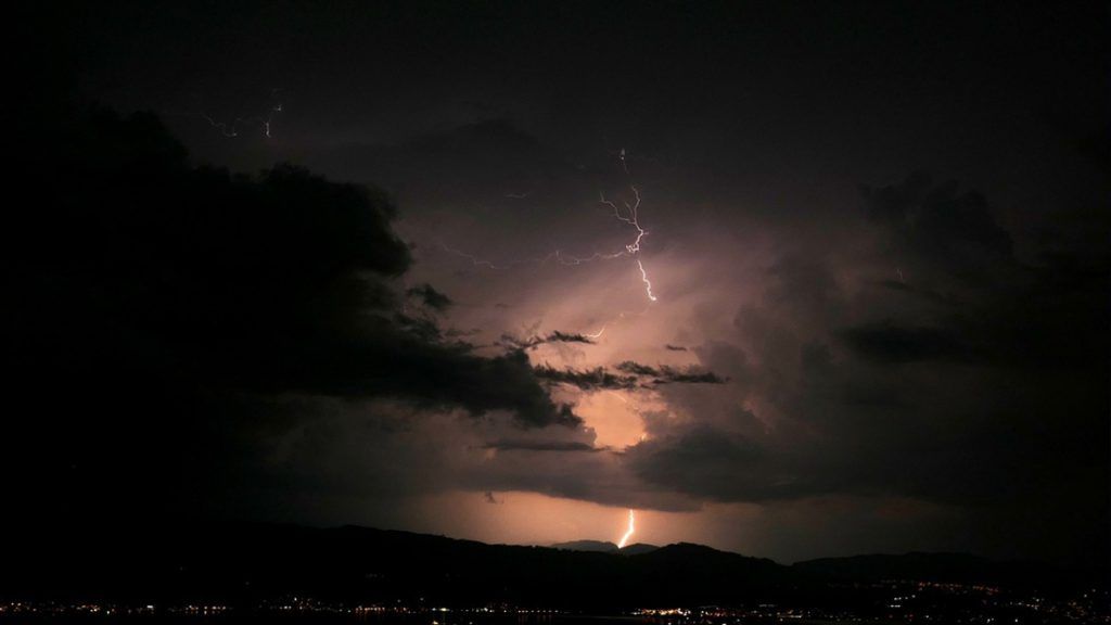
The storms expected on Saturday evening in the country could be intense and lead to significant accumulations of precipitation, mainly in the south-east of Belgium, the Royal Meteorological Institute (RMI) announced on Saturday.
Faced with these bad weather conditions, a yellow alert for thunderstorms will be active on Saturday from 9:00 p.m. until Sunday morning at 10:00 a.m. in the provinces of Liège, Luxembourg and Namur.
A rain and thunderstorm zone will reach the south of the country in the evening and will extend over the three south-eastern provinces. Average accumulations of 20 to 40 litres per square metre will be likely, with more localised peaks of 50 l/m² or even a little more. Strong gusts and hail will also be possible under the first storms, mainly in the province of Luxembourg.
The storms will evacuate towards Germany on Sunday morning.
This precipitation may also be present in the center of the country during the night, but “their intensity will be less, currently not justifying a warning“, specifies the MRI.
This weekend’s forecast
The weather will initially be mostly sunny with more clouds over the south of the country this Saturday. Over the hours, these cloud fields will spread to all regions with cloud cover becoming more variable.
A few showers or a local thunderstorm could already occur in places in the afternoon. The maximum temperatures will be around 20 degrees at sea, around 24 to 25 degrees in the centre and up to 26 or 27 degrees in the far south of the country, according to the IRM forecasts.
At the beginning of the evening, a few showers will be possible, but it is at the end of the evening and during the night that a more structured and active rain-storm zone will reach the south of the country. It will wave mainly over the regions located south of the Sambre-et-Meuse furrow, sometimes giving abundant precipitation.
A few strong gusts of wind and hail will initially be possible mainly in the regions bordering the Grand Duchy of Luxembourg.
In the west of the country, however, the weather will remain drier with wider clearings. The minimums will oscillate between 13 and 17 degrees.
On Sunday, mainly in the east and south-east of the country, cloud cover will still be abundant with moderate rain.
Elsewhere, the weather will be drier with sunny spells. In the afternoon, the improvement will affect the entire territory, but towards the evening, the risk of precipitation will increase again, from the west. The maxima will oscillate between 17 to 18 degrees on the coast as well as on the relief and 22 or 23 degrees on the plain.
irm yellow alert storm rain weather


