Par
Maxim T'sjoen
Published on
Nov. 20, 2024 at 7:45 a.m.
See my news
Follow News
Cold, snow, ice. Here is the meteorological triptych that awaits France for this Thursday, November 21, 2024.
And already, 24 hours before the event, Météo France places 45 departments on yellow alert for snow and ice. These vigilances go from east to west, from Brittany to the Alps, via Normandy, Île-de-France and Alsace.
Departments on snow and ice vigilance
Ain, Allier, Alpes-de-Haute-Provence, Hautes-Alpes, Aube, Calvados, Cher, Côte-d'Or, Côtes d'Armor, Doubs, Eure, Eure-et-Loir, Finistère, Ille-et-Vilaine , Indre, Indre-et-Loire, Isère, Jura, Loir-et-Cher, Loire-Atlantique, Loiret, Maine-et-Loire, Manche, Haute-Marne, Mayenne, Morbihan, Nièvre, Orne, Haut-Rhin, Haute-Saône, Saône-et-Loire, Sarthe, Savoie, Haute-Savoie, Paris, Seine-et-Marne, Yvelines, Vosges, Yonne, Terri. from Belfort, Essonne, Hauts-de-Seine, Seine-St-Denis, Val-de-Marne, Val-D'Oise.
Snow on the plain
Concretely, if snow is already expected in the Alps from this Wednesday, November 20, the bulk of the snowy episode is to watch out for this Thursday.
The cold and the precipitation form a cocktail which suggests that snowflakes could fall between Brittany, the Pays de la Loire, the Centre, Burgundy, Franche-Comté and the Rhône-Alpes area”, lists Guillaume Séchet, founding meteorologist of weather-cities.
So, a large part of the territory could experience snowflakes…and ice.
Perhaps more along a corridor between Brittany, Île-de-France and the Rhône-Alpes area, where there could be three to five centimeters of snow.
Of course, on the heights the snow will be more abundant. Thus, the Massif Central will be able to accommodate 10 to 15 cm of snow, as will the Vosges.
The largest accumulations are expected in the Alps: “around 1.65 m of snow could fall, i.e. the first major precipitation of snow in the Alps”, underlines Yann Amice.
What dangers?
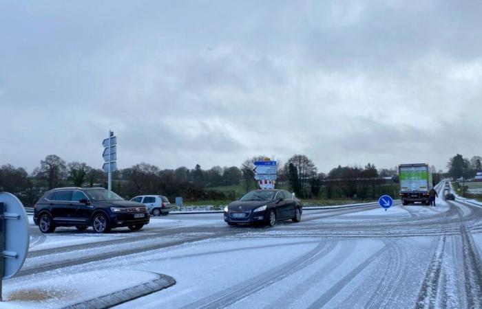
Météo France reminds that the “consequences of snow and ice are especially noticeable in the plains and in towns”. And this, even if the snow cover is light.
Only a few centimeters of sticky snow can disrupt road traffic, air and rail traffic.
Very heavy, wet snow is easily evacuated by road traffic, but it can also melt and refreeze in the form of patches of ice. The formation of black ice or patches of ice makes the road network impassable and increases the risk of accidents.
The weight of wet snow can also cause damage such as collapsing roofs or greenhouses. Vigilance will therefore be required this Thursday.
Follow all the news from your favorite cities and media by subscribing to Mon Actu.


