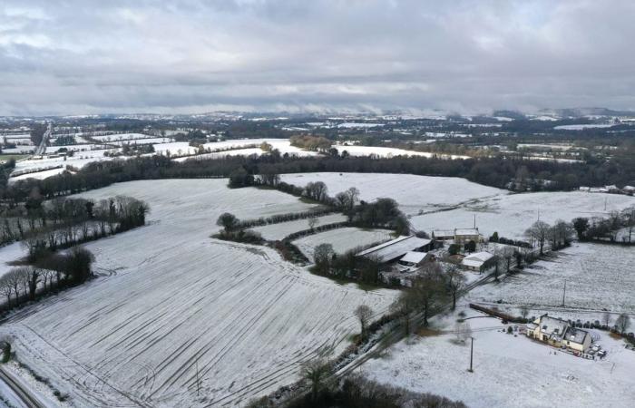
Up to 5 centimeters in the Monts d’Arrée, on the heights of the Côtes d’Armor and in the north of Ille-et-Vilaine. Snowfall is expected to begin next night from midnight. Some roads may be slippery. Elsewhere, the rains will continue to swell rivers that are already very loaded with the risk of flooding.
The essentials of the day: our exclusive selection
Every day, our editorial team reserves the best regional news for you. A selection just for you, to stay in touch with your regions.
France Télévisions uses your email address to send you the newsletter “Today’s essentials: our exclusive selection”. You can unsubscribe at any time via the link at the bottom of this newsletter. Our privacy policy
Snow will appear from midnight tonight in part of Brittany. A layer of 2 to 5 centimeters could fall on central Finistère, but also on the heights of the Côtes d’Armor department and the north of Ille-et-Vilaine.
According to Steven Tual, forecaster for the “Temps Breton” site, the conditions will be marked by “an isothermal phenomenon. The heavier the rain, the lower the rain/snow limit.”
Between 2 and 5 cm of snow expected next night in parts of Brittany.
•
© “Temps Breton” website
Even if this is an ephemeral snow episode, it will still start around midnight next night and end around 10 a.m. Friday morning. Among the areas likely to be affected, “the heights of the Monts d’Arrée, but also the hills of Bel Air or Lanfains, the Mené in the Côtes d’Armor but also in the north of Ille-et-Vilaine and more particularly Fougères as well as in the north of Morbihan and the Pontivy region” according to the “Temps Breton” website.
In certain cases, particularly on certain secondary roads, the roadway could become slippery. You will therefore have to be particularly vigilant while driving tomorrow morning.
READ ALSO: severe flooding in Ille-et-Vilaine
Snow on the Breton heights and also a lot of rain everywhere else in the region. According to Météo France, the disruptions that are expected will cause between 15 and 20 millimeters of rainfall or even more than 30 millimeters, particularly in the south of Finistère and Morbihan. Consequences: risk of flooding. For Sany Villette-Chouieb, chief forecaster at Météo France Rennes, “many rivers are now classified as orange and yellow flood alert.“
Breton courses in “Flood” vigilance
•
© Météo France
In Ille-et-Vilaine, the Seiche and Vilaine median basins in the Rennes region were placed on orange alert. In some areas, rivers have largely burst their banks. For Morbihan, Blavet, in the west of the department, and the Nantes canal, in the east, are classified under flood yellow vigilance. Same thing for Aulne and Elée in South Finistère.
Fortunately, these very humid conditions should give way to drier and milder weather from Sunday.


