Par
Timothée L'Angevin
Published on
Jan 5, 2025 at 8:59 a.m.
See my news
Follow News
The time is changing in France at the moment. On Saturday 4, almost the entire east of the country was on orange alert for snow, and the roads were slipping, causing injuries and even one death in Côte-d'Or.
This Sunday, January 5, 2025, the weather is warm. Before a big gust of wind this evening: around fifteen departments are still on yellow alert for this reason. And almost all of France is affected for this reason on Monday.
The depression which will deepen over the near Atlantic during the night from Sunday to Monday will cause a strong gale in the west and north from Sunday evening to early Monday afternoon.
Gusts of 130 km/h?
Gusts reaching more than 100 km/h (up to 130 according to certain models) are expected, coming from Spain. The squalls will first affect the southwest (Charentes and Vendée), before rushing inland and following a diagonal going to Lorraine, passing through the center and Île-de-France. We also expect big squalls on the summits.
According to Météo France, “gusts approach 100 km/h during the night from Sunday to Monday from Haute-Loire to the south of Lyon and in the Pre-Alps”. The weather organization envisages winds at “60 to 80 km/h from Brittany to Flanders, 70 to 90 km/h to the west of the Pyrenees with possible surges in the Basque Country”.
The west of Brittany, then a large area between Aquitaine and the east of the country, should be shaken from this Sunday evening, or even this Monday, January 6, 2025, early in the morning. Auvergne-Rhône-Alpes as well as the extreme south-east are also expected to be affected, with gusts of wind reaching up to a hundred km/h.
A storm is therefore brewing, and according to the count of the names of meteorological phenomena, the latter could be named Florianeif it is indeed named.
Models still uncertain
Below, the cumulative gusts between Sunday and Tuesday according to the French Arpege model (map from Météociel). The more the color turns purple, the more violent the wind will be. According to this model, gusts of more than 120 km/h are expected inland:
If the map is not displayed, click here.
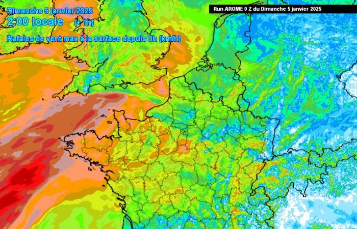
The cumulative gusts between Sunday and Monday according to the other French model Arome (map from Météociel). This model, the most pessimistic, foresees gusts of 130 km/h. The more the color turns purple, the more violent the wind will be.
If the map is not displayed, click here.
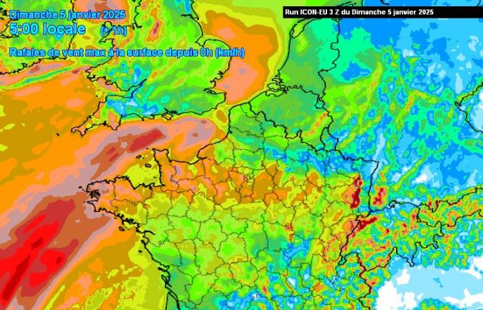
Accumulated gusts between Sunday and Tuesday according to the German Icon model (map from Météociel). The more the color turns purple, the more violent the wind will be:
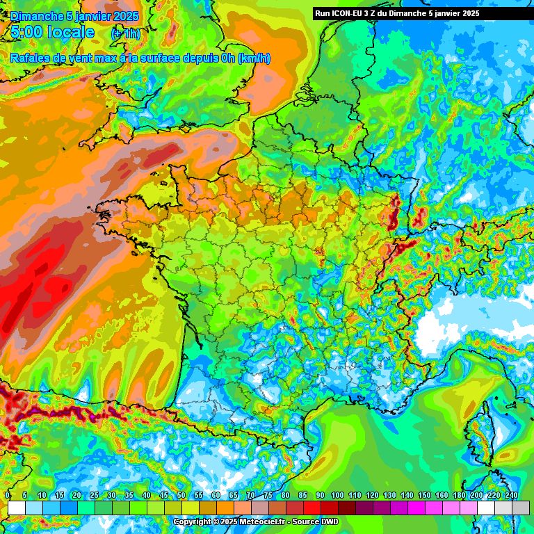
If the map is not displayed, click here.
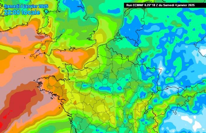
Accumulated gusts between Sunday and Tuesday according to the European ECMWF model (map from Météociel). The more the color turns purple, the more violent the wind will be. This model, less pessimistic, predicts maximum gusts of 90 km/h inland:
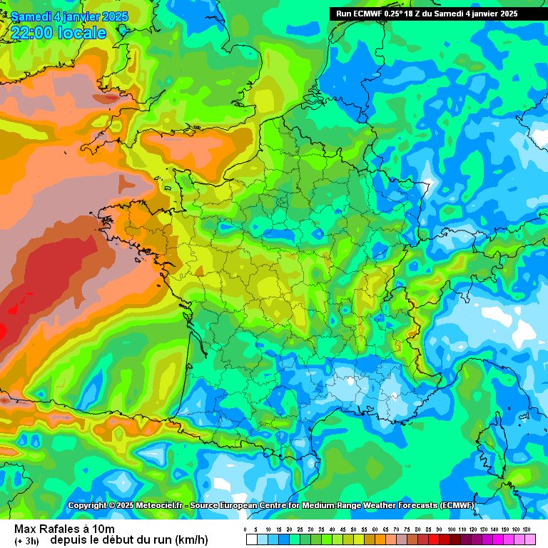
If the map is not displayed, click here.
Follow all the news from your favorite cities and media by subscribing to Mon Actu.

