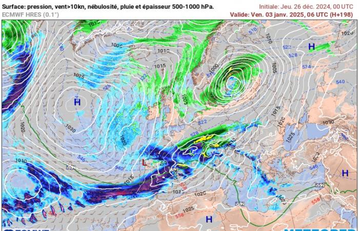
An anticyclonic situation currently concerns France. Will this last? Well no. But what to expect now? Find out the weather forecast.
The anticyclonic weather that we have been experiencing for several days will gradually give way to depressions by the start of next year. But what to expect for New Year’s Eve in France? Discover the weather forecast through these new lines that we are offering you.
Increasingly cloudy and windy
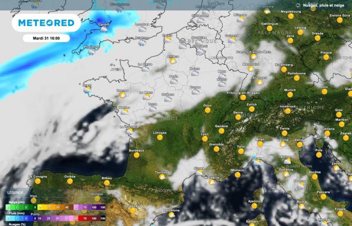
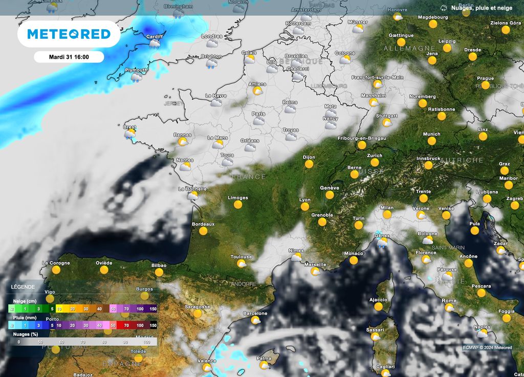
For New Year’s Eve, it’s a France cut in two that looms. Indeed, high pressures will be present in the eastern and southern half of France. This will have the consequence ofbringing much sunnier weather to these areas while over a good northern half, the depressions located further north will influence the weather by bringing lots of clouds.
Clouds which are expected to be very present at the end of the afternoon and during the evening over the regions going from Brittany to the Grand-Est, while passing through the Centre-Val-de-Loire region.
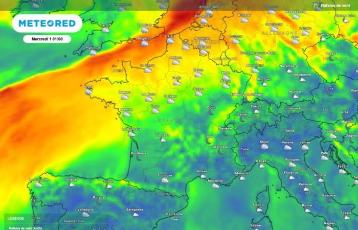
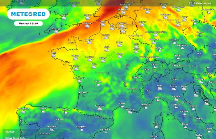
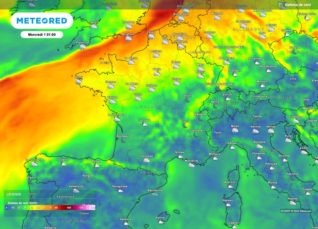
Gusts of wind will also be the order of the day, especially during the New Year. It is more particularly along the northwest coastline that the strongest winds are expected with speeds of the order of 70 to 80km/h.
Inlandgenerally count on 30 to 50km/hlocally 60-65km/h (for the Normandy / Hauts-de-France part). A fairly present wind therefore oriented towards the southwest.
For the southern half, the weather conditions are expected to be rather calm and clear, again due to protection provided by high pressures. A transition to the new year which promises to be calm in many regions…and above all without violent phenomena.
Strong agitation afterwards
Instability is expected to increase at the start of next year. Indeed, a depression regime will appear bringing its share of rainy and even stormy disturbances.
Indeed, a secondary depression should take place between next Wednesday and Thursday. This will result in a tightening of the isobars (lines of equal pressure) over at least a good quarter of north-west France.
To date, it is still difficult to announce precisely the areas concerned but also the wind speed. The risk of strong gales or even storms is still there.
Towards winter weather
This agitation, however, appears to be temporary. Indeed, an anticyclone will take place over the Atlantic, favoring the establishment of a north then north-east sector flow over France.

This transition could take place with a risk of snowfall at very low altitude. Cold weather will follow across the whole of France. Rather dry winter conditions should then continue until around January 10… at least according to the most optimistic projections for the resistance of the cold.
Details of this colder period will be provided over the coming days. Coats and scarves shouldn’t be put away anytime soon!

