Winter weather is forecast in France after a short milder period between Friday and Saturday. So keep the sweaters and coats with you!
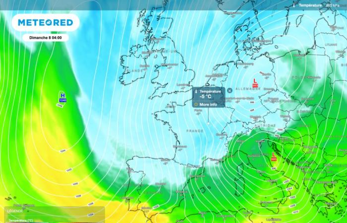
From this Sunday, the weather conditions will become more and more wintery. Indeed, a depression will shift towards the north of Europe, favoring a shift in winds to the northwest then north.
Temperature drops
Initially, temperatures will simply approach normal. However, fairly quickly we should see the mercury plummet more significantly. And for good reason, the winds will shift to the northeast, bringing much colder air.
The low pressure complex will position itself towards Central Europe, while gradually sliding towards the Mediterranean basin. Further west and north, an anticyclonic zone will appear.
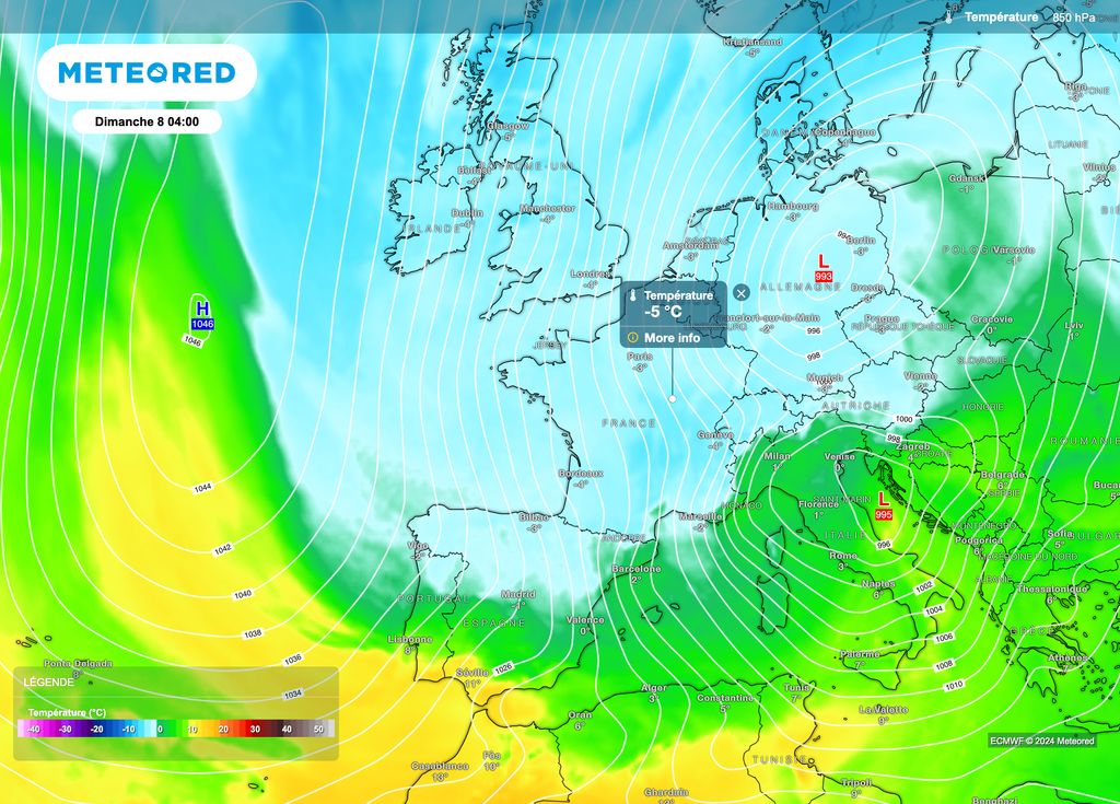
This configuration will allow the persistence of cold conditions in France. The frosts will become much more numerous and could even reach the southern half of the hexagon. At least this is what the European ECMWF model and the American GFS model envisage. A bit of cold which should persist until the middle of next week at least.
Towards snowfall in the plains?
If you are expecting further snowfall in the plains, you may have a little luck with showers in the form of sleet. These should interest the northeast quarter on Sunday.

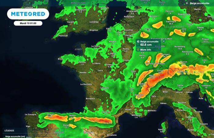
Elsewhere in France, a risk of rain and mixed snow (or even snow alone in high intensities) is taking shape over the course of next week. For the moment, there are no signs of lasting snowfall that really sticks to the ground. Weather forecasts which should change over the coming days.
On the mountain side, winter will indeed set in over the next few days. Fairly regular and sometimes moderate snowfall is expected. A good news for several ski resorts who are impatiently awaiting these bad weather. Snowfall which should also occur in mid-mountains.
Lasting episode?
According to several atmospheric projections, we are heading towards 5 to 7 days of more wintry weather in France. That being said, beyond next Friday, a return of the ocean regime could occur.
This would result in a rise in temperatures, all the more pronounced as we move towards the plains. In the mountains too, the mercury would start to rise again, limiting the snow to higher altitudes.
All this of course requires confirmation but to date, no cold spell is expected over several weeks. So stay connected to Tameteo.com to follow the developments in the weather forecasts!

