After the violent storms this weekend in Champagne-Ardenne, torrential rain and runoff have swollen the Marne, which was in flood this Monday upstream of Saint-Dizier (Haute-Marne). The level continued to rise and could approach the flood thresholds of May 2013 in the middle of the week, before falling rapidly. But the flood peak is spreading and will end up reaching the Seine in the second half of the week.
Propagation of the flood wave from the Marne to the Seine
Seine: a flow rate that is starting to rise again © The Weather Channel
The current hydrological situation in the Seine basin shows some similarities with that experienced at the beginning of April when torrential rains caused widespread flooding in Burgundy. The flood waves had converged towards the Seine and the level had risen to 4 m in Paris, overflowing onto certain sections of riverbank roads, which can be closed when the river level reaches approximately 4 metres above its normal level, which is 2 metres. From 3.45 m, some sections of the right bank are starting to be closed. Currently, this prospect is not on the agenda because the river level, which had dropped back to its low water mark (lowest summer level), was at 1.70 m on Monday 1 July. In addition, the contribution of the Marne will remain insufficient to cause a rise in the Seine as in April, especially since the Der reservoir lake, designed to regulate the flow of the Marne, will be able to reduce this flood, although it is 91% full (above average for this time of year).
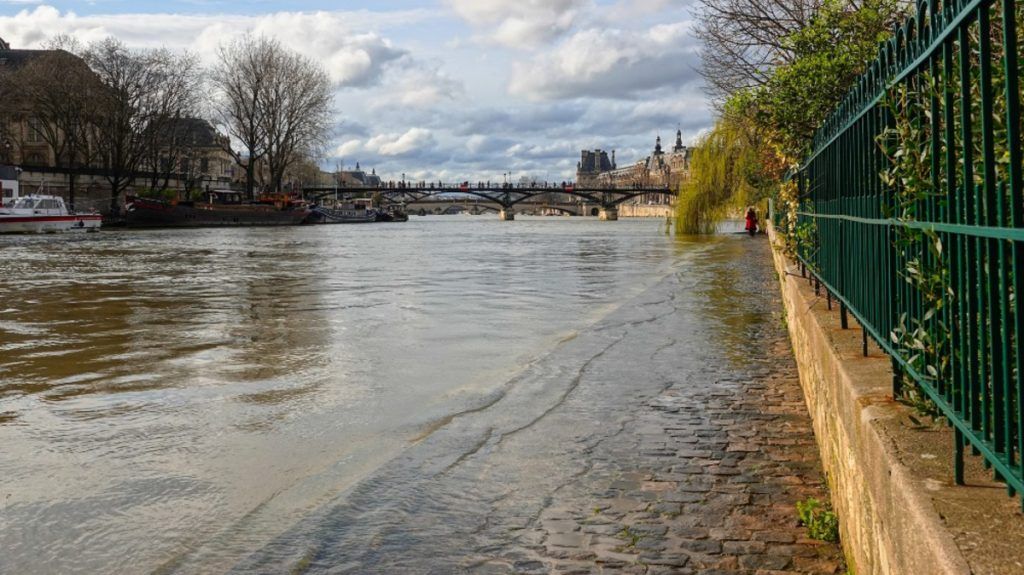
A rise in water levels and increased flow rates in the coming days in Paris
The Seine in Paris on July 1st © The Weather Channel
The Seine is a river with slow hydrological reactions, which collects the waters of large tributaries, of which the Marne is one of the three main ones (with the Yonne and the Oise). This spring, the level of the Seine in Paris remained high for a long time in March and April, between 3 and 4 m, after remaining quite low during the winter. The various rain and storm episodes in the spring and early summer contributed to frequent water inflows, the last major one dating back to the beginning of April. More recently, the water levels and flow rates of the Seine increased on June 23 (2.20 m in Paris), before starting to fall again in recent days. But currently, after weekend rains and stormsthe level is rising, gaining 50 cm in 24 hours between Sunday and this Monday. The rise in the water level is also correlated with the increase in flow, that is to say the volume of water circulating between the banks.
This new increase is likely to be quite long-lasting due to the arrival of the flood wave in the Marne in the second half of the week, which should start to pass under the bridges of Paris this weekend. This development could even be reinforced by the arrival of new storms on Saturday. Thus, based on the reaction of the Seine on June 23, we can envisage a rise in the level to 2.20 m, and an increase in the flow to 660 m3/second. Not only will this flood wave cause significant turbidity (the characteristic brown color of the river linked to suspended matter in the water), but it will also cause a degradation of the bacteriological quality of the water.
In comparison, let us recall that the average water level of the Seine at this time of year is around 1.50 m and its flow rate is 200 cubic meters per second. The flow rate of the Seine in Paris is therefore currently more than triple the normal. More than the water height, the flow rate is a crucial element for holding white water events in the river, because, by increasing, it generates a strong current. This is also the reason why the French open water swimming team was unable to train on June 10.
What developments can we expect for the rest of July?
Average monthly flow of the Seine in Paris © The Weather Channel
First of all, let’s remember that the swimming events in the Seine are scheduled for the beginning of August, which is preferable: this is, in fact, the statistical period of the year when the flow of the Seine is the lowest (with September), except in the event of a major storm. Between now and then, depending on the upcoming weather conditions, the Seine still has time to return to its low water level. usual summer (* lowest water level). Our medium term forecasts
are precisely considering a return to much more stable, dry and sunny weather conditions for the second half of July. If this trend materialises, the Marne flood wave will have plenty of time to evacuate. By decreasing, the flow will also allow the Seine to regain appreciable transparency, and perhaps also an improvement in sanitary quality.
- -


