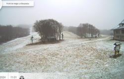
Are therefore concerned: Côtes-d'Armor, Ille-et-Vilaine, Calvados, Eure, Manche, Orne, Mayenne, Sarthe, Eure-et-Loir, Loir- et-Cher, Loiret, Aube, Yonne, Haute-Marne, Côte-d’Or, Vosges, Haute-Saône, Doubs, Territory of Belfort, Haut-Rhin and the entire Île-de-France region. Other departments could follow.
Strong wind in the South-West
In question, the passage of the Caetano depression which should cause snowfall on Thursday all the way to the plain and complicate traffic conditions. The first snowflakes could fall between the end of the night from Wednesday to Thursday and the evening of Thursday on all the departments on alert. Météo-France forecasts 1 to 3 cm of snow in Paris but up to 7 cm in Essonne. 2 to 5 cm of snow could fall on the plains in Brittany and Normandy, or even 10 cm locally. “This snow will be particularly wet and could pose problems for transport,” warns the forecasting organization in its bulletin.
Météo-France
On the heights, we expect to see 10 cm of snow above 200/300 m, and up to 15 to 20 cm in the east of Franche-Comté. “The accumulations of snow in the Alps, in mid-mountains, will be significant, 30 to 50 cm above 1,500 m, or even 70 cm locally, and will require particular attention,” adds Météo-France.
The south of France will be spared by snow on Thursday but not by the wind. Strong gusts are expected on the Aquitaine coast, Pays de la Loire and the Massif Central. “Strong wind gusts that can exceed 100 km/h are possible,” alert Météo-France, which has activated orange “strong wind” vigilance in 17 departments, including 7 in New Aquitaine.


