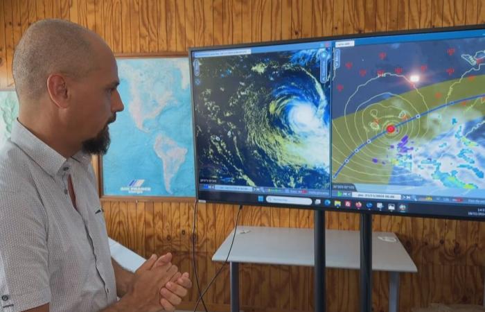
It's a certainty: Bheki will not pass near our home at the stadium, neither a cyclone nor a storm. On Thursday, it will have had time to weaken further, and will bring rain and thunderstorms, in quantities which will depend on its trajectory.
This Monday, November 18, 2024 at 5 p.m., the Bheki low pressure system was located 1,410 km away in the East-North-East sector of Reunion Island at the tropical cyclone stage.
As former Météo France chief forecaster Jacques Ecormier already explained earlier today, it is at a much weakened stage that Bheki should pass near Reunion.
If this Monday evening Bheki was still well structured, the cyclone has already started to weaken, and will continue to do so very markedly over the next 48 hours.
Watch the report from Réunion La 1ère:
Where is Cyclone Bheki? Update with Météo France this Monday.
•
©Reunion the 1st
“Between now and its passage as close as possible to Reunion, expected for Thursday, it will be a very unstructured, very weakened system which will pass“, affirms and reaffirms Sébastien Langlade, operational manager of the CMRS (Specialized Regional Cyclone Meteorological Center).
“No threat of a storm and even less of a tropical cyclone passing near Reunion Island on Thursday”
Sébastien Langlade, operational manager of the CMRS
So that’s a certainty. What remains less certain is the trajectory that Bheki will adopt, and on which the rain-storm risk which will affect Reunion will depend.
“What we are monitoring is the risk of heavy rain and thunderstorms during the day on Thursday and the nights surrounding this day. It is still a little early to quantify this risk“, continues Sébastien Langlade.
Two options exist: if the remains of the system pass south of Reunion, the most active rain-storm masses would remain far away, and the island would then not experience “only moderate rain, relatively modest“. This Monday evening, it was the most likely scenario.
•
©Météo France Indian Ocean
On the other hand, in the case of a passage to the north of the island, which has not yet been completely ruled out, the episode of rain and storm would be more significant. “This is not the preferred scenario for the moment, but we will monitor this over the next two days“, concludes Sébastien Langlade.
The sea will be a little rougher than usual, especially in the East, but nothing exceptional, reports the meteorologist.
To summarize, there is no need to panic, but only to be a little vigilant during the second part of the week regarding possible heavy rain or storms.
The inhabitants of Rodrigues will be able to observe significantly more degraded conditions, with strong winds and dangerous seas between Tuesday afternoon and Wednesday morning, under the influence of the system which will still be relatively strong when it passes nearby.


