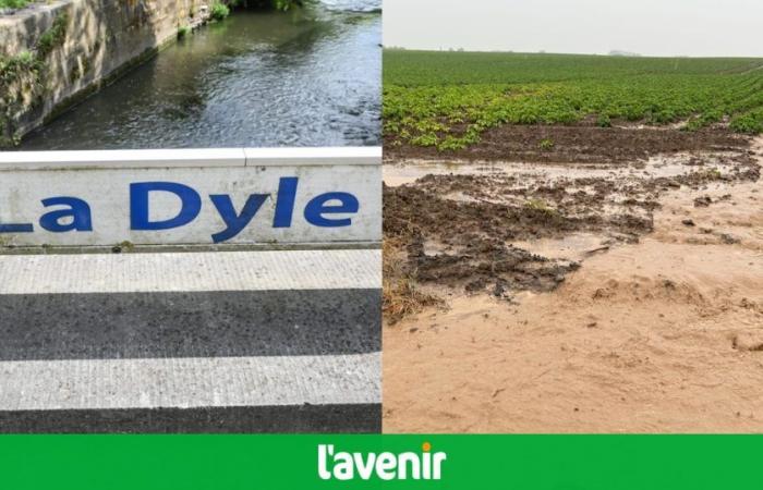
The alert thresholds have been reached since midnight at several stations on the Dyle and its tributaries following heavy precipitation, warns, in a new update during the night of this Tuesday to this Wednesday, the hydrometry website in Wallonia.
The Dendre and its tributaries are in the flood pre-alert phase. The other rivers in Wallonia are currently in a normal phase.
“The accumulations observed were particularly significant in Hainaut and Walloon Brabant where damage from runoff and exceedances of pre-alert and alert thresholds were observed. The levels should stabilize in the second half of the night,” further specifies the hydrometry site in Wallonia.
The heavy rains that fell on Tuesday afternoon in Walloon Brabant notably caused flooding in Chastre, Jodoigne and Mont-Saint-Guibert, as well as the overflow of the Hain in Walhain. Floods were also noted in Picardy Wallonia.
In Flanders, the alert threshold of two rivers was exceeded in the towns of Grammont and Zwalm, in East Flanders. Several other places in the Flemish Ardennes were also affected by the floods.
Around twenty interventions for the Liège firefighters
Liège firefighters intervened around twenty times this Tuesday evening, after the bad weather which affected Belgium, they indicated Wednesday morning. No injuries were reported.
The interventions mainly took place between 6 p.m. and 8 p.m., for pumping or cutting operations. The Basse-Meuse region was particularly affected.
In Bassenge, the downpours caused road flooding. Roads had to be temporarily closed to traffic, but no evacuation was necessary.
Firefighters also had to intervene in Ans, Oreye, Remicourt, and Avernas-le-Bauduin, in the town of Hannut, where large mudslides spread through the streets. Some roads there also had to be closed to traffic.
A dry day this Wednesday, the return of storms Thursday
The weather will be very cloudy with local mist and fog in many areas. Wednesday morning, except in the northwest of the country where clearings will be present. A little rain or a shower will still be possible at first.
During the afternoon, the weather will become dry everywhere and clearings will affect most of these regions, according to the latest forecasts from the IRM. Maximums will range between 16 and 21 degrees in moderate winds.
The next night, high then medium clouds will become more numerous and at the end of the night there will be a few showers from the southwest. The minimums will vary between 9 degrees in the upper Ardennes to 11 degrees in the plains and will reach up to 14 degrees in Gaume.
THURSDAY, rains and stormy showers will move from France towards our regions; they will sometimes be very intense with cumulative precipitation which can once again be significant and locally exceed 25 mm in 24 hours. The maximums will be between 17 or 18 degrees by the sea and 23 or 24 degrees in most regions of the east of the country.


