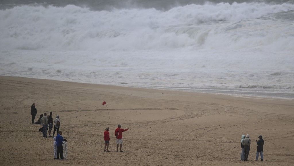

The Kirk depression began to sweep France this Wednesday, with “intense rain” expected from Vendée to the Ardennes as well as a “very strong gust of wind” in the east of the country, Météo France alerts, which has placed 35 departments on orange alert for “floods”, “rain-flooding” or “strong wind”. There Seine-et-Marne switches to red “flood” alertthe Alpes-Maritimes on orange “rain-flood” vigilance and Meurthe-et-Moselle on orange “flood” vigilance, according to the latest bulletin from 4 p.m. Meteorologists are warning of the risk of flooding, due to “soils already very wet” after a particularly rainy month of September.
In detail, 25 departments are on orange alert for rain-flooding. It is about Aisnethe Alpes-Maritimes, the Ardennes, Aube, Eure-et-Loir, Indre-et-Loire, Loir-et-Cher, Loire-Atlantique, the LoiretMaine-et-Loire, Marne, Mayennethe Meuse, Oise, la Sarthe, Paris, Seine-et-MarneYvelines, Deux-Sèvres, Vendée, Essonne, Hauts-de-Seine, Seine-Saint-Denis, Val-de-Marne, Val-d’Oise.
Three departments are on orange alert for floods : the Alpes-Maritimes, Meurthe-et-Moselle and Vendée. Et ten departments are affected by an orange vigilance for winds. These are Ain, Doubs, Isère, Jura, Loire, of the Pyrenees-AtlantiquesHautes-Pyrénées, Rhône, Haute-Saône, Saône-et-Loire. The Territoire-de-Belfort will go into orange “strong wind” alert from midnight.
Eric Turpin
More than a month of rain in just 24 hours
In Seine-et-Marne, “the expected amounts of rain could cause a strong to exceptional flood on (the) Grand Morin river. Rapid rises and localized overflows could be observed as early as Wednesday evening”, specifies the specialized government site Vigicrues.
Elsewhere, the accumulation of precipitation over the whole day will be very significant, up to the equivalent of a month of rain in one day on an axis going from Vendée to Champagne-Ardenne via the region Parisian.
In the Pays de la Loire, the first region affected by the center of the depression, between 60 and 80 mm, or even up to 90 mm of rain are locally expected during the day. In Loire-Atlantique, the rains will increase in intensity during the day, reaching 10 to 15 mm in an hour, according to a press release from the prefecture. The rains will gradually ease but “50 à 70 mm” are still planned in the Paris basin and in Champagne-Ardenne and “30 to 50mm” near the Belgian border.
Stormy rains will also affect the Alpes-Maritimes in the evening. Currently on yellow alert, they could be placed on orange alert.
This precipitation will occur in a context of already very humid soils and could therefore cause floods. In Deux-Sèvres, over the last 24 hours, 40 to 50 mm of rain have already fallen locally.
Gusts of more than 100 km/h in the plains
According to Météo France, gusts of 211km/h were recorded overnight in the area of the Iraty ski resort, in the Pyrénées-Atlantiques. “Such gusts in Iraty are not usual”explains Christophe Dedieu, president of the Météo Pyrénées association, to AFP.
“In the afternoon” this Wednesday, “from Dauphiné to Lyonnais to the Loire and Burgundy France-Comté, we expect gusts of 90 to 110 km/h”warns Météo France. Gusts of up to 120 to 150 km/h on the summits and 100 to 110 km/h on the plains were already expected in the Pyrenees and Béarn.
Still 19 departments in orange on Thursday
THURSDAYthe Kirk depression will evacuate from the northeast, with still significant rain in the northeast and in the Alps. Météo France now estimates that only 19 are the number of departments that will be on orange alert on Thursday, only for “rain-flooding”, and mainly in Ile-de-France and Lorraine.
“Very rare” meteorological event
“There is an impact of climate change on this type of event”, analyzes this Wednesday morning on franceinfoAlix Roumagnac, President of Predict Services, the “risks” subsidiary of Météo France. Storm Kirk is an ancient hurricaneclassified in category 3 born in the Atlantic. This summer, this ocean broke heat records, due to climate change which is causing both land heatwaves and sea heatwaves. The meteorologist explains: “When the Atlantic is warmer, there is more humidity, therefore higher precipitation capacities“.
This meteorological event “very rare“can have three consequences: sea surge (i.e. an abnormal rise in sea level at high tide or its decline at low tide), wind and rain.”Winds should not expect exceptional speeds“, according to Alix Roumagnac, but a factor worries him, because “this storm occurs very early in the season, the trees still have leaves, and therefore more resistance to the wind“, the risks of falling trees are therefore greater.
Rail traffic interrupted on certain lines in the South-West
To prevent the passage of the Kirk depression, the SNCF announced the total interruption of rail traffic on certain routes in the South-West this Wednesday. Train traffic will be interrupted from 9 a.m. to 8 p.m. on the Saintes/Royan routes and on the Médoc line between Macau and Le Verdon.
And from 2 p.m. to 8 p.m., train traffic will be interrupted on the following routes:
The SNCF ensures that replacement buses will be put in place for the lines concerned. The company recommends that travelers find out about the running of their trains before going to the station, on the application SNCF Connect and on the site TER Nouvelle-Aquitaine.
Furthermore, in the Loire, “following a landslide caused by heavy rain on Tuesday, TER traffic between Lyon and Saint-Etienne is interrupted until midday this Wednesday”announced the SNCF.