Published on October 8, 2024 at 10:00 a.m.
Cold, snow, rain, what will our winter be like? La Nina will change the look of the season. Preliminary analysis.
In short:
-
Winter risks showing its teeth in December;
-
La Nina will dominate next season;
-
Two possible scenarios: La Nina in the center or east of the Pacific;
-
Mild winter in the first case, colder in the other.
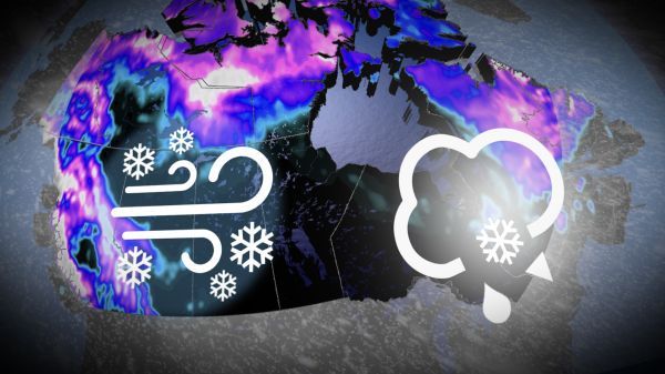
A big winter
MétéoMédia meteorologists have carried out a preliminary analysis of what winter 2024-2025 should look like. Remember that the exercise here consists of taking a first look at the season by considering the main players who are likely to influence the shape of the months of December, January and February in Quebec. Currently, models indicate that one phenomenon may dictate the overall picture of the quarter. In addition, winter is likely to set in more quickly in December.
“Some indications suggest that winter will set in a little more clearly than in recent years,” estimates Réjean Ouimet, meteorologist. The cold and the snow were often long in coming. It would be different this year. Remember that the last cold December in Quebec dates back to 2018.”
La Nina, two positions
La Nina refers to a cold water anomaly in the equatorial Pacific. NOAA experts predict that a low-intensity phenomenon is on track to take hold by December. In the years when this situation occurred, the cold and snow could assert themselves from the first weeks. However, two possibilities are emerging: La Nina near the South American coast, or in the central Pacific. These scenarios will not have the same consequences in Quebec next season.

Mild Winter
Positioning risks determining the shape of winter in Quebec. In fact, even in the case of a season considered mild, rest assured that the cold will appear and that snow will be there. However, the frequency and intensity of Arctic air descents would be less if this first scenario materializes.
“One of the two scenarios implies that the cold is focused west of the Great Lakes and mainly affects Western Canada,” explains Réjean Ouimet. The return flow from the southwest favors warm weather in Quebec. This is dependent on the La Nina phenomenon which is more anchored in the central Pacific. »

Cold winter
The second scenario involves positioning strong winds at altitude favorable to polar vortex flows. These descents of cold air from the Arctic would give us a significantly harsher winter. However, this does not mean that there would never be mild spells or periods where the mercury approaches normal.