The alert will last until Friday midnight. Snowfall of up to 20 cm is possible on the heights and temperatures could drop to -8°C overnight from Thursday to Friday.
Updated: Traffic conditions can be difficult on the A38 as well as in the areas of Sombernon, Saint-Seine-l’Abbaye, Beaune, Bligny-sur-Ouche and Nolay.
Updated November 21, 2024:
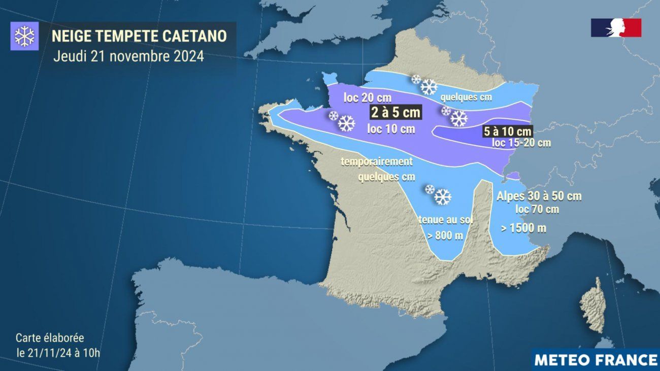
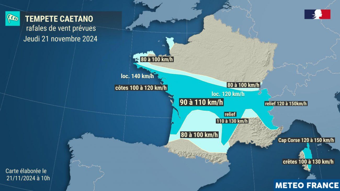
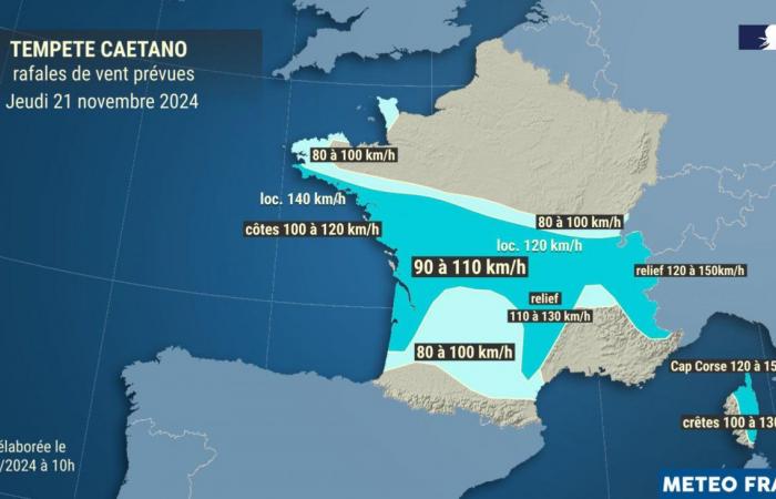
Due to the passage of the Caetano depression over France, Météo France forecasts snow in the plains on an axis going from North Brittany/Normandy to the Grand-Est, sometimes heavy snow over the Alps and an episode of winds strong from the Atlantic coasts to the Northern Alps then back to Corsica.
Météo France has placed the Côte-d’Or on Orange alert for snow and ice, from this Thursday, November 21, 2024, 11 a.m., until this Friday, November 22, 2024, noon. A yellow alert will ensue until at least midnight Friday.
All departments of Burgundy-Franche-Comté will be affected to varying degrees by this vigilance against snow and ice. Saône-et-Loire, Jura and Doubs will also experience yellow vigilance in strong winds.
In this context, the Côte-d’Or prefecture recalled the precautions to be taken (read the press release).
Inforoute 21 press release of November 21, 2024:
Currently, following significant snowfall, salting and/or snow removal operations are underway on the departmental roads of Côte-d’Or.
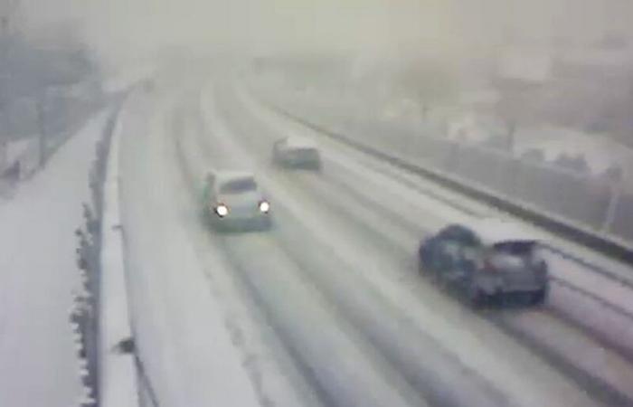
Traffic conditions can be difficult, particularly on the A 38 La Côte-d’Orienne, as well as in the areas of SOMBERNON, SAINT SEINE L’ABBAYE, BEAUNE, BLIGNY SUR OUCHE, NOLAY.
ATTENTION, Météo France has classified the Côte-d’Or department under ORANGE SNOW / ICE vigilance from today 11 a.m. and until tomorrow 12 p.m.: notable episode of snowfall, with significant cumulative thicknesses forecast ( 5 to 10 cm in the plain, 7 to 15 cm over the rest of the department, with sometimes locally on the heights up to 20 cm possible), accompanied, during the night, a very clear drop in temperatures (-1 to -4°C in the plains, -5 to -8°C in the rest of the department) favoring the formation of widespread ice.
By Prefectural decree of Eastern Defense and Security Zone n°2024-27/EMIZ of 11/20/2024, from today 11 a.m. and until tomorrow 10 a.m., vehicles with a gross vehicle weight greater than 7.5 tonnes are limited to 70 km/h and are prohibited from overtaking or changing lanes when at least one lane of traffic on the roadway is covered with snow or ice on all or part of its surface. Zonal decree n°2024-27/EMIZ
When driving, remain vigilant and careful: adapt your driving to the traffic conditions, and give priority to winter service vehicles.
Weather Alert Bulletin Eastern Zone*
Published on Thursday November 21, 2024 at 4:17 p.m. (metropolitan time)
Current situation
New developments: confirmation of forecasts.
General situation: an active disturbance linked to the CAETANO depression extends over Burgundy-Franche-Comté as well as the south of the Grand-Est. This disturbance gives snowfall (locally sustained) at low altitude in the departments concerned.
Notable observations: snowfall occurs in Burgundy-Franche-Comté, Champagne, Vosges and Haut-Rhin. Up to 3 to 5 cm of snow has fallen on Burgundy and the Langres plateau in the Vosges department since mid-to-late morning on Thursday.
Predictability and uncertainties
The uncertainties lie in the southern extension of the orange snow-ice warning and depend on the trajectory of this depression. This is why other departments may be placed on orange alert during future vigilance updates.
Snow Ice
Qualification
Early snowfall for the regions concerned and sufficiently notable to make traffic conditions difficult.
Expected development
The snowy episode continues until the first part of the night in all departments on alert. It is then confined to Franche-Comté and Haut-Rhin in the middle of the night from Thursday to Friday, before evacuating towards Switzerland and the Alps at the end of the night.
In all the departments concerned, 5 to 10 cm of snow is generally expected.
Locally, accumulations could rise up to 15, locally 20 cm in Yonne, on the Côte d’Or plateaus, in Haute-Saône and in the Belfort/Montbéliard/southern Haut-Rhin sector.
The snowfall fades in the second half of the night from Thursday to Friday, shifting towards Switzerland and the Alps.
Be careful, a widespread refreeze occurs in the second part of the night, hence an extension of the orange alert until Friday midday.
For information after the exit from orange vigilance in the middle of the day on Friday the departments remain on yellow vigilance for the risk of snow/ice. In fact, light snow showers are circulating during the day on Friday. The forecast snowfall accumulations remain low and heterogeneous.
JCT
